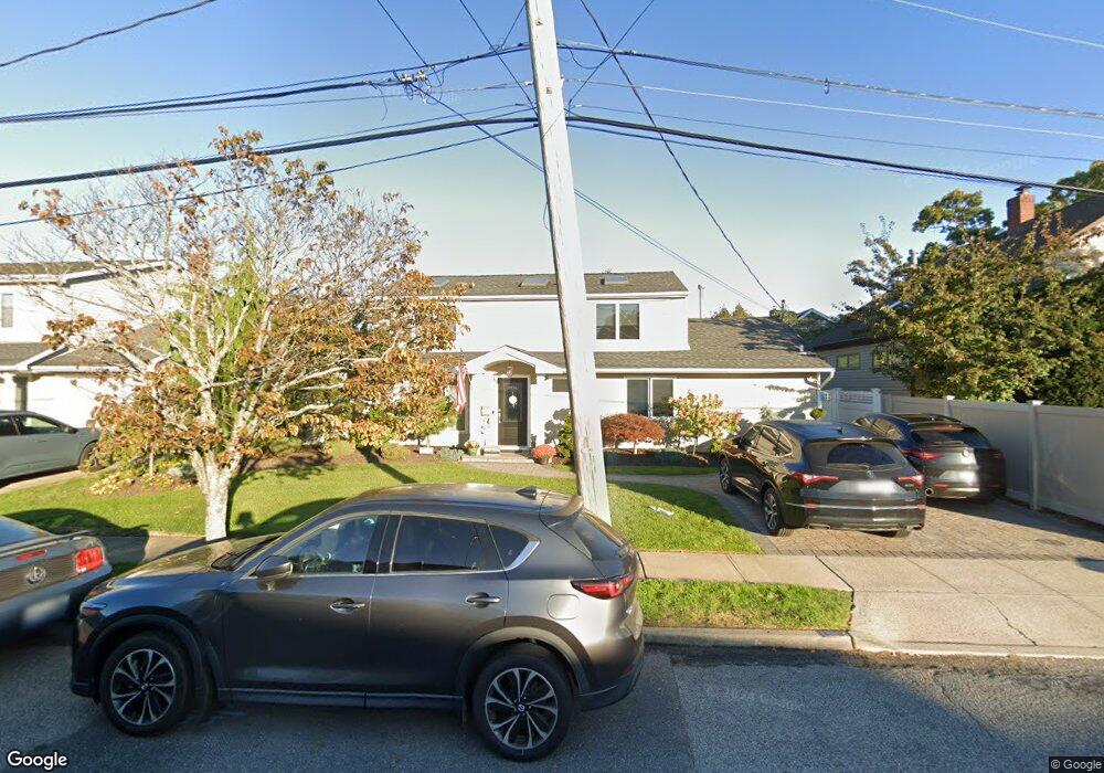
119 Hampton Way Merrick, NY 11566
Estimated Value: $785,651 - $1,146,000
Studio
2
Baths
2,199
Sq Ft
$439/Sq Ft
Est. Value
About This Home
This home is located at 119 Hampton Way, Merrick, NY 11566 and is currently estimated at $965,826, approximately $439 per square foot. 119 Hampton Way is a home located in Nassau County with nearby schools including Merrick Avenue Middle School, John F. Kennedy High School, and St. Elizabeth Ann Seton Regional School.
Ownership History
Date
Name
Owned For
Owner Type
Purchase Details
Closed on
Aug 20, 2008
Sold by
Hawxhurst Cindy A and Hawxhurst Robert E
Bought by
Hawxhurst Cindy A
Current Estimated Value
Purchase Details
Closed on
May 29, 1996
Sold by
Seliger Maria
Bought by
Hawxhurst Robert and Hawxhurst Cindy
Home Financials for this Owner
Home Financials are based on the most recent Mortgage that was taken out on this home.
Original Mortgage
$100,000
Outstanding Balance
$6,325
Interest Rate
7.89%
Estimated Equity
$959,501
Create a Home Valuation Report for This Property
The Home Valuation Report is an in-depth analysis detailing your home's value as well as a comparison with similar homes in the area
Home Values in the Area
Average Home Value in this Area
Purchase History
| Date | Buyer | Sale Price | Title Company |
|---|---|---|---|
| Hawxhurst Cindy A | -- | Metropolitan Abstract Corp | |
| Hawxhurst Robert | $165,000 | -- |
Source: Public Records
Mortgage History
| Date | Status | Borrower | Loan Amount |
|---|---|---|---|
| Open | Hawxhurst Robert | $100,000 |
Source: Public Records
Tax History
| Year | Tax Paid | Tax Assessment Tax Assessment Total Assessment is a certain percentage of the fair market value that is determined by local assessors to be the total taxable value of land and additions on the property. | Land | Improvement |
|---|---|---|---|---|
| 2025 | $16,392 | $540 | $278 | $262 |
| 2024 | $3,628 | $526 | $270 | $256 |
| 2023 | $14,237 | $562 | $289 | $273 |
| 2022 | $14,237 | $556 | $289 | $267 |
| 2021 | $18,377 | $525 | $270 | $255 |
| 2020 | $12,219 | $688 | $642 | $46 |
| 2019 | $11,603 | $688 | $602 | $86 |
| 2018 | $10,808 | $734 | $0 | $0 |
| 2017 | $7,549 | $780 | $543 | $237 |
| 2016 | $10,887 | $747 | $635 | $112 |
| 2015 | $3,127 | $788 | $609 | $179 |
| 2014 | $3,127 | $788 | $609 | $179 |
| 2013 | $3,117 | $830 | $642 | $188 |
Source: Public Records
Map
Nearby Homes
- 109 Elliot St
- 2794 Lincoln Blvd
- 110 Hampton Way
- 2829 Frankel Blvd
- 2072 Brighton Way
- 23 Bay St
- 2077 Byron Rd
- 2070 Beverly Way
- 217 Bayview Ave
- 2845 Whaleneck Dr
- 2038 Berfond Ct
- 2066 Holland Way
- 140 Frankel Blvd
- 2522 Hewlett Ln
- 2043 Ripley Ln
- 2542 Lefferts Place
- 2884 Bay Dr
- 2505 Walters Ct
- 2863 Harbor Rd
- 2729 Shore Dr
- 117 Hampton Way
- 2754 Wynsum Ave
- 112 Elliot St
- 2138 Elliot St Unit 2138
- 2736 Wynsum Ave
- 110 Elliot St
- 115 Hampton Way
- 2150 Hampton Way
- 118 Hampton Way
- 108 Elliot St
- 116 Hampton Way
- 113 Hampton Way
- 2768 Wynsum Ave
- 106 Elliot St
- 2759 Wynsum Ave
- 114 Hampton Way
- 2753 Wynsum Ave
- 2745 Wynsum Ave
- 111 Elliot St
- 2728 Wynsum Ave
Your Personal Tour Guide
Ask me questions while you tour the home.