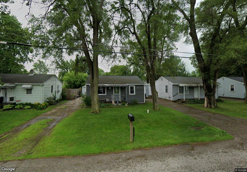
1190 E Decamp St Burton, MI 48529
South Side NeighborhoodEstimated Value: $69,011 - $84,000
Studio
--
Bath
692
Sq Ft
$112/Sq Ft
Est. Value
About This Home
This home is located at 1190 E Decamp St, Burton, MI 48529 and is currently estimated at $77,753, approximately $112 per square foot. 1190 E Decamp St is a home located in Genesee County with nearby schools including Carman-Ainsworth High School and International Academy of Flint (K-12).
Ownership History
Date
Name
Owned For
Owner Type
Purchase Details
Closed on
Dec 23, 2024
Sold by
Dunn Deborah Ann
Bought by
Dunn Deborah Ann and Dimmer Olivia Kathryn
Current Estimated Value
Purchase Details
Closed on
Sep 11, 2019
Sold by
Legato Robert W Revocable Living and Legato Girard G
Bought by
Reatals Dunn
Home Financials for this Owner
Home Financials are based on the most recent Mortgage that was taken out on this home.
Interest Rate
3.49%
Purchase Details
Closed on
Sep 8, 2005
Sold by
Legato Robert W and Legato Roberta Ann
Bought by
Legato Robert W
Create a Home Valuation Report for This Property
The Home Valuation Report is an in-depth analysis detailing your home's value as well as a comparison with similar homes in the area
Home Values in the Area
Average Home Value in this Area
Purchase History
| Date | Buyer | Sale Price | Title Company |
|---|---|---|---|
| Dunn Deborah Ann | -- | None Listed On Document | |
| Dunn Deborah Ann | -- | None Listed On Document | |
| Dunn Deborah A | -- | None Listed On Document | |
| Dunn Deborah Ann | -- | None Listed On Document | |
| Dunn Deborah A | -- | None Listed On Document | |
| Reatals Dunn | -- | -- | |
| Legato Robert W | -- | -- |
Source: Public Records
Mortgage History
| Date | Status | Borrower | Loan Amount |
|---|---|---|---|
| Previous Owner | Reatals Dunn | -- |
Source: Public Records
Tax History
| Year | Tax Paid | Tax Assessment Tax Assessment Total Assessment is a certain percentage of the fair market value that is determined by local assessors to be the total taxable value of land and additions on the property. | Land | Improvement |
|---|---|---|---|---|
| 2025 | $1,164 | $28,300 | $0 | $0 |
| 2024 | $1,018 | $22,700 | $0 | $0 |
| 2023 | $984 | $23,300 | $0 | $0 |
| 2022 | $227 | $21,400 | $0 | $0 |
| 2021 | $111 | $14,000 | $0 | $0 |
| 2020 | $1,022 | $14,200 | $0 | $0 |
| 2019 | $714 | $12,800 | $0 | $0 |
| 2018 | $779 | $12,100 | $0 | $0 |
| 2017 | $760 | $12,100 | $0 | $0 |
| 2016 | $757 | $11,600 | $0 | $0 |
| 2015 | $759 | $0 | $0 | $0 |
| 2012 | -- | $10,400 | $10,400 | $0 |
Source: Public Records
Map
Nearby Homes
- 1219 Norton St
- 1216 E Hemphill Rd
- 1233 Carman St
- 846 W Hemphill Rd
- 1377 Allen St
- 1391 Wells St
- 612 Clinton St
- 1335 Connell St
- 805 Alvord Ave
- 912 Huron St
- 730 Alvord Ave
- 845 Alvord Ave
- 806 Alvord Ave
- 652 Crawford St
- 640 Crawford St
- 1019 E Bristol Rd
- 1453 Carman St
- 1450 Carman St
- 713 Leland St
- 1122 Markham St
- 1182 E Decamp St
- 1191 Norton St
- 1183 Norton St
- 1197 Norton St
- 1176 E Decamp St
- 1200 E Decamp St
- 1181 Norton St
- 1201 Norton St
- 1189 E Decamp St
- 1172 E Decamp St
- 1185 E Decamp St
- 1171 Norton St
- 1175 E Decamp St
- 1199 E Decamp St
- 1205 Norton St
- 1166 E Decamp St
- 1167 Norton St
- 1171 E Decamp St
- 1192 Allen St
- 1184 Norton St
Your Personal Tour Guide
Ask me questions while you tour the home.