Estimated Value: $260,000 - $317,000
3
Beds
1
Bath
1,652
Sq Ft
$170/Sq Ft
Est. Value
About This Home
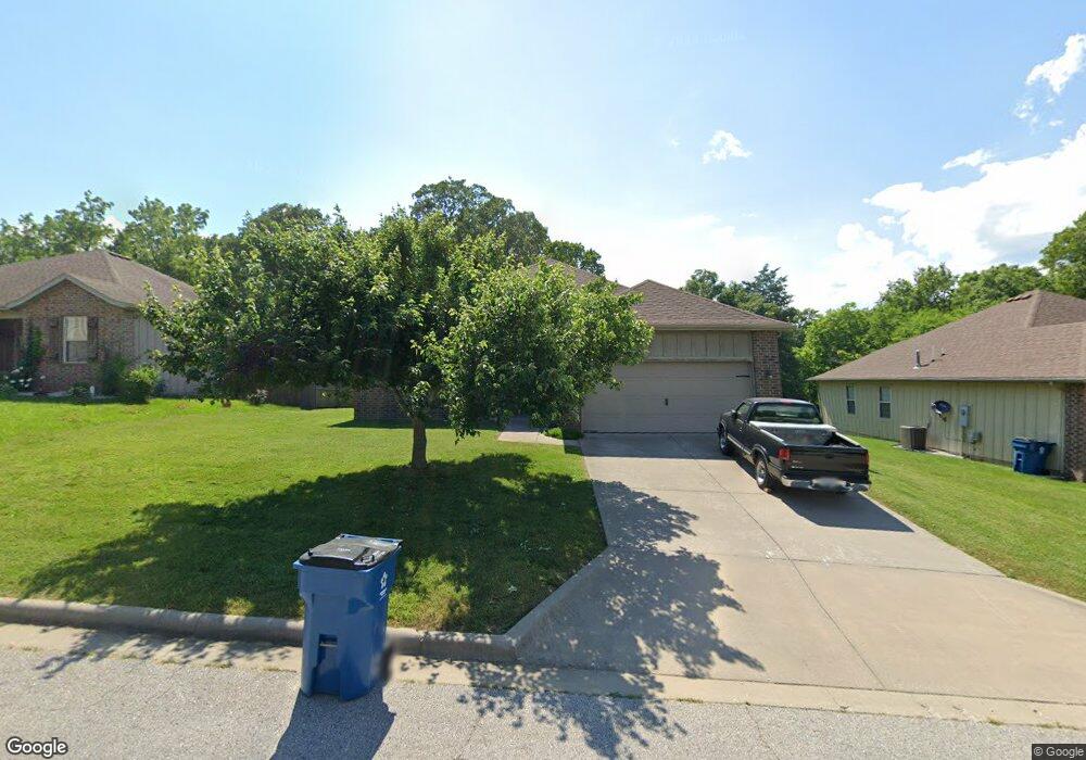
This home is located at 1193 S 21st Ave, Ozark, MO 65721 and is currently estimated at $280,820, approximately $169 per square foot. 1193 S 21st Ave is a home with nearby schools including East Elementary School, Ozark Junior High School, and Ozark Middle School.
Ownership History
Date
Name
Owned For
Owner Type
Purchase Details
Closed on
Feb 1, 2012
Sold by
Browne Martin S and Browne Brooke
Bought by
Browne Martin S and Browne Brooke
Current Estimated Value
Purchase Details
Closed on
Apr 30, 2007
Sold by
Andrea Development Group Inc
Bought by
Browne Martin and Browne Brooke
Home Financials for this Owner
Home Financials are based on the most recent Mortgage that was taken out on this home.
Original Mortgage
$119,920
Outstanding Balance
$71,344
Interest Rate
6.13%
Mortgage Type
New Conventional
Estimated Equity
$209,476
Create a Home Valuation Report for This Property
The Home Valuation Report is an in-depth analysis detailing your home's value as well as a comparison with similar homes in the area
Home Values in the Area
Average Home Value in this Area
Purchase History
We collect this data history from publicly available records. To have your information removed, we recommend requesting removal directly through your county’s website.
| Date | Buyer | Sale Price | Title Company |
|---|---|---|---|
| Browne Martin S | -- | None Available | |
| Browne Martin | -- | Lincoln Evans Land Title Com |
Source: Public Records
Mortgage History
We collect this data history from publicly available records. To have your information removed, we recommend requesting removal directly through your county’s website.
| Date | Status | Borrower | Loan Amount |
|---|---|---|---|
| Open | Browne Martin | $119,920 |
Source: Public Records
Tax History
| Year | Tax Paid | Tax Assessment Tax Assessment Total Assessment is a certain percentage of the fair market value that is determined by local assessors to be the total taxable value of land and additions on the property. | Land | Improvement |
|---|---|---|---|---|
| 2025 | $1,703 | $28,820 | -- | -- |
| 2024 | $1,701 | $27,210 | -- | -- |
| 2023 | $1,701 | $27,210 | $0 | $0 |
| 2022 | $1,651 | $26,350 | $0 | $0 |
| 2021 | $1,598 | $26,350 | $0 | $0 |
| 2020 | $1,460 | $24,320 | $0 | $0 |
| 2019 | $1,460 | $24,320 | $0 | $0 |
| 2018 | $1,450 | $24,320 | $0 | $0 |
| 2017 | $1,450 | $24,320 | $0 | $0 |
| 2016 | $1,426 | $24,320 | $0 | $0 |
| 2015 | $1,426 | $24,320 | $24,320 | $0 |
| 2014 | $1,415 | $24,400 | $0 | $0 |
| 2013 | $14 | $24,400 | $0 | $0 |
| 2011 | $14 | $49,360 | $0 | $0 |
Source: Public Records
Map
Nearby Homes
- 1804 E Samuel J St
- 2014 E Jay St
- 1509 E Hartley St
- 1502 S 17th Ave
- 1502 E Sycamore St
- 350 S Countryman Rd
- 000 E Hartley Rd
- 902 S 14th Ave
- 1807 E Costa Mesa Ct
- 1100 E Robertson St
- 1703 S 10th Ave
- 1925 E Maricopa Ave
- 1800 S 14th Ave
- 1604 Sherwood Ct
- 1300 E Bain St
- 218 S 9th Ave
- 1701 S 15th Ave
- 707 S 7th Ave
- 701 Becky Ln
- 1433 E Warren Ave
- 1197 S 21st Ave
- 1189 S 21st Ave
- 1199 S 21st Ave
- 1095 S 21st Ave
- 2106 E Robin St
- 1196 S 20th Ave
- 1201 S 21st Ave
- 1085 S 21st Ave
- 1200 S 20th Ave
- 2105 E Finch St
- 2105 E Robin St
- 2110 E Robin St
- 1205 S 21st Ave
- 1075 S 21st Ave
- 2111 E Finch St
- 2114 E Robin St
- 2109 E Robin St
- 1202 S 20th Ave
- 1195 S 20th Ave
- 1207 S 21st Ave
Your Personal Tour Guide
Ask me questions while you tour the home.