12 Bridle Path West Townsend, MA 01474
Estimated Value: $506,000 - $594,621
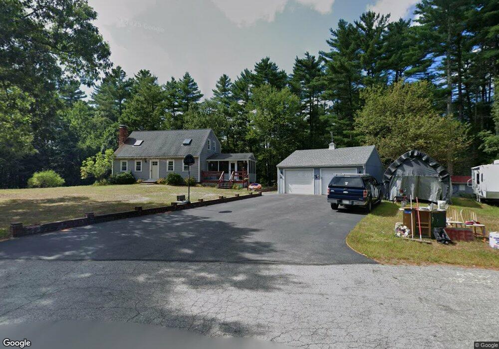
About This Home
This home is located at 12 Bridle Path, West Townsend, MA 01474 and is currently estimated at $558,405, approximately $245 per square foot. 12 Bridle Path is a home located in Middlesex County with nearby schools including North Middlesex Regional High School.
Ownership History
We collect this data history from publicly available records. To have your information removed, we recommend requesting removal directly through your county’s website.
Purchase Details
Purchase Details
Home Values in the Area
Average Home Value in this Area
Purchase History
We collect this data history from publicly available records. To have your information removed, we recommend requesting removal directly through your county’s website.
| Date | Buyer | Sale Price | Title Company |
|---|---|---|---|
| -- | -- | ||
| $95,900 | -- |
Mortgage History
We collect this data history from publicly available records. To have your information removed, we recommend requesting removal directly through your county’s website.
| Date | Status | Borrower | Loan Amount |
|---|---|---|---|
| Previous Owner | $50,000 | ||
| Previous Owner | $75,000 | ||
| Previous Owner | $36,000 |
Tax History
We collect this data history from publicly available records. To have your information removed, we recommend requesting removal directly through your county’s website.
| Year | Tax Paid | Tax Assessment Tax Assessment Total Assessment is a certain percentage of the fair market value that is determined by local assessors to be the total taxable value of land and additions on the property. | Land | Improvement |
|---|---|---|---|---|
| 2025 | $6,589 | $453,800 | $126,500 | $327,300 |
| 2024 | $6,425 | $445,900 | $126,500 | $319,400 |
| 2023 | $6,347 | $415,900 | $113,500 | $302,400 |
| 2022 | $5,933 | $336,900 | $92,800 | $244,100 |
| 2021 | $7,634 | $324,600 | $95,300 | $229,300 |
| 2020 | $0 | $286,300 | $78,200 | $208,100 |
| 2019 | $5,503 | $284,700 | $78,200 | $206,500 |
| 2018 | $5,255 | $259,400 | $78,000 | $181,400 |
| 2017 | $4,868 | $247,500 | $77,600 | $169,900 |
| 2016 | $4,760 | $240,400 | $77,600 | $162,800 |
| 2015 | $4,623 | $241,900 | $84,600 | $157,300 |
| 2014 | $4,628 | $236,500 | $83,600 | $152,900 |
Map
- 83 Mason Rd
- 87 Turnpike Rd
- 53 W Meadow Rd
- 2 W Meadow Rd
- 38 W Elm St
- 549 Main St
- 134 Barker Hill Rd
- 43 W Meadow Estates Dr
- 1188 Valley Rd
- 9 Turnpike Rd
- 00 Juniper Hill
- 5 Turnpike Rd Unit 311,three
- 0 Davis Rd
- 731 Foster Rd
- 87A Brookline St
- 1 Depot Street Extension Unit 4
- 0 Brookline St
- 211 Main St
- 53 Heywood Rd
- 522 Greenville Rd
- 16 Bridle Path
- 126 Old Turnpike Rd
- 128 Old Turnpike Rd
- 18 Bridle Path
- 3 Briar Way
- 15 Bridle Path
- 120 Old Turnpike Rd
- 9 Bridle Path
- 4 Briar Way
- 118 Old Turnpike Rd
- 1 Briar Way
- 7 Bridle Path
- 160 Old Turnpike Rd
- 2 Briar Way
- 12 Fox Run
- 116 Old Turnpike Rd
- 73 Mason Rd
- 5 Bridle Path
- 71 Mason Rd
- 75 Mason Rd
Ask me questions while you tour the home.