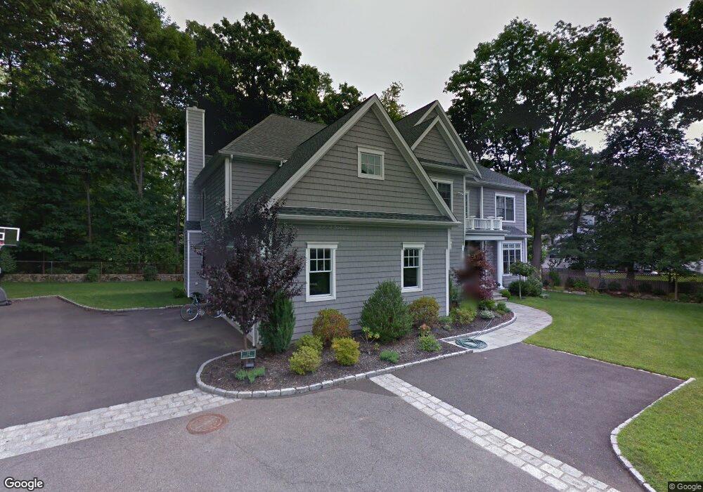
12 Brown St Darien, CT 06820
Estimated Value: $2,620,000 - $3,423,000
5
Beds
5
Baths
3,832
Sq Ft
$793/Sq Ft
Est. Value
About This Home
This home is located at 12 Brown St, Darien, CT 06820 and is currently estimated at $3,037,511, approximately $792 per square foot. 12 Brown St is a home located in Fairfield County with nearby schools including Holmes Elementary School, Middlesex Middle School, and Darien High School.
Ownership History
Date
Name
Owned For
Owner Type
Purchase Details
Closed on
Mar 15, 2004
Sold by
Mcguinness G Rogalle E and Mcclancy Christopher P
Bought by
Kisken Stephen J and Kisken Barbara
Current Estimated Value
Create a Home Valuation Report for This Property
The Home Valuation Report is an in-depth analysis detailing your home's value as well as a comparison with similar homes in the area
Home Values in the Area
Average Home Value in this Area
Purchase History
| Date | Buyer | Sale Price | Title Company |
|---|---|---|---|
| Kisken Stephen J | $470,000 | -- |
Source: Public Records
Mortgage History
| Date | Status | Borrower | Loan Amount |
|---|---|---|---|
| Closed | Kisken Stephen J | $195,000 | |
| Closed | Kisken Stephen J | $223,000 | |
| Open | Kisken Stephen J | $400,000 |
Source: Public Records
Tax History
| Year | Tax Paid | Tax Assessment Tax Assessment Total Assessment is a certain percentage of the fair market value that is determined by local assessors to be the total taxable value of land and additions on the property. | Land | Improvement |
|---|---|---|---|---|
| 2025 | $25,521 | $1,648,640 | $574,560 | $1,074,080 |
| 2024 | $24,219 | $1,648,640 | $574,560 | $1,074,080 |
| 2023 | $21,432 | $1,217,020 | $441,980 | $775,040 |
| 2022 | $20,969 | $1,217,020 | $441,980 | $775,040 |
| 2021 | $3,898 | $1,217,020 | $441,980 | $775,040 |
| 2020 | $19,910 | $1,217,020 | $441,980 | $775,040 |
| 2019 | $20,044 | $1,217,020 | $441,980 | $775,040 |
| 2018 | $0 | $1,181,670 | $390,320 | $791,350 |
| 2017 | $19,096 | $1,181,670 | $390,320 | $791,350 |
| 2016 | $18,635 | $1,181,670 | $390,320 | $791,350 |
| 2015 | $18,139 | $1,181,670 | $390,320 | $791,350 |
| 2014 | $17,737 | $1,181,670 | $390,320 | $791,350 |
Source: Public Records
Map
Nearby Homes
- 15 Charles St
- 11 Patton Dr
- 167 Hollow Tree Ridge Rd
- 166 Hollow Tree Ridge Rd
- 86 Middlesex Rd
- 25 Devon Rd
- 12 Walmsley Rd
- 22 Radio Place Unit 10
- 29 Walmsley Rd
- 3 Abbey Rd
- 88 Maple Tree Ave Unit G
- 66 Stanton Rd
- 3 Hickory Ln
- 24 King St
- 32 Relihan Rd
- 25 Hillside Ave
- 5 Middlesex Rd
- 3 Revere Rd
- 15 Tremont Ave
- 16 Fairfield Ave
Your Personal Tour Guide
Ask me questions while you tour the home.