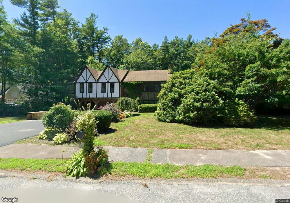
12 Debra Rd Pembroke, MA 02359
Estimated Value: $740,139 - $845,000
4
Beds
3
Baths
1,704
Sq Ft
$459/Sq Ft
Est. Value
About This Home
This home is located at 12 Debra Rd, Pembroke, MA 02359 and is currently estimated at $782,035, approximately $458 per square foot. 12 Debra Rd is a home located in Plymouth County with nearby schools including Pembroke High School and Cardinal Cushing Centers.
Ownership History
Date
Name
Owned For
Owner Type
Purchase Details
Closed on
Sep 27, 2021
Sold by
Mccarthy Stephen
Bought by
Laura Mccarthy and Laura Mccarthy
Current Estimated Value
Purchase Details
Closed on
May 4, 2001
Sold by
Phillips Eleanor
Bought by
Mccarthy Stephen
Home Financials for this Owner
Home Financials are based on the most recent Mortgage that was taken out on this home.
Original Mortgage
$229,600
Interest Rate
6.85%
Mortgage Type
Purchase Money Mortgage
Create a Home Valuation Report for This Property
The Home Valuation Report is an in-depth analysis detailing your home's value as well as a comparison with similar homes in the area
Home Values in the Area
Average Home Value in this Area
Purchase History
We collect this data history from publicly available records. To have your information removed, we recommend requesting removal directly through your county’s website.
| Date | Buyer | Sale Price | Title Company |
|---|---|---|---|
| Laura Mccarthy | -- | None Available | |
| Mccarthy Stephen | $287,000 | -- |
Source: Public Records
Mortgage History
We collect this data history from publicly available records. To have your information removed, we recommend requesting removal directly through your county’s website.
| Date | Status | Borrower | Loan Amount |
|---|---|---|---|
| Previous Owner | Mccarthy Stephen | $229,600 | |
| Previous Owner | Mccarthy Stephen | $25,000 | |
| Previous Owner | Mccarthy Stephen | $70,000 | |
| Previous Owner | Mccarthy Stephen | $58,000 |
Source: Public Records
Tax History
| Year | Tax Paid | Tax Assessment Tax Assessment Total Assessment is a certain percentage of the fair market value that is determined by local assessors to be the total taxable value of land and additions on the property. | Land | Improvement |
|---|---|---|---|---|
| 2025 | $7,671 | $638,200 | $326,400 | $311,800 |
| 2024 | $7,573 | $629,500 | $321,200 | $308,300 |
| 2023 | $7,455 | $586,100 | $296,400 | $289,700 |
| 2022 | $6,788 | $479,700 | $236,100 | $243,600 |
| 2021 | $6,739 | $462,200 | $230,900 | $231,300 |
| 2020 | $6,709 | $463,000 | $230,900 | $232,100 |
| 2019 | $6,510 | $445,900 | $220,800 | $225,100 |
| 2018 | $6,443 | $432,700 | $220,800 | $211,900 |
| 2017 | $6,325 | $418,900 | $206,000 | $212,900 |
| 2016 | $6,234 | $408,500 | $196,000 | $212,500 |
| 2015 | $5,948 | $403,500 | $186,000 | $217,500 |
Source: Public Records
Map
Nearby Homes
- 31 Hillcrest Dr
- 286 North St
- 8 Royal Dane Dr Unit 71
- 848 Plain St Unit 28
- 848 Plain St Unit 32
- 965 Temple St
- 3 Proprietors Dr Unit 7
- 2 Proprietors Dr Unit 25
- 2 Proprietors Dr Unit 27
- 261 Washington St
- 5 Snowy Owl Cir
- 3 Harlow Brook Way Unit 3
- 2 Harlow Brook Way Unit 2
- 172 Washington St
- 267 Sandy Hill Dr
- 180 Plain St
- 32 Bowsprit Ln
- 24 Proctor St
- 15 Masthead Dr
- 26 Pierce Dr
- 4 Debra Rd
- 18 Debra Rd
- 15 Debra Rd
- 18 Long Hill Rd
- 32 Long Hill Rd
- 19 Debra Rd
- 31 Long Hill Rd
- 29 Hillcrest Dr Unit 12
- 12 Long Hill Rd
- 27 Long Hill Rd
- 41 Hillcrest Dr
- 40 Long Hill Rd
- 19 Long Hill Rd
- 25 Hillcrest Dr Unit Lot10
- 25 Hillcrest Dr
- 23 Hillcrest Dr Unit 9
- 37 Long Hill Rd
- 19 Hillcrest Dr
- 91 Hemlock Dr
- 11 Long Hill Rd
Your Personal Tour Guide
Ask me questions while you tour the home.