
Seller's Agent in 2026
Jackie Crawford Ross
RE/MAX
(774) 272-1912
1 in this area
101 Total Sales
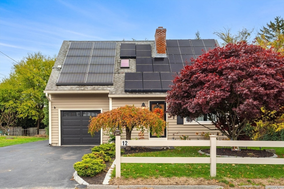
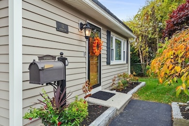
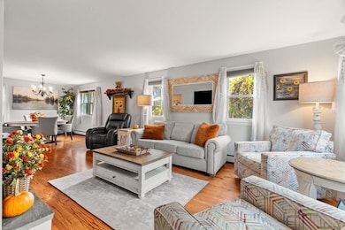
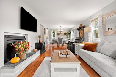

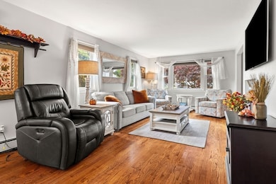
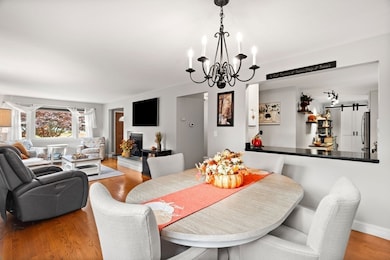
*Offer deadline Monday, November 10th @ 5pm* This adorable 3 bed, 1.5 bath 1,584 square foot Cape with 1 car garage is ready for its next owner! The inviting first floor features an open living and dining area with hardwood floors and a fireplace. The updated kitchen flows seamlessly off the dining area and has exterior access to the enlarged composite deck making this the entertainer's dream home! An updated half bathroom completes the first floor. Upstairs you will find 3 generously sized bedrooms with hardwood floors and an updated full bathroom. The walk-out basement provides plenty of storage and endless opportunities. Outside you will find a professionally landscaped yard with a storage shed. Check MLS attachments for a list of updates! Located in a desirable Worcester neighborhood with easy access to route 190 and 290, parks, schools, dining, and local hospitals, this property offers both comfort and convenience. Don’t miss your opportunity to make this lovely home yours
| Date | Type | Sale Price | Title Company |
|---|---|---|---|
| Quit Claim Deed | $517,000 | -- | |
| Deed | $239,000 | -- | |
| Deed | $239,000 | -- |
| Date | Status | Loan Amount | Loan Type |
|---|---|---|---|
| Open | $465,300 | New Conventional | |
| Previous Owner | $216,897 | FHA |
| Date | Event | Price | List to Sale | Price per Sq Ft |
|---|---|---|---|---|
| 01/05/2026 01/05/26 | Sold | $517,000 | +3.4% | $326 / Sq Ft |
| 11/11/2025 11/11/25 | Pending | -- | -- | -- |
| 11/06/2025 11/06/25 | For Sale | $499,900 | -- | $316 / Sq Ft |
| Year | Tax Paid | Tax Assessment Tax Assessment Total Assessment is a certain percentage of the fair market value that is determined by local assessors to be the total taxable value of land and additions on the property. | Land | Improvement |
|---|---|---|---|---|
| 2025 | $5,490 | $416,200 | $114,900 | $301,300 |
| 2024 | $5,365 | $390,200 | $114,900 | $275,300 |
| 2023 | $5,162 | $360,000 | $99,900 | $260,100 |
| 2022 | $4,753 | $312,500 | $79,900 | $232,600 |
| 2021 | $4,723 | $290,100 | $63,900 | $226,200 |
| 2020 | $4,588 | $269,900 | $63,900 | $206,000 |
| 2019 | $4,284 | $238,000 | $57,500 | $180,500 |
| 2018 | $4,287 | $226,700 | $57,500 | $169,200 |
| 2017 | $4,092 | $212,900 | $57,500 | $155,400 |
| 2016 | $4,073 | $197,600 | $42,200 | $155,400 |
| 2015 | $3,966 | $197,600 | $42,200 | $155,400 |
| 2014 | $3,861 | $197,600 | $42,200 | $155,400 |
Seller's Agent in 2026
Jackie Crawford Ross
RE/MAX
(774) 272-1912
1 in this area
101 Total Sales
D
Buyer's Agent in 2026
Dina Salerno
eXp Realty
1 in this area
4 Total Sales
Source: MLS Property Information Network (MLS PIN)
MLS Number: 73452044
APN: WORC-000032-000014-000168
Disclaimer: Certain information contained herein is derived from information provided by parties other than Homes.com. All information provided is deemed reliable, but is not guaranteed to be accurate and should be independently verified.
![]() The property listing data and information, or the Images, set forth herein were provided to MLS Property Information Network, Inc. from third party sources, including sellers, lessors and public records, and were compiled by MLS Property Information Network, Inc. The property listing data and information, and the Images, are for the personal, non-commercial use of consumers having a good faith interest in purchasing or leasing listed properties of the type displayed to them and may not be used for any purpose other than to identify prospective properties which such consumers may have a good faith interest in purchasing or leasing. MLS Property Information Network, Inc. and its subscribers disclaim any and all representations and warranties as to the accuracy of the property listing data and information, or as to the accuracy of any of the Images, set forth herein.
The property listing data and information, or the Images, set forth herein were provided to MLS Property Information Network, Inc. from third party sources, including sellers, lessors and public records, and were compiled by MLS Property Information Network, Inc. The property listing data and information, and the Images, are for the personal, non-commercial use of consumers having a good faith interest in purchasing or leasing listed properties of the type displayed to them and may not be used for any purpose other than to identify prospective properties which such consumers may have a good faith interest in purchasing or leasing. MLS Property Information Network, Inc. and its subscribers disclaim any and all representations and warranties as to the accuracy of the property listing data and information, or as to the accuracy of any of the Images, set forth herein.
Ask me questions while you tour the home.