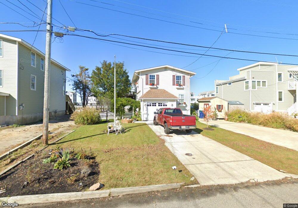
12 Point Dr Somers Point, NJ 08244
Estimated Value: $640,135 - $1,076,000
Studio
--
Bath
1,508
Sq Ft
$559/Sq Ft
Est. Value
About This Home
This home is located at 12 Point Dr, Somers Point, NJ 08244 and is currently estimated at $842,784, approximately $558 per square foot. 12 Point Dr is a home located in Atlantic County with nearby schools including Egg Harbor Township High School, ChARTer TECH High School for the Performing Arts, and Saint Joseph Regional School.
Ownership History
Date
Name
Owned For
Owner Type
Purchase Details
Closed on
Aug 10, 2007
Sold by
Leonard Joseph A
Bought by
Leonard Joseph A and Leonard Candace M
Current Estimated Value
Create a Home Valuation Report for This Property
The Home Valuation Report is an in-depth analysis detailing your home's value as well as a comparison with similar homes in the area
Purchase History
| Date | Buyer | Sale Price | Title Company |
|---|---|---|---|
| Leonard Joseph A | -- | None Available |
Source: Public Records
Tax History
| Year | Tax Paid | Tax Assessment Tax Assessment Total Assessment is a certain percentage of the fair market value that is determined by local assessors to be the total taxable value of land and additions on the property. | Land | Improvement |
|---|---|---|---|---|
| 2025 | $10,978 | $327,300 | $246,500 | $80,800 |
| 2024 | $10,978 | $327,300 | $246,500 | $80,800 |
| 2023 | $10,915 | $327,300 | $246,500 | $80,800 |
| 2022 | $10,915 | $327,300 | $246,500 | $80,800 |
| 2021 | $11,004 | $327,300 | $246,500 | $80,800 |
| 2020 | $10,804 | $327,300 | $246,500 | $80,800 |
| 2019 | $10,510 | $327,300 | $246,500 | $80,800 |
| 2018 | $10,284 | $327,300 | $246,500 | $80,800 |
| 2017 | $10,248 | $327,300 | $246,500 | $80,800 |
| 2016 | $9,842 | $327,300 | $246,500 | $80,800 |
| 2015 | $9,698 | $327,300 | $246,500 | $80,800 |
| 2014 | $9,505 | $327,300 | $246,500 | $80,800 |
Source: Public Records
Map
Nearby Homes
- 107 Stern Dr
- 8 Neptune Dr Unit 8
- 1304 Harbour CV S Cove Unit 1304
- 1304 Harbour Cove S
- 110 E Maryland Ave
- 1205 Harbour Cove S
- 1205 Harbour Cove S Unit 1205
- 211 Harbour Cove Unit 5211
- 1803 Pleasant Ave
- 301 Harbour Cove Unit 301
- 309 Harbour Cove Unit 3309
- 314 Harbour Cove
- 310 Harbour Cove Unit 3310
- 305 Harbour Cove Unit 305
- 1002 Pleasant Ave
- 537 Bay Ave Unit 1st floor
- 100 Decatur Ave
- 1020 Pleasant Ave
- 1013 Pleasant Ave
- 1014 Pleasant Ave
Your Personal Tour Guide
Ask me questions while you tour the home.