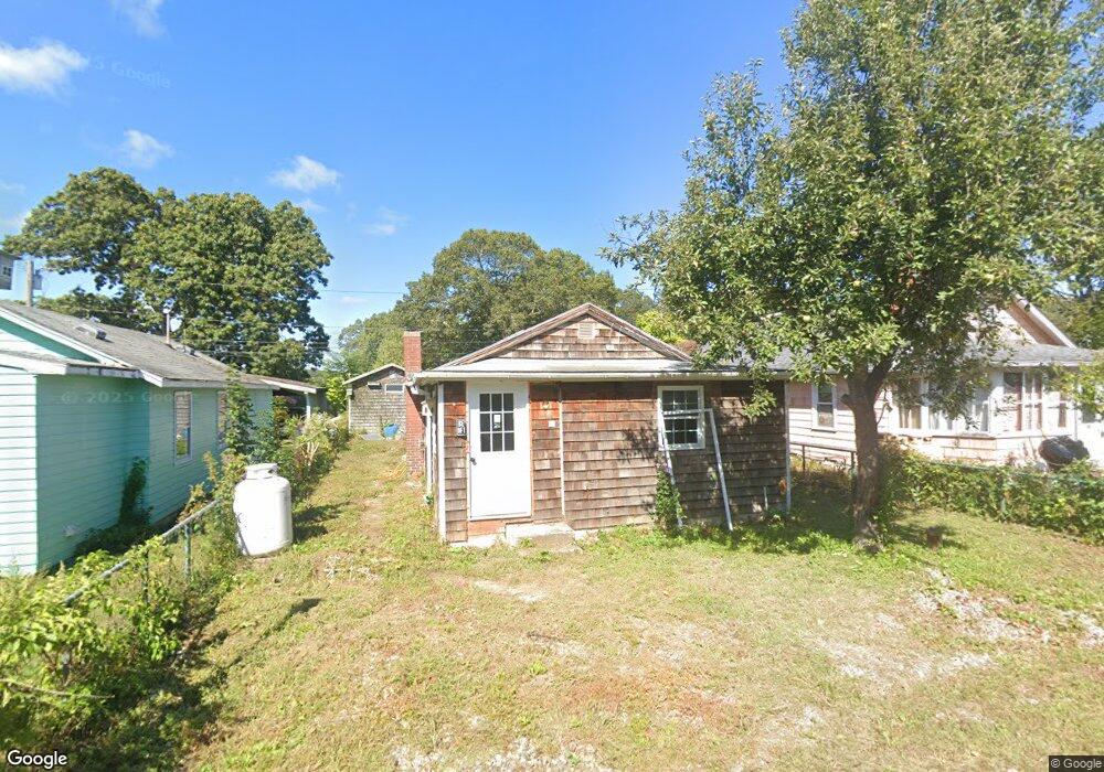
12 Point St Preston, CT 06365
Estimated Value: $140,840 - $252,000
1
Bed
1
Bath
580
Sq Ft
$365/Sq Ft
Est. Value
About This Home
This home is located at 12 Point St, Preston, CT 06365 and is currently estimated at $211,710, approximately $365 per square foot. 12 Point St is a home located in New London County with nearby schools including Integrated Day Charter School and St. Bernard School.
Ownership History
Date
Name
Owned For
Owner Type
Purchase Details
Closed on
Nov 19, 2025
Sold by
Siggens Joseph B and Cote Ann
Bought by
Southeastern Ct Prop Llp
Current Estimated Value
Home Financials for this Owner
Home Financials are based on the most recent Mortgage that was taken out on this home.
Original Mortgage
$152,100
Outstanding Balance
$151,813
Interest Rate
6.3%
Mortgage Type
Future Advance Clause Open End Mortgage
Estimated Equity
$59,897
Create a Home Valuation Report for This Property
The Home Valuation Report is an in-depth analysis detailing your home's value as well as a comparison with similar homes in the area
Home Values in the Area
Average Home Value in this Area
Purchase History
| Date | Buyer | Sale Price | Title Company |
|---|---|---|---|
| Southeastern Ct Prop Llp | -- | -- |
Source: Public Records
Mortgage History
| Date | Status | Borrower | Loan Amount |
|---|---|---|---|
| Open | Southeastern Ct Prop Llp | $152,100 |
Source: Public Records
Tax History
| Year | Tax Paid | Tax Assessment Tax Assessment Total Assessment is a certain percentage of the fair market value that is determined by local assessors to be the total taxable value of land and additions on the property. | Land | Improvement |
|---|---|---|---|---|
| 2025 | $1,856 | $73,920 | $36,260 | $37,660 |
| 2024 | $1,728 | $73,920 | $36,260 | $37,660 |
| 2023 | $1,696 | $73,920 | $36,260 | $37,660 |
| 2022 | $1,703 | $61,100 | $31,500 | $29,600 |
| 2021 | $1,646 | $61,100 | $31,500 | $29,600 |
| 2020 | $1,644 | $61,100 | $31,500 | $29,600 |
| 2019 | $1,615 | $61,100 | $31,500 | $29,600 |
| 2018 | $1,590 | $61,100 | $31,500 | $29,600 |
| 2017 | $1,582 | $65,900 | $31,500 | $34,400 |
| 2016 | $1,565 | $65,900 | $31,500 | $34,400 |
| 2015 | $1,516 | $65,900 | $31,500 | $34,400 |
| 2014 | $1,525 | $65,900 | $31,500 | $34,400 |
Source: Public Records
Map
Nearby Homes
- 43 Drawbridge Rd
- 3 Holdsworth Rd
- 4 N Glenwoods Rd
- 1918 Route 12
- 36 Bittersweet Dr
- 16 Marlene Dr
- 51 Dydo Dr
- 27 Linda Ave
- 0 Clarks Falls Unit 24089817
- 23 Avery Hill Rd
- 9 Oakridge Dr
- 104 Route 2a
- 183 Whalehead Rd
- 61 Fort Shantok Rd
- 1637 Connecticut 12
- 165 Massapeag Rd
- 1465 Norwich New London (Rte 32) Turnpike
- 31 Woodland Dr
- 36 Route 2a
- 32 Cedar Ln
Your Personal Tour Guide
Ask me questions while you tour the home.