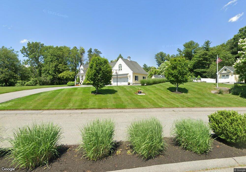
12 Stonebridge Dr Dracut, MA 01826
Estimated Value: $839,000 - $962,000
4
Beds
4
Baths
2,722
Sq Ft
$322/Sq Ft
Est. Value
About This Home
This home is located at 12 Stonebridge Dr, Dracut, MA 01826 and is currently estimated at $875,401, approximately $321 per square foot. 12 Stonebridge Dr is a home located in Middlesex County with nearby schools including George H. Englesby Elementary School, Richardson Middle School, and Dracut Senior High School.
Ownership History
Date
Name
Owned For
Owner Type
Purchase Details
Closed on
Nov 27, 1991
Sold by
Dracut Pinetree Rlty
Bought by
Andersson Robert P and Laurie Arsenault
Current Estimated Value
Create a Home Valuation Report for This Property
The Home Valuation Report is an in-depth analysis detailing your home's value as well as a comparison with similar homes in the area
Home Values in the Area
Average Home Value in this Area
Purchase History
We collect this data history from publicly available records. To have your information removed, we recommend requesting removal directly through your county’s website.
| Date | Buyer | Sale Price | Title Company |
|---|---|---|---|
| Andersson Robert P | $147,700 | -- |
Source: Public Records
Mortgage History
We collect this data history from publicly available records. To have your information removed, we recommend requesting removal directly through your county’s website.
| Date | Status | Borrower | Loan Amount |
|---|---|---|---|
| Open | Andersson Robert P | $278,000 | |
| Closed | Andersson Robert P | $287,868 | |
| Closed | Andersson Robert P | $114,500 | |
| Closed | Andersson Robert P | $130,000 |
Source: Public Records
Tax History
| Year | Tax Paid | Tax Assessment Tax Assessment Total Assessment is a certain percentage of the fair market value that is determined by local assessors to be the total taxable value of land and additions on the property. | Land | Improvement |
|---|---|---|---|---|
| 2025 | $8,488 | $838,700 | $251,800 | $586,900 |
| 2024 | $8,345 | $798,600 | $240,000 | $558,600 |
| 2023 | $8,067 | $696,600 | $208,700 | $487,900 |
| 2022 | $8,030 | $653,400 | $189,800 | $463,600 |
| 2021 | $4,179 | $608,700 | $172,400 | $436,300 |
| 2020 | $7,632 | $571,700 | $167,200 | $404,500 |
| 2019 | $7,866 | $572,100 | $159,200 | $412,900 |
| 2018 | $3,572 | $496,200 | $159,200 | $337,000 |
| 2017 | $6,489 | $496,200 | $159,200 | $337,000 |
| 2016 | $6,371 | $429,300 | $160,000 | $269,300 |
| 2015 | $6,206 | $415,700 | $160,000 | $255,700 |
| 2014 | $5,945 | $410,300 | $160,000 | $250,300 |
Source: Public Records
Map
Nearby Homes
- 31 Raven Rd
- 15 Esther Way Unit Lot 8
- 69 Springdale Ave
- 23 Jericho Rd
- 15 Jasmine Ct
- 52 Frederick St Unit 26
- 112 Genest St Unit 9
- 53 Vinal St
- 551 Hildreth St Unit 21
- 24 Waldo St
- 1905 Lakeview Ave
- 84 Tennis Plaza Rd Unit 33
- 42 Lannon Ave
- 20 Grouse Run
- 39 Lantern Ln Unit 4
- 13 Dallas Dr Unit 305
- 13 Dallas Dr Unit 107
- 15 Lantern Ln Unit 6
- 94 Hampson St
- 1310 Mammoth Rd
- 331 Colburn Ave
- 281 Colburn Ave
- 20 Stonebridge Dr
- 320 Colburn Ave
- 11 Apple Blossom Dr
- 330 Colburn Ave
- 330 Colburn Ave
- 324 Colburn Ave
- 27 Stonebridge Dr
- 314 Colburn Ave
- 273 Colburn Ave
- 28 Stonebridge Dr
- 340 Colburn Ave
- 21 Apple Blossom Dr
- 42 Stonebridge Dr
- 10 Apple Blossom Dr
- 35 Stonebridge Dr
- 294 Colburn Ave
- 348 Colburn Ave
- 134 Cross Rd
Your Personal Tour Guide
Ask me questions while you tour the home.