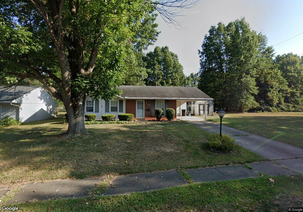
120 Circle Dr Baltimore, OH 43105
Estimated Value: $212,000 - $254,000
3
Beds
1
Bath
950
Sq Ft
$247/Sq Ft
Est. Value
About This Home
This home is located at 120 Circle Dr, Baltimore, OH 43105 and is currently estimated at $234,461, approximately $246 per square foot. 120 Circle Dr is a home located in Fairfield County with nearby schools including Liberty Union Elementary School, Liberty Union Middle School, and Liberty Union High School.
Ownership History
Date
Name
Owned For
Owner Type
Purchase Details
Closed on
Jul 30, 2009
Sold by
Burnside John D
Bought by
Burnside Maria
Current Estimated Value
Purchase Details
Closed on
Oct 2, 2002
Sold by
Runyon Brian K
Bought by
Burnside John D and Burnside Maria
Home Financials for this Owner
Home Financials are based on the most recent Mortgage that was taken out on this home.
Original Mortgage
$45,000
Outstanding Balance
$18,278
Interest Rate
6.39%
Mortgage Type
New Conventional
Estimated Equity
$216,183
Purchase Details
Closed on
Aug 12, 1996
Sold by
Fox Billie H
Bought by
Runyon Brian K and Runyon Elizabeth A
Home Financials for this Owner
Home Financials are based on the most recent Mortgage that was taken out on this home.
Original Mortgage
$74,344
Interest Rate
8.33%
Mortgage Type
FHA
Create a Home Valuation Report for This Property
The Home Valuation Report is an in-depth analysis detailing your home's value as well as a comparison with similar homes in the area
Home Values in the Area
Average Home Value in this Area
Purchase History
| Date | Buyer | Sale Price | Title Company |
|---|---|---|---|
| Burnside Maria | -- | None Available | |
| Burnside John D | $104,500 | -- | |
| Runyon Brian K | $74,500 | -- |
Source: Public Records
Mortgage History
| Date | Status | Borrower | Loan Amount |
|---|---|---|---|
| Open | Burnside John D | $45,000 | |
| Previous Owner | Runyon Brian K | $74,344 |
Source: Public Records
Tax History
| Year | Tax Paid | Tax Assessment Tax Assessment Total Assessment is a certain percentage of the fair market value that is determined by local assessors to be the total taxable value of land and additions on the property. | Land | Improvement |
|---|---|---|---|---|
| 2025 | $4,290 | $63,260 | $25,330 | $37,930 |
| 2024 | $4,290 | $57,140 | $20,410 | $36,730 |
| 2023 | $2,192 | $57,140 | $20,410 | $36,730 |
| 2022 | $2,174 | $57,140 | $20,410 | $36,730 |
| 2021 | $1,747 | $41,620 | $16,250 | $25,370 |
| 2020 | $1,786 | $41,620 | $16,250 | $25,370 |
| 2019 | $1,816 | $41,620 | $16,250 | $25,370 |
| 2018 | $1,627 | $32,710 | $16,250 | $16,460 |
| 2017 | $1,636 | $34,200 | $16,250 | $17,950 |
| 2016 | $1,612 | $34,200 | $16,250 | $17,950 |
| 2015 | $1,502 | $33,370 | $16,250 | $17,120 |
| 2014 | $1,441 | $33,370 | $16,250 | $17,120 |
| 2013 | $1,441 | $33,370 | $16,250 | $17,120 |
Source: Public Records
Map
Nearby Homes
- 201 E Dorchester Dr
- 407 S Main St
- 601 S Main St
- 403 S Walnut St
- 113 S Park Dr
- 220 N Wagner Ave
- 112 N Creekview Ct
- 727 W Washington St
- 7836 Basil Rd NW
- 445 Baltimore Somerset Rd NE
- 116 S High St
- 0 Basil Rd NW Unit 226003110
- 570 Baltimore Somerset Rd NE Unit Lot 1
- 201 N Liberty St
- 0 S Company St Unit Lot 2 225029545
- 0 S Company St Unit Lot 1 225029543
- 0 Cherry Ln Unit 226008720
- 0 Lancaster-Newark Rd NE Unit Lot A
- 0 Lancaster-Newark Rd NE
- 1455 Giesy Rd NW
- 116 Circle Dr
- 112 Circle Dr
- 109 Circle Dr
- 105 Circle Dr
- 108 Circle Dr
- 221 E Elmwood Dr
- 104 Circle Dr
- 140 Tremont Ct
- 144 Tremont Ct
- 304 E Dorchester Dr
- 502 S Park Dr
- 506 S Park Dr
- 510 S Park Dr
- 200 E Dorchester Dr
- 424 S Park Dr
- 422 S Park Dr
- 148 Tremont Ct
- 305 E Dorchester Dr
- 205 E Dorchester Dr
- 308 E Dorchester Dr
Your Personal Tour Guide
Ask me questions while you tour the home.