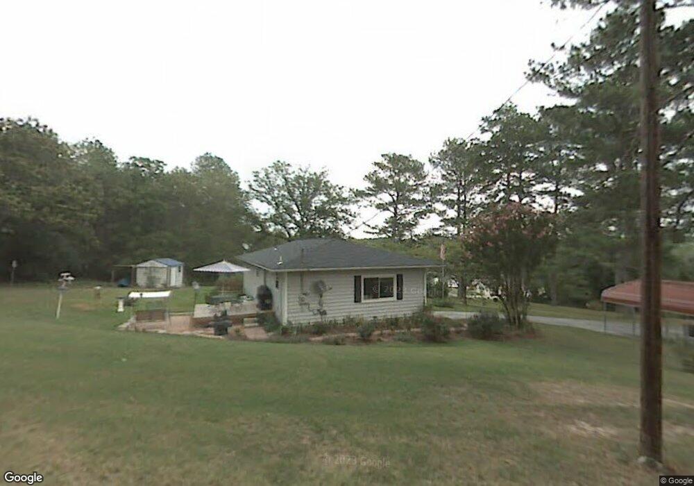
120 Davis Rd Chickamauga, GA 30707
Estimated Value: $186,386 - $246,000
About This Home
This home is located at 120 Davis Rd, Chickamauga, GA 30707 and is currently estimated at $215,347, approximately $224 per square foot. 120 Davis Rd is a home located in Walker County with nearby schools including Cherokee Ridge Elementary School, Rossville Middle School, and Ridgeland High School.
Ownership History
We collect this data history from publicly available records. To have your information removed, we recommend requesting removal directly through your county’s website.
Purchase Details
Purchase Details
Purchase Details
Purchase Details
Purchase Details
Purchase History
We collect this data history from publicly available records. To have your information removed, we recommend requesting removal directly through your county’s website.
| Date | Buyer | Sale Price | Title Company |
|---|---|---|---|
| -- | -- | ||
| -- | -- | ||
| -- | -- | ||
| $20,000 | -- | ||
| -- | -- |
Tax History
We collect this data history from publicly available records. To have your information removed, we recommend requesting removal directly through your county’s website.
| Year | Tax Paid | Tax Assessment Tax Assessment Total Assessment is a certain percentage of the fair market value that is determined by local assessors to be the total taxable value of land and additions on the property. | Land | Improvement |
|---|---|---|---|---|
| 2025 | $134 | $73,258 | $19,578 | $53,680 |
| 2024 | $286 | $69,517 | $18,646 | $50,871 |
| 2023 | $218 | $64,946 | $16,648 | $48,298 |
| 2022 | $108 | $49,704 | $8,025 | $41,679 |
| 2021 | $108 | $34,709 | $8,025 | $26,684 |
| 2020 | $109 | $30,534 | $8,025 | $22,509 |
| 2019 | $714 | $30,534 | $8,025 | $22,509 |
| 2018 | $808 | $30,534 | $8,025 | $22,509 |
| 2017 | $805 | $30,534 | $8,025 | $22,509 |
| 2016 | $575 | $30,534 | $8,025 | $22,509 |
| 2015 | $594 | $19,824 | $2,264 | $17,560 |
| 2014 | $515 | $19,824 | $2,264 | $17,560 |
| 2013 | -- | $19,823 | $2,264 | $17,559 |
Map
- 550 Osburn Rd
- 0 Osburn Rd Unit 10727590
- 425 Wildewood Trail
- 669 Chandler Rd
- 55 Rutledge St
- 134 Oakwood Terrace
- 140 Arlington Dr
- 117 S Forest Rd
- 67 Arlington Dr
- 94 Arlington Dr
- 100 Arlington Dr
- 108 Arlington Dr
- 116 Arlington Dr
- 124 Arlington Dr
- 146 Arlington Dr
- 80 Heritage Dr
- 191 Haleys Cove Dr
- 241 Hiawatha Cir
- 89 W Heritage Dr
- 630 Hurtt Rd
Ask me questions while you tour the home.