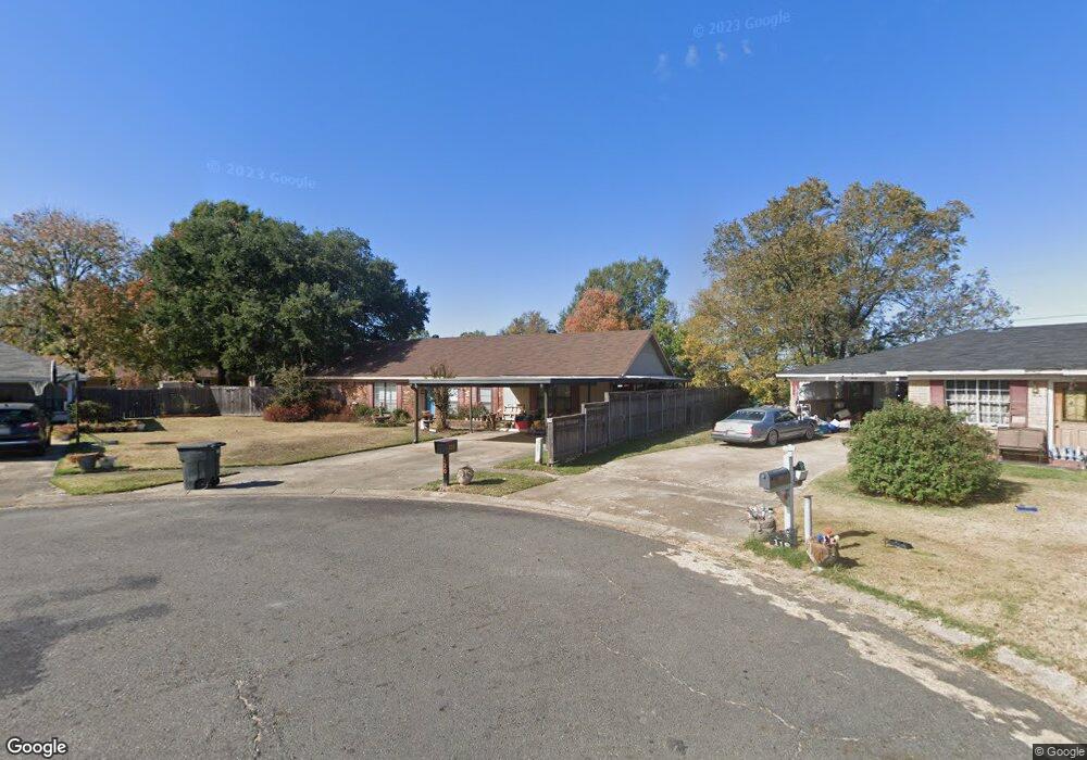
120 Norfolk Place Monroe, LA 71202
Estimated Value: $97,076 - $436,000
3
Beds
2
Baths
1,972
Sq Ft
$98/Sq Ft
Est. Value
About This Home
This home is located at 120 Norfolk Place, Monroe, LA 71202 and is currently estimated at $193,269, approximately $98 per square foot. 120 Norfolk Place is a home located in Ouachita Parish with nearby schools including Shady Grove Elementary School, Richwood Junior High School, and Richwood High School.
Ownership History
Date
Name
Owned For
Owner Type
Purchase Details
Closed on
Feb 15, 2023
Sold by
Boggs Karyn Graves
Bought by
Boggs Nelson Donald
Current Estimated Value
Home Financials for this Owner
Home Financials are based on the most recent Mortgage that was taken out on this home.
Original Mortgage
$81,250
Outstanding Balance
$78,230
Interest Rate
6.12%
Estimated Equity
$115,039
Create a Home Valuation Report for This Property
The Home Valuation Report is an in-depth analysis detailing your home's value as well as a comparison with similar homes in the area
Purchase History
| Date | Buyer | Sale Price | Title Company |
|---|---|---|---|
| Boggs Nelson Donald | -- | Nela Title Company Llc | |
| Boggs Karyn Graves | $81,250 | Nela Title Company Llc |
Source: Public Records
Mortgage History
| Date | Status | Borrower | Loan Amount |
|---|---|---|---|
| Open | Boggs Karyn Graves | $81,250 | |
| Closed | Boggs Nelson Donald | $81,250 |
Source: Public Records
Tax History
| Year | Tax Paid | Tax Assessment Tax Assessment Total Assessment is a certain percentage of the fair market value that is determined by local assessors to be the total taxable value of land and additions on the property. | Land | Improvement |
|---|---|---|---|---|
| 2025 | $348 | $9,989 | $1,100 | $8,889 |
| 2024 | $348 | $9,989 | $1,100 | $8,889 |
| 2023 | $350 | $8,724 | $1,100 | $7,624 |
| 2022 | $3,630 | $5,250 | $650 | $4,600 |
| 2021 | $0 | $5,250 | $650 | $4,600 |
| 2020 | $685 | $5,250 | $650 | $4,600 |
| 2019 | $675 | $5,250 | $650 | $4,600 |
| 2018 | $0 | $5,250 | $650 | $4,600 |
| 2017 | $1,196 | $9,510 | $1,250 | $8,260 |
| 2016 | $643 | $5,250 | $650 | $4,600 |
| 2015 | -- | $5,250 | $650 | $4,600 |
| 2014 | -- | $5,250 | $650 | $4,600 |
| 2013 | -- | $5,250 | $650 | $4,600 |
Source: Public Records
Map
Nearby Homes
- 111 Garrett Rd
- 0 I-20 Frontage Rd Unit Russel Sage Road
- 0 I-20 Frontage Rd Unit 135300
- 000 Garrett Rd
- 106 Salem Dr
- 2096 Highway 139
- 3812 Segrest Mercy St
- 7600 Frontage Rd
- 1801 Martin Luther King Junior Dr Unit Corner of Ruffin & M
- 3370 Garrett Rd
- 1411 Griffin St Unit 1413 GRIFFIN STREET
- 00 U S 165 Unit 2.04 Acres
- 0 U S 165 Unit 146203
- 0 U S 165 Unit 216510
- 108 Garden Park Dr
- 1909 Medra Dr
- 1800 Medra Dr
- 0 Martin Luther King Junior Dr
- 105 Humble Cir
- 3912 Barlow St
- 118 Norfolk Place
- 116 Charlotte Cir
- 122 Norfolk Place
- 114 Charlotte Cir
- 118 Charlotte Cir
- 124 Norfolk Place
- 116 Norfolk Place
- 114 Norfolk Place
- 112 Charlotte Cir
- 126 Norfolk Place
- 120 Charlotte Cir
- 112 Norfolk Place
- 110 Charlotte Cir
- 115 Charlotte Cir
- 110 Norfolk Place
- 113 Charlotte Cir
- 118 Huntington Dr
- 119 Huntington Dr
- 116 Huntington Dr
- 131 Charlotte Cir
Your Personal Tour Guide
Ask me questions while you tour the home.