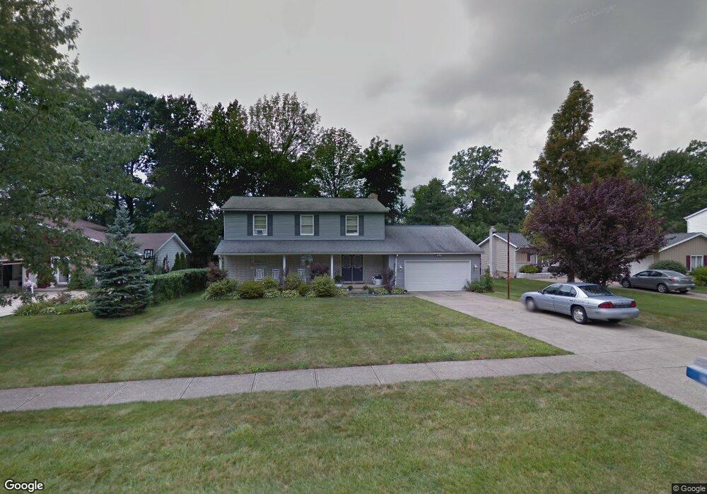
120 Normandy Dr Brunswick, OH 44212
Estimated Value: $326,096 - $389,000
About This Home
This home is located at 120 Normandy Dr, Brunswick, OH 44212 and is currently estimated at $353,524, approximately $145 per square foot. 120 Normandy Dr is a home located in Medina County with nearby schools including Brunswick Memorial Elementary School, Willets Middle School, and Brunswick High School.
Ownership History
We collect this data history from publicly available records. To have your information removed, we recommend requesting removal directly through your county’s website.
Purchase Details
Purchase Details
Home Values in the Area
Average Home Value in this Area
Purchase History
We collect this data history from publicly available records. To have your information removed, we recommend requesting removal directly through your county’s website.
| Date | Buyer | Sale Price | Title Company |
|---|---|---|---|
| -- | -- | ||
| $83,000 | -- |
Tax History
We collect this data history from publicly available records. To have your information removed, we recommend requesting removal directly through your county’s website.
| Year | Tax Paid | Tax Assessment Tax Assessment Total Assessment is a certain percentage of the fair market value that is determined by local assessors to be the total taxable value of land and additions on the property. | Land | Improvement |
|---|---|---|---|---|
| 2025 | $4,758 | $104,240 | $27,480 | $76,760 |
| 2024 | $4,758 | $75,360 | $25,580 | $49,780 |
| 2023 | $3,242 | $75,360 | $25,580 | $49,780 |
| 2022 | $3,115 | $75,360 | $25,580 | $49,780 |
| 2021 | $2,664 | $59,810 | $20,300 | $39,510 |
| 2020 | $2,397 | $59,810 | $20,300 | $39,510 |
| 2019 | $2,397 | $59,810 | $20,300 | $39,510 |
| 2018 | $2,163 | $52,440 | $18,420 | $34,020 |
| 2017 | $2,166 | $52,440 | $18,420 | $34,020 |
| 2016 | $2,164 | $52,440 | $18,420 | $34,020 |
| 2015 | $2,236 | $52,420 | $18,800 | $33,620 |
| 2014 | $2,228 | $52,420 | $18,800 | $33,620 |
| 2013 | $2,179 | $52,420 | $18,800 | $33,620 |
Map
- 201 Melbourne Dr
- 169 Aster Place
- 16492 Sunwood Oval
- 3920 Skyview Dr
- 3942 Edward Dr
- 17504 Willow Wood Dr
- 4039 Magnolia Dr
- 19157 Howe Rd
- 4090 Magnolia Dr
- 19740 Benbow Rd
- 18100 Rustic Hollow
- 148 Wellford Way
- 3713 Grafton Rd
- 19474 Benbow Rd
- 19687 Cross Creek Oval
- 551 Carolyn Dr
- 16543 Peppergrass Cir
- 18086 Winchester Ct
- 141 Fenwick Dr
- 4117 Keswick Dr
- 97 Normandy Dr
- 105 Normandy Dr
- 87 Normandy Dr
- 96 Claremont Dr
- 111 Normandy Dr
- 104 Claremont Dr
- 88 Claremont Dr
- 96 Normandy Dr
- 112 Claremont Dr
- 104 Normandy Dr
- 88 Normandy Dr
- 119 Normandy Dr
- 112 Normandy Dr
- 67 Claremont Dr
- 65 Claremont Dr
- 120 Claremont Dr
- 69 Claremont Dr
- 63 Claremont Dr
- 127 Normandy Dr
- 71 Claremont Dr
Ask me questions while you tour the home.