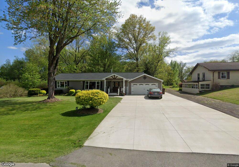
1200 Proctor Rd Akron, OH 44306
Ellet NeighborhoodEstimated Value: $272,000 - $293,000
2
Beds
2
Baths
1,568
Sq Ft
$179/Sq Ft
Est. Value
About This Home
This home is located at 1200 Proctor Rd, Akron, OH 44306 and is currently estimated at $280,725, approximately $179 per square foot. 1200 Proctor Rd is a home located in Summit County with nearby schools including Springfield High School, Eagle Elementary, and Chapel Hill Christian School-Green Campus.
Ownership History
Date
Name
Owned For
Owner Type
Purchase Details
Closed on
Oct 28, 2025
Sold by
Frye Charles L and Frye Catherine E
Bought by
Allen David James and Allen Jessica Antoinette
Current Estimated Value
Home Financials for this Owner
Home Financials are based on the most recent Mortgage that was taken out on this home.
Original Mortgage
$274,928
Outstanding Balance
$274,928
Interest Rate
6.26%
Mortgage Type
FHA
Estimated Equity
$5,797
Create a Home Valuation Report for This Property
The Home Valuation Report is an in-depth analysis detailing your home's value as well as a comparison with similar homes in the area
Home Values in the Area
Average Home Value in this Area
Purchase History
| Date | Buyer | Sale Price | Title Company |
|---|---|---|---|
| Allen David James | $280,000 | American Title Solutions |
Source: Public Records
Mortgage History
| Date | Status | Borrower | Loan Amount |
|---|---|---|---|
| Open | Allen David James | $274,928 |
Source: Public Records
Tax History
| Year | Tax Paid | Tax Assessment Tax Assessment Total Assessment is a certain percentage of the fair market value that is determined by local assessors to be the total taxable value of land and additions on the property. | Land | Improvement |
|---|---|---|---|---|
| 2025 | $3,077 | $54,597 | $13,825 | $40,772 |
| 2024 | $3,077 | $54,597 | $13,825 | $40,772 |
| 2023 | $3,077 | $54,597 | $13,825 | $40,772 |
| 2022 | $2,699 | $41,349 | $10,395 | $30,954 |
| 2021 | $2,527 | $39,603 | $10,395 | $29,208 |
| 2020 | $2,492 | $39,610 | $10,400 | $29,210 |
| 2019 | $2,834 | $41,920 | $9,360 | $32,560 |
| 2018 | $2,724 | $41,920 | $9,360 | $32,560 |
| 2017 | $2,375 | $41,920 | $9,360 | $32,560 |
| 2016 | $2,397 | $34,980 | $9,360 | $25,620 |
| 2015 | $2,375 | $34,980 | $9,360 | $25,620 |
| 2014 | $2,347 | $34,980 | $9,360 | $25,620 |
| 2013 | $2,567 | $38,190 | $9,360 | $28,830 |
Source: Public Records
Map
Nearby Homes
- 1190 Swartz Rd
- 1212 Derbydale Rd
- 1785 Mohawk Dr
- 1674 Betz Dr
- 1649 Betz Rd
- 1899 Edwards Dr
- 1031 Archmere Dr
- 1554 Woods Rd
- 1653 Mohawk Dr
- 1088 Buena Vista Dr
- 1608 Mohawk Dr Unit 1610
- 1664 Woods Rd
- 2057 Darnell Dr
- 1713 Woods Rd
- 785 Chenoweth Extension
- 1724 Krumroy Rd
- 960 Impala Dr
- 801 Chaffin Rd
- 1731 Berger Rd
- 747 Killian Rd
- 1188 Proctor Rd
- 1178 Proctor Rd
- 1185 Proctor Rd
- 1206 Proctor Rd
- 1171 Proctor Rd
- 1203 Proctor Rd
- 1163 Proctor Rd
- 1154 Proctor Rd
- 1884 Knight Rd
- 1155 Proctor Rd
- 1146 Proctor Rd
- 1902 Knight Rd
- 1910 Knight Rd
- 1920 Knight Rd
- 1137 Proctor Rd
- 1930 Knight Rd
- 1136 Proctor Rd
- 1868 Knight Rd
- 1940 Knight Rd
- 1885 Knight Rd
Your Personal Tour Guide
Ask me questions while you tour the home.