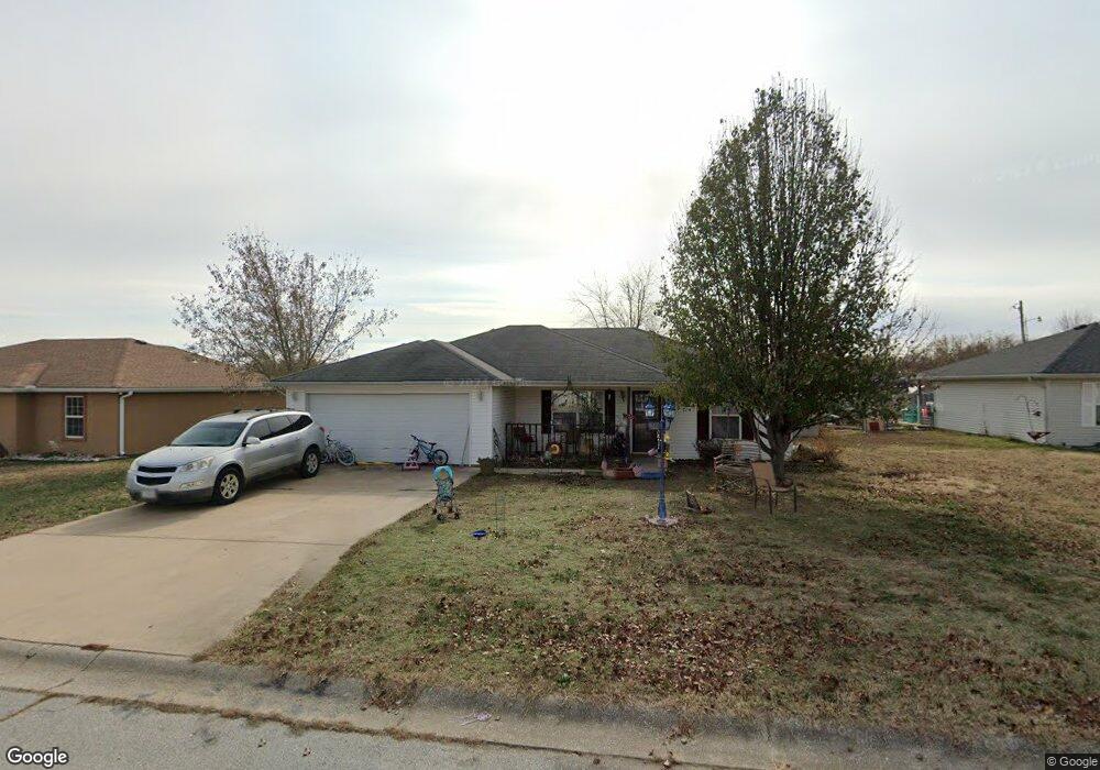
1204 Meadow Ridge Carl Junction, MO 64834
Estimated Value: $232,000 - $258,000
About This Home
This home is located at 1204 Meadow Ridge, Carl Junction, MO 64834 and is currently estimated at $246,526, approximately $129 per square foot. 1204 Meadow Ridge is a home located in Jasper County with nearby schools including Carl Junction Primary School (K-1), Carl Junction Intermediate School, and Carl Junction Primary School (2-3).
Ownership History
We collect this data history from publicly available records. To have your information removed, we recommend requesting removal directly through your county’s website.
Purchase Details
Home Financials for this Owner
Home Financials are based on the most recent Mortgage that was taken out on this home.Purchase Details
Purchase History
We collect this data history from publicly available records. To have your information removed, we recommend requesting removal directly through your county’s website.
| Date | Buyer | Sale Price | Title Company |
|---|---|---|---|
| -- | -- | ||
| -- | None Available |
Mortgage History
We collect this data history from publicly available records. To have your information removed, we recommend requesting removal directly through your county’s website.
| Date | Status | Borrower | Loan Amount |
|---|---|---|---|
| Open | $135,757 |
Tax History
We collect this data history from publicly available records. To have your information removed, we recommend requesting removal directly through your county’s website.
| Year | Tax Paid | Tax Assessment Tax Assessment Total Assessment is a certain percentage of the fair market value that is determined by local assessors to be the total taxable value of land and additions on the property. | Land | Improvement |
|---|---|---|---|---|
| 2025 | $1,273 | $24,640 | $2,050 | $22,590 |
| 2024 | $1,280 | $21,750 | $2,050 | $19,700 |
| 2023 | $1,280 | $21,750 | $2,050 | $19,700 |
| 2022 | $1,344 | $22,760 | $2,050 | $20,710 |
| 2021 | $1,153 | $22,760 | $2,050 | $20,710 |
| 2020 | $1,080 | $20,960 | $2,050 | $18,910 |
| 2019 | $1,025 | $20,960 | $2,050 | $18,910 |
| 2018 | $1,071 | $21,940 | $0 | $0 |
| 2017 | $1,073 | $21,940 | $0 | $0 |
| 2016 | $812 | $16,760 | $0 | $0 |
| 2015 | $795 | $16,760 | $0 | $0 |
| 2014 | $795 | $16,760 | $0 | $0 |
Map
- 1313 Covey Dr
- 039 County Road 270
- 404 Karen Dr
- 310 N Grimes St
- 311 Miller St
- 201 Karen Dr
- 102 S Arlington Dr
- TBD Temple St
- 307 Ashmore St
- 407 Hodge Dr
- 807 Aberdeen Ave
- 809 Aberdeen Ave
- 901 Aberdeen Ave
- 903 Aberdeen Ave
- 303 Ballard St
- 905 Aberdeen Ave
- 909 Aberdeen Ave
- 1001 Aberdeen Ave
- 804 Aberdeen Ave
- 806 Aberdeen Ave
- 1202 Meadow Ridge
- 1206 Meadow Ridge
- 1208 Meadow Ridge
- 1203 Meadow Ridge
- 1207 Meadow Ridge
- 1205 Bob White Ln
- 1205 Meadow Ridge
- 1205 Meadow Ridge Unit 1
- 1207 Bob White Ln
- 1203 Bob White Ln
- 1209 Meadow Ridge
- 410 Quail Run Unit 1
- 410 Quail Run
- 1201 Meadow Ridge
- 1210 Meadow Ridge
- 412 Quail Run
- 1209 Bob White Ln
- 408 Quail Run
- 1211 Bob White Ln
- 406 Quail Run
Ask me questions while you tour the home.