S
Seller's Agent in 2025
Sheila Brown
ChrisTrey Realty
(478) 318-8323
14 Total Sales


Estimated Value: $67,000 - $72,771
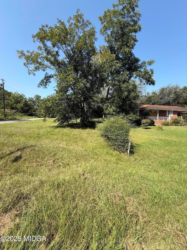
Attention DIY enthusiasts and investors! Looking for a project? Look no further! This 4 sided brick 3BD/2BA fixer-upper offers incredible potential for those with a keen eye for design and renovation. Whether you're an experienced investor or a first-time homeowner seeking a rewarding DIY experience, this property is ready to be transformed into a home that you'll be proud of. In addition to the main dwelling, there is an adjoining corner lot that can be used for family gatherings, cookouts or parking pad. No Blind Offers! Sold As- Is.Call your agent today!
Last Buyer's Agent
Brokered Agent
Brokered Sale
| Date | Buyer | Sale Price | Title Company |
|---|---|---|---|
| Flores Martha | $67,000 | None Listed On Document | |
| Smith Linda Diane Single | -- | None Listed On Document | |
| Smith Linda Diane Single | -- | None Listed On Document | |
| Smith Linda Diane Singleton | -- | None Available | |
| Singleton Gladys | -- | None Available |
| Date | Event | Price | List to Sale | Price per Sq Ft |
|---|---|---|---|---|
| 12/29/2025 12/29/25 | Sold | $67,000 | -10.7% | $62 / Sq Ft |
| 10/31/2025 10/31/25 | Pending | -- | -- | -- |
| 10/06/2025 10/06/25 | Price Changed | $75,000 | -21.1% | $70 / Sq Ft |
| 09/20/2025 09/20/25 | For Sale | $95,000 | -- | $88 / Sq Ft |
| Year | Tax Paid | Tax Assessment Tax Assessment Total Assessment is a certain percentage of the fair market value that is determined by local assessors to be the total taxable value of land and additions on the property. | Land | Improvement |
|---|---|---|---|---|
| 2025 | $391 | $28,866 | $3,498 | $25,368 |
| 2024 | $328 | $25,711 | $2,880 | $22,831 |
| 2023 | $364 | $24,931 | $2,100 | $22,831 |
| 2022 | $169 | $16,439 | $3,440 | $12,999 |
| 2021 | $71 | $10,575 | $1,290 | $9,285 |
| 2020 | $54 | $9,646 | $1,290 | $8,356 |
| 2019 | $35 | $8,718 | $1,290 | $7,428 |
| 2018 | $53 | $8,718 | $1,290 | $7,428 |
| 2017 | $30 | $8,718 | $1,290 | $7,428 |
| 2016 | $25 | $8,718 | $1,290 | $7,428 |
| 2015 | $38 | $8,718 | $1,290 | $7,428 |
| 2014 | $53 | $10,661 | $1,376 | $9,285 |
S
Seller's Agent in 2025
Sheila Brown
ChrisTrey Realty
(478) 318-8323
14 Total Sales
B
Buyer's Agent in 2025
Brokered Agent
Brokered Sale
Source: Middle Georgia MLS
MLS Number: 181482
APN: S063-0210
Disclaimer: Certain information contained herein is derived from information provided by parties other than Homes.com. All information provided is deemed reliable, but is not guaranteed to be accurate and should be independently verified.
![]() Listings on this website come from the MGMLS IDX Compilation and may be held by
Listings on this website come from the MGMLS IDX Compilation and may be held by
brokerage firms other than the owner of this website. The listing brokerage is identified in any listing details. Information is deemed reliable but is not guaranteed. If you believe any MGMLS Listing contains material that infringes your copyrighted work, please click here to review our DMCA policy and learn how to submit a takedown
request. ©2026 MGMLS.
Ask me questions while you tour the home.
