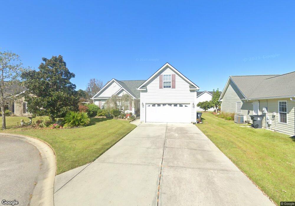
1204 Peyton Ct Myrtle Beach, SC 29588
Estimated Value: $281,000 - $329,000
3
Beds
2
Baths
1,989
Sq Ft
$154/Sq Ft
Est. Value
About This Home
This home is located at 1204 Peyton Ct, Myrtle Beach, SC 29588 and is currently estimated at $305,805, approximately $153 per square foot. 1204 Peyton Ct is a home located in Horry County with nearby schools including Socastee Elementary School, Forestbrook Middle School, and Socastee High School.
Ownership History
Date
Name
Owned For
Owner Type
Purchase Details
Closed on
May 31, 2016
Sold by
Allen Andrew B
Bought by
Hans Aaron M and Hans Kelly K
Current Estimated Value
Purchase Details
Closed on
Jan 26, 2009
Sold by
Master In Equity Horry County
Bought by
Lasalle Bank Na
Purchase Details
Closed on
Nov 5, 2004
Sold by
Hughes Pete and Hughes Lesia L
Bought by
Ullmeyer Chris and Ullmeyer Janice
Purchase Details
Closed on
Mar 24, 2004
Sold by
Independent Builders Development Inc
Bought by
Hughes Pete and Hughes Lesia L
Home Financials for this Owner
Home Financials are based on the most recent Mortgage that was taken out on this home.
Original Mortgage
$144,092
Interest Rate
5.55%
Mortgage Type
Construction
Create a Home Valuation Report for This Property
The Home Valuation Report is an in-depth analysis detailing your home's value as well as a comparison with similar homes in the area
Home Values in the Area
Average Home Value in this Area
Purchase History
| Date | Buyer | Sale Price | Title Company |
|---|---|---|---|
| Hans Aaron M | $148,000 | -- | |
| Lasalle Bank Na | $2,500 | -- | |
| Ullmeyer Chris | $166,900 | -- | |
| Hughes Pete | $32,000 | -- |
Source: Public Records
Mortgage History
| Date | Status | Borrower | Loan Amount |
|---|---|---|---|
| Previous Owner | Hughes Pete | $144,092 |
Source: Public Records
Tax History
| Year | Tax Paid | Tax Assessment Tax Assessment Total Assessment is a certain percentage of the fair market value that is determined by local assessors to be the total taxable value of land and additions on the property. | Land | Improvement |
|---|---|---|---|---|
| 2025 | -- | $0 | $0 | $0 |
| 2024 | -- | $18,346 | $3,900 | $14,446 |
| 2023 | $0 | $6,710 | $1,439 | $5,271 |
| 2021 | $535 | $12,541 | $2,281 | $10,260 |
| 2020 | $628 | $12,541 | $2,281 | $10,260 |
| 2019 | $628 | $12,541 | $2,281 | $10,260 |
| 2018 | $0 | $8,752 | $1,876 | $6,876 |
| 2017 | $0 | $8,752 | $1,876 | $6,876 |
| 2016 | $0 | $8,752 | $1,876 | $6,876 |
| 2015 | -- | $8,753 | $1,877 | $6,876 |
| 2014 | $521 | $8,753 | $1,877 | $6,876 |
Source: Public Records
Map
Nearby Homes
- 245 Colby Ct
- 244 Colby Ct
- 1412 Reid Ct
- TBD W Oak Circle Dr
- 525 Sims Dr Unit MB
- 188 Governors Loop
- 240 Foxpath Loop
- 708 Luttie Rd
- 252 Stonebrook Dr
- 811 Luttie Rd
- 101 Horizon River Dr Unit H8
- 111 Horizon River Dr Unit F-8
- 13 Smith Blvd
- 202 Luttie Rd
- 31 Smith Blvd
- 607 Geddings Dr
- 209 Stonebrook Dr
- 104 Meredith Ct Unit 104 Meredith Court
- 205 Stonebrook Dr
- 3704 Chapel Ln
- 255 Colby Ct
- 259 Colby Ct Unit MB
- 263 Colby Ct
- 1308 Lars Ct
- 1312 Lars Ct
- 251 Colby Ct
- 256 Colby Ct
- 1304 Lars Ct
- 1304 Lars Ct Unit 1304 Lars Court, Law
- 267 Colby Ct
- 1305 Lars Ct Unit Lawsons Landing
- 1305 Lars Ct
- 260 Colby Ct
- 266 Colby Ct
- 252 Colby Ct
- 1212 Peyton Ct
- 1505 Riley Ct
- 268 Colby Ct
- 1300 Lars Ct
- 500 Oak Circle Dr Unit B-4
Your Personal Tour Guide
Ask me questions while you tour the home.