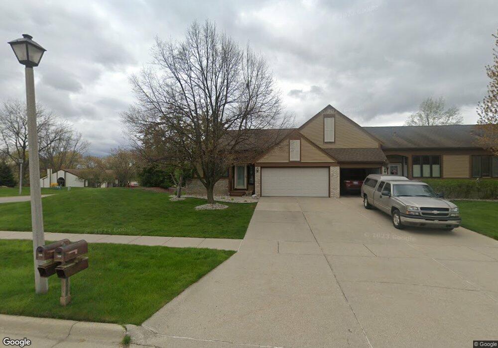
1205 Brookside Dr Unit 85 Lansing, MI 48917
Estimated Value: $307,998 - $321,000
3
Beds
2
Baths
1,364
Sq Ft
$230/Sq Ft
Est. Value
About This Home
This home is located at 1205 Brookside Dr Unit 85, Lansing, MI 48917 and is currently estimated at $313,500, approximately $229 per square foot. 1205 Brookside Dr Unit 85 is a home located in Eaton County with nearby schools including Willow Ridge Elementary School, Leon W. Hayes Middle School, and Grand Ledge High School.
Ownership History
Date
Name
Owned For
Owner Type
Purchase Details
Closed on
Oct 19, 2022
Sold by
Hillabrandt John F and Hillabrandt Carol J
Bought by
Hillabrandt John F and Hillabrandt Carol J
Current Estimated Value
Purchase Details
Closed on
Oct 24, 2006
Sold by
Davis Harley B
Bought by
Hillabrandt John F and Hillabrandt Carol J
Home Financials for this Owner
Home Financials are based on the most recent Mortgage that was taken out on this home.
Original Mortgage
$100,000
Interest Rate
6.5%
Mortgage Type
Unknown
Purchase Details
Closed on
Jun 23, 2003
Sold by
Davis Kathryn Joyce
Bought by
Davis Harley B
Home Financials for this Owner
Home Financials are based on the most recent Mortgage that was taken out on this home.
Original Mortgage
$171,700
Interest Rate
5.36%
Mortgage Type
Unknown
Create a Home Valuation Report for This Property
The Home Valuation Report is an in-depth analysis detailing your home's value as well as a comparison with similar homes in the area
Home Values in the Area
Average Home Value in this Area
Purchase History
| Date | Buyer | Sale Price | Title Company |
|---|---|---|---|
| Hillabrandt John F | -- | None Listed On Document | |
| Hillabrandt John F | $194,500 | None Available | |
| Davis Harley B | -- | Transnation Title |
Source: Public Records
Mortgage History
| Date | Status | Borrower | Loan Amount |
|---|---|---|---|
| Previous Owner | Hillabrandt John F | $100,000 | |
| Previous Owner | Davis Harley B | $171,700 |
Source: Public Records
Tax History
| Year | Tax Paid | Tax Assessment Tax Assessment Total Assessment is a certain percentage of the fair market value that is determined by local assessors to be the total taxable value of land and additions on the property. | Land | Improvement |
|---|---|---|---|---|
| 2025 | $3,304 | $140,900 | $0 | $0 |
| 2024 | $1,674 | $128,800 | $0 | $0 |
| 2023 | $1,560 | $120,500 | $0 | $0 |
| 2022 | $2,787 | $114,300 | $0 | $0 |
| 2021 | $2,661 | $106,300 | $0 | $0 |
| 2020 | $2,624 | $101,600 | $0 | $0 |
| 2019 | $2,584 | $94,479 | $0 | $0 |
| 2018 | $2,424 | $85,900 | $0 | $0 |
| 2017 | $2,370 | $80,000 | $0 | $0 |
| 2016 | -- | $74,700 | $0 | $0 |
| 2015 | -- | $73,500 | $0 | $0 |
| 2014 | -- | $63,906 | $0 | $0 |
| 2013 | -- | $62,900 | $0 | $0 |
Source: Public Records
Map
Nearby Homes
- 1026 Brookside Dr
- 6542 Brook Trail
- 6527 Brook Trail Unit 18
- 6525 Brook Trail Unit 17
- 6528 Brook Trail Unit 21
- 1205 Woodmeadow Unit 201
- 1156 Wolf Run Dr
- 1106 S Ridge Rd
- 7114 Treasure Isle Unit 56
- 7108 Captiva Dr
- 6142 W Saginaw Hwy
- 7234 Farm Hill Dr Unit 36
- 6102 Bradford Ln
- 6403 Willow Bend Dr
- 1510 Sand Point Dr
- 7315 Chellmar Dr Unit 49
- 7225 Creekside Dr Unit 37
- 7436 Creekside Dr Unit 10
- 2120 Walmar Dr
- 0 Lot B Willow
- 1207 Brookside Dr
- 1209 Brookside Dr Unit 87
- 1211 Brookside Dr Unit 88
- 1221 Brookside Dr
- 1124 Summergreen Ln
- 1110 Summergreen Ln
- 1110 Summergreen Ln Unit 102
- 1114 Summergreen Ln Unit 100
- 1114 Summergreen Ln
- 1117 Brookside Dr
- 1126 Summergreen Ln Unit 98
- 1210 Brookside Dr
- 1210 Brookside Dr Unit 68
- 1206 Brookside Dr Unit 66
- 1208 Brookside Dr
- 1208 Brookside Dr Unit 67
- 1223 Brookside Dr Unit 90
- 1115 Brookside Dr
Your Personal Tour Guide
Ask me questions while you tour the home.