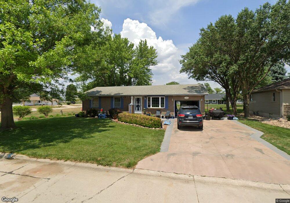
1206 E 3rd St Friend, NE 68359
Estimated Value: $155,087 - $185,000
1
Bed
1
Bath
1,040
Sq Ft
$161/Sq Ft
Est. Value
About This Home
This home is located at 1206 E 3rd St, Friend, NE 68359 and is currently estimated at $167,522, approximately $161 per square foot. 1206 E 3rd St is a home located in Saline County with nearby schools including Friend Elementary School and Friend High School.
Ownership History
Date
Name
Owned For
Owner Type
Purchase Details
Closed on
Jun 23, 2021
Sold by
Nickel David M and Nickel Joyce Lynn
Bought by
Light Jet Properties Llc
Current Estimated Value
Purchase Details
Closed on
Jul 11, 2014
Sold by
David P David P
Bought by
Kasl David P
Purchase Details
Closed on
Dec 21, 2009
Sold by
Horky Roger A and Horky Ramona F
Bought by
Horky Roger A and Horky Ramona F
Create a Home Valuation Report for This Property
The Home Valuation Report is an in-depth analysis detailing your home's value as well as a comparison with similar homes in the area
Purchase History
| Date | Buyer | Sale Price | Title Company |
|---|---|---|---|
| Light Jet Properties Llc | $55,000 | Title Svcs Of Saunders Cnty | |
| Kasl David P | -- | -- | |
| Horky Roger A | -- | -- |
Source: Public Records
Tax History
| Year | Tax Paid | Tax Assessment Tax Assessment Total Assessment is a certain percentage of the fair market value that is determined by local assessors to be the total taxable value of land and additions on the property. | Land | Improvement |
|---|---|---|---|---|
| 2025 | $2,370 | $161,780 | $13,120 | $148,660 |
| 2024 | -- | $148,265 | $13,120 | $135,145 |
| 2023 | $2,751 | $141,830 | $13,120 | $128,710 |
| 2022 | $1,538 | $106,665 | $11,715 | $94,950 |
| 2021 | $1,539 | $103,900 | $11,715 | $92,185 |
| 2020 | $1,553 | $102,090 | $11,715 | $90,375 |
| 2019 | $1,489 | $96,975 | $11,715 | $85,260 |
| 2018 | $1,820 | $90,660 | $11,715 | $78,945 |
| 2017 | $1,878 | $90,660 | $11,715 | $78,945 |
| 2016 | $1,910 | $92,270 | $11,715 | $80,555 |
| 2015 | $2,100 | $81,075 | $13,315 | $67,760 |
| 2014 | $1,674 | $78,470 | $13,315 | $65,155 |
Source: Public Records
Map
Nearby Homes
Your Personal Tour Guide
Ask me questions while you tour the home.