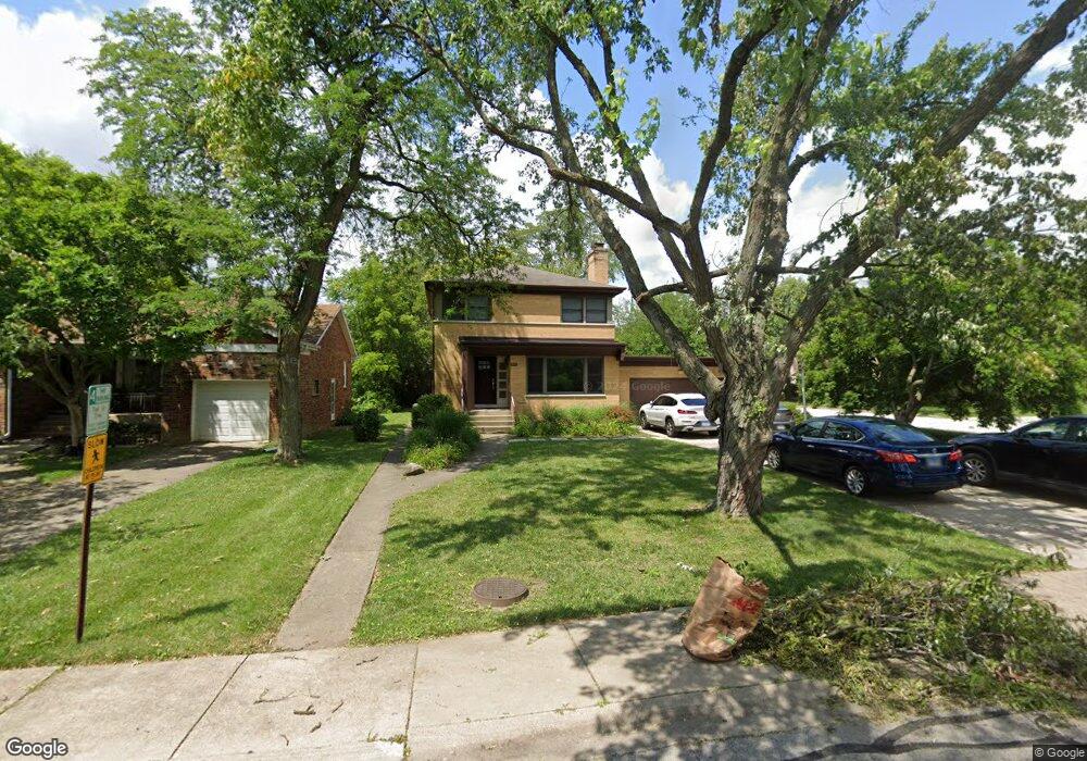
1206 Strieff Ln Flossmoor, IL 60422
Estimated Value: $275,000 - $330,000
4
Beds
3
Baths
2,284
Sq Ft
$136/Sq Ft
Est. Value
About This Home
This home is located at 1206 Strieff Ln, Flossmoor, IL 60422 and is currently estimated at $310,409, approximately $135 per square foot. 1206 Strieff Ln is a home located in Cook County with nearby schools including Heather Hill Elementary School, Parker Junior High School, and Homewood-Flossmoor High School.
Ownership History
Date
Name
Owned For
Owner Type
Purchase Details
Closed on
Aug 29, 2003
Sold by
Green Michael
Bought by
Barnett Jamie and Barnett Asherah
Current Estimated Value
Home Financials for this Owner
Home Financials are based on the most recent Mortgage that was taken out on this home.
Original Mortgage
$211,375
Interest Rate
6.23%
Mortgage Type
Unknown
Purchase Details
Closed on
Jul 5, 1996
Sold by
Barbara Bierg Joel and Barbara Bierg
Bought by
Green Michael
Home Financials for this Owner
Home Financials are based on the most recent Mortgage that was taken out on this home.
Original Mortgage
$125,000
Interest Rate
8.07%
Create a Home Valuation Report for This Property
The Home Valuation Report is an in-depth analysis detailing your home's value as well as a comparison with similar homes in the area
Home Values in the Area
Average Home Value in this Area
Purchase History
| Date | Buyer | Sale Price | Title Company |
|---|---|---|---|
| Barnett Jamie | $222,500 | Cti | |
| Green Michael | $171,000 | -- |
Source: Public Records
Mortgage History
| Date | Status | Borrower | Loan Amount |
|---|---|---|---|
| Previous Owner | Barnett Jamie | $211,375 | |
| Previous Owner | Green Michael | $125,000 |
Source: Public Records
Tax History
| Year | Tax Paid | Tax Assessment Tax Assessment Total Assessment is a certain percentage of the fair market value that is determined by local assessors to be the total taxable value of land and additions on the property. | Land | Improvement |
|---|---|---|---|---|
| 2025 | $12,635 | $29,546 | $5,541 | $24,005 |
| 2024 | $12,635 | $29,546 | $5,541 | $24,005 |
| 2023 | $8,047 | $33,000 | $5,541 | $27,459 |
| 2022 | $8,047 | $18,383 | $4,786 | $13,597 |
| 2021 | $8,110 | $18,382 | $4,785 | $13,597 |
| 2020 | $7,887 | $18,382 | $4,785 | $13,597 |
| 2019 | $9,260 | $20,613 | $4,281 | $16,332 |
| 2018 | $8,909 | $20,613 | $4,281 | $16,332 |
| 2017 | $8,777 | $20,613 | $4,281 | $16,332 |
| 2016 | $5,971 | $13,772 | $3,778 | $9,994 |
| 2015 | $5,933 | $13,772 | $3,778 | $9,994 |
| 2014 | $5,850 | $13,772 | $3,778 | $9,994 |
| 2013 | $5,814 | $14,797 | $3,778 | $11,019 |
Source: Public Records
Map
Nearby Homes
- 2708 Hawthorne Ln
- 1141 Leavitt Ave Unit 115
- 1139 Leavitt Ave Unit 203
- 1139 Leavitt Ave Unit 212
- 2817 Flossmoor Rd
- 1314 Bunker Ave
- 2640 Central Dr Unit 1-N
- 1248 Berry Ln
- 2622 Central Dr Unit 2N
- 1002 Douglas Ave
- 2931 Sunset Ave
- 2929 Flossmoor Rd
- 926 Braemar Rd
- 1430 Brassie Ave
- 831 Verne Ln
- 3118 Elaine Ct Unit 232
- 1418 Western Ave
- 725 Braemar Rd
- 808 Sterling Ave
- 2937 Kathleen Ln
- 1212 Strieff Ln
- 1215 Douglas Ave
- 1218 Strieff Ln
- 1143 Douglas Ave
- 2714 Hawthorne Ln
- 1222 Strieff Ln
- 1139 Douglas Ave
- 2709 Hawthorne Ln
- 1223 Douglas Ave
- 2713 Emelia Ct
- 1208 Douglas Ave
- 1135 Douglas Ave
- 1214 Douglas Ave
- 1146 Douglas Ave
- 1231 Douglas Ave
- 2700 Hawthorne Ln
- 2707 Emelia Ct
- 1138 Leavitt Ave
- 1232 Strieff Ln
- 1220 Douglas Ave
Your Personal Tour Guide
Ask me questions while you tour the home.