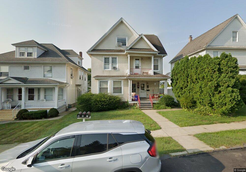
1207 Watson St Scranton, PA 18504
Hyde Park NeighborhoodEstimated Value: $164,000 - $288,000
Studio
--
Bath
2,670
Sq Ft
$85/Sq Ft
Est. Value
About This Home
This home is located at 1207 Watson St, Scranton, PA 18504 and is currently estimated at $227,878, approximately $85 per square foot. 1207 Watson St is a home located in Lackawanna County with nearby schools including Frances Willard School, West Scranton Intrmd School, and West Scranton High School.
Ownership History
Date
Name
Owned For
Owner Type
Purchase Details
Closed on
Jul 14, 2021
Sold by
Scartelli Ralph A and Scartelli Jean
Bought by
Chickey Chester
Current Estimated Value
Home Financials for this Owner
Home Financials are based on the most recent Mortgage that was taken out on this home.
Original Mortgage
$175,000
Outstanding Balance
$156,785
Interest Rate
2.93%
Mortgage Type
Purchase Money Mortgage
Estimated Equity
$71,093
Purchase Details
Closed on
May 2, 1990
Bought by
Scartelli Ralph A and Scartelli Jean
Create a Home Valuation Report for This Property
The Home Valuation Report is an in-depth analysis detailing your home's value as well as a comparison with similar homes in the area
Home Values in the Area
Average Home Value in this Area
Purchase History
| Date | Buyer | Sale Price | Title Company |
|---|---|---|---|
| Chickey Chester | $150,000 | None Available | |
| Scartelli Ralph A | $70,000 | -- |
Source: Public Records
Mortgage History
| Date | Status | Borrower | Loan Amount |
|---|---|---|---|
| Open | Chickey Chester | $175,000 |
Source: Public Records
Tax History
| Year | Tax Paid | Tax Assessment Tax Assessment Total Assessment is a certain percentage of the fair market value that is determined by local assessors to be the total taxable value of land and additions on the property. | Land | Improvement |
|---|---|---|---|---|
| 2026 | $37,740 | $235,890 | $37,320 | $198,570 |
| 2025 | $3,684 | $11,600 | $1,600 | $10,000 |
| 2024 | $3,363 | $11,600 | $1,600 | $10,000 |
| 2023 | $3,363 | $11,600 | $1,600 | $10,000 |
| 2022 | $3,289 | $11,600 | $1,600 | $10,000 |
| 2021 | $3,289 | $11,600 | $1,600 | $10,000 |
| 2020 | $3,227 | $11,600 | $1,600 | $10,000 |
| 2019 | $4,098 | $16,100 | $1,600 | $14,500 |
| 2018 | $4,098 | $16,100 | $1,600 | $14,500 |
| 2017 | $4,022 | $16,100 | $1,600 | $14,500 |
| 2016 | $1,105 | $16,100 | $1,600 | $14,500 |
| 2015 | $2,984 | $16,100 | $1,600 | $14,500 |
| 2014 | -- | $16,100 | $1,600 | $14,500 |
Source: Public Records
Map
Nearby Homes
- 1227 Rundle St
- 1200 Watson St
- LOT#16 Reynolds Ave
- Lot# 7 Reynolds Ave
- 1127 Rundle St
- 1301 Sloan St
- 1335 Sloan St
- 1250 S 1252 6th
- 924 S Main Ave
- 1009 1011 Acker Ave Unit L 109
- 815 S 9th Ave
- 1155 W Elm St
- 1010 Eynon St
- 1215 Eynon St
- 1223 Eynon St
- 1140 Hampton St
- 910 Hampton St
- 1158 Hampton St
- 532 Eynon St
- 414 S 416 S Edwards Ct
- 1205 1/2 Watson St
- 1205 Watson St
- 1203 Watson St
- 1211 Watson St
- 1213 Watson St
- 1201 Watson St
- 1215 Watson St
- 1206 Rundle St
- 1210 Rundle St
- 1202 Watson St Unit 1204
- 1204 Rundle St
- 1212 Rundle St
- 1212 Rundle St
- 1208 Rundle St
- 1208 Watson St
- 1208 Watson St Unit L 47
- 1214 Rundle St
- 1210 Watson St
- 1206 Watson St
- 1217 Watson St
Your Personal Tour Guide
Ask me questions while you tour the home.