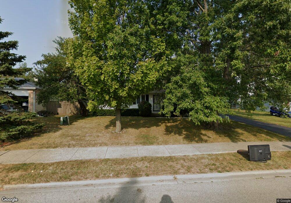
1208 Lorelei Dr Zion, IL 60099
West Zion NeighborhoodEstimated Value: $233,195 - $290,000
About This Home
This home is located at 1208 Lorelei Dr, Zion, IL 60099 and is currently estimated at $262,549, approximately $248 per square foot. 1208 Lorelei Dr is a home located in Lake County with nearby schools including Newport Elementary School, Beach Park Middle School, and Zion-Benton Township High School.
Ownership History
We collect this data history from publicly available records. To have your information removed, we recommend requesting removal directly through your county’s website.
Purchase Details
Purchase Details
Home Financials for this Owner
Home Financials are based on the most recent Mortgage that was taken out on this home.Home Values in the Area
Average Home Value in this Area
Purchase History
We collect this data history from publicly available records. To have your information removed, we recommend requesting removal directly through your county’s website.
| Date | Buyer | Sale Price | Title Company |
|---|---|---|---|
| -- | -- | ||
| $104,000 | -- |
Mortgage History
We collect this data history from publicly available records. To have your information removed, we recommend requesting removal directly through your county’s website.
| Date | Status | Borrower | Loan Amount |
|---|---|---|---|
| Closed | $103,170 |
Tax History
We collect this data history from publicly available records. To have your information removed, we recommend requesting removal directly through your county’s website.
| Year | Tax Paid | Tax Assessment Tax Assessment Total Assessment is a certain percentage of the fair market value that is determined by local assessors to be the total taxable value of land and additions on the property. | Land | Improvement |
|---|---|---|---|---|
| 2025 | $5,655 | $61,512 | $10,274 | $51,238 |
| 2024 | $5,351 | $55,945 | $9,344 | $46,601 |
| 2023 | $5,246 | $49,880 | $8,331 | $41,549 |
| 2022 | $5,246 | $46,210 | $6,836 | $39,374 |
| 2021 | $5,149 | $43,349 | $6,413 | $36,936 |
| 2020 | $4,944 | $40,772 | $6,032 | $34,740 |
| 2019 | $4,787 | $37,980 | $5,619 | $32,361 |
| 2018 | $4,231 | $33,843 | $5,075 | $28,768 |
| 2017 | $4,132 | $31,394 | $4,708 | $26,686 |
| 2016 | $3,786 | $28,499 | $4,274 | $24,225 |
| 2015 | $3,585 | $25,859 | $3,878 | $21,981 |
| 2014 | $3,315 | $24,674 | $3,660 | $21,014 |
| 2012 | $3,816 | $26,277 | $3,898 | $22,379 |
Map
- 4014 Ridge Rd
- 3909 Sedge St
- 3903 9th St
- 614 Kakos Ct
- 42145 N Kenosha Rd
- 3501 Portsmouth Dr
- 11778 W 12th St
- 3413 Harbor Ridge Dr
- 1708 Sunshine Ln
- 3308 Wembley Dr
- 646 Meadow Ln
- 1901 Freedom Ct Unit 385
- 1405 Lewis Ave
- 1707 Joanna Ave
- 1904 Joanna Ave
- 1828 Horeb Ave
- 2400 Mark Ave
- 40798 N Forest View Rd
- 41616 N Delany Rd
- 3117 23rd St
- 1206 Lorelei Dr
- 1212 Lorelei Dr
- 1204 Lorelei Dr
- 1209 Lorelei Dr
- 1211 Lorelei Dr
- 4019 Brigadoon Dr
- 1202 Lorelei Dr
- 1214 Lorelei Dr
- 1207 Pheasant Run
- 1209 Pheasant Run
- 1213 Lorelei Dr
- 1205 Pheasant Run
- 1211 Pheasant Run
- 4015 Brigadoon Dr
- 4017 Brigadoon Dr
- 1203 Pheasant Run
- 1200 Lorelei Dr Unit 11
- 4022 Brigadoon Dr
- 1215 Lorelei Dr
- 1201 Pheasant Run
Ask me questions while you tour the home.