12095 State Route 301 Lagrange, OH 44050
Estimated Value: $222,000 - $347,000
About This Home
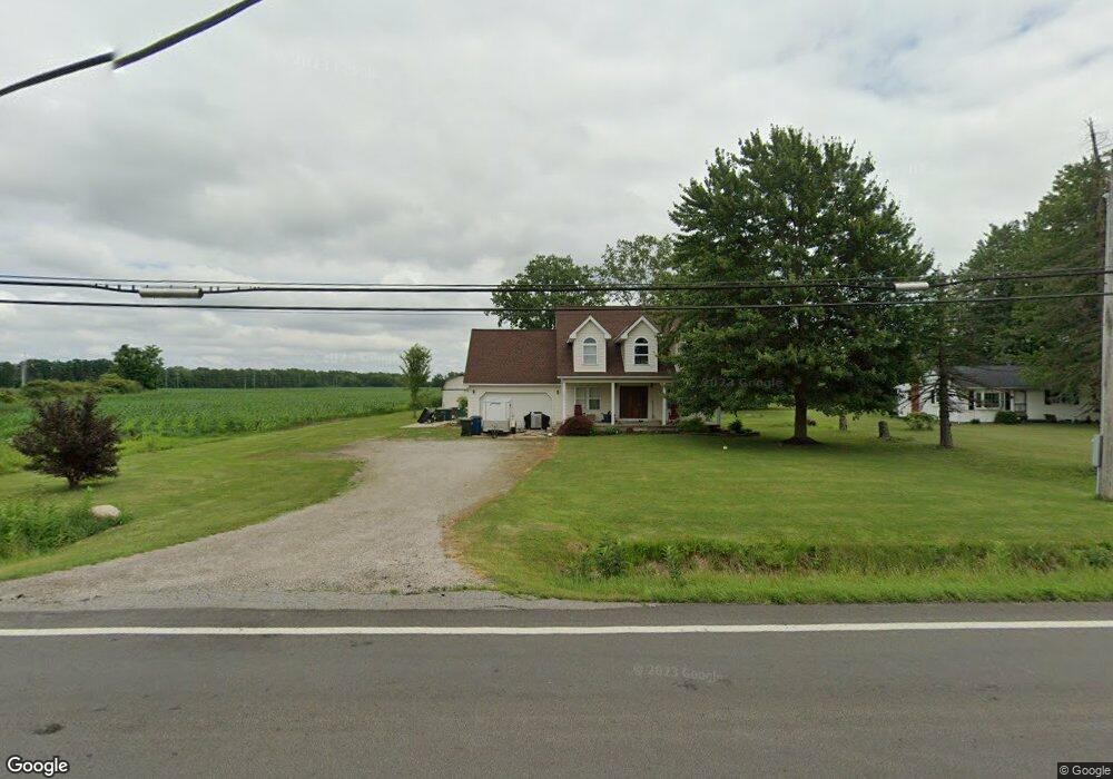
This home is located at 12095 State Route 301, Lagrange, OH 44050 and is currently estimated at $278,207, approximately $190 per square foot. 12095 State Route 301 is a home located in Lorain County with nearby schools including Keystone Elementary School, Keystone Middle School, and Keystone High School.
Ownership History
We collect this data history from publicly available records. To have your information removed, we recommend requesting removal directly through your county’s website.
Purchase Details
Home Financials for this Owner
Home Financials are based on the most recent Mortgage that was taken out on this home.Purchase Details
Home Financials for this Owner
Home Financials are based on the most recent Mortgage that was taken out on this home.Purchase Details
Home Financials for this Owner
Home Financials are based on the most recent Mortgage that was taken out on this home.Purchase Details
Home Financials for this Owner
Home Financials are based on the most recent Mortgage that was taken out on this home.Purchase Details
Purchase History
We collect this data history from publicly available records. To have your information removed, we recommend requesting removal directly through your county’s website.
| Date | Buyer | Sale Price | Title Company |
|---|---|---|---|
| -- | Costanzo & Lazzaro Pll | ||
| $81,000 | Omega Title Agency Llc | ||
| $80,000 | Attorney | ||
| $179,000 | Foundation Title Agency | ||
| -- | Midland Title |
Mortgage History
We collect this data history from publicly available records. To have your information removed, we recommend requesting removal directly through your county’s website.
| Date | Status | Borrower | Loan Amount |
|---|---|---|---|
| Open | $6,625 | ||
| Open | $274,540 | ||
| Previous Owner | $106,298 | ||
| Previous Owner | $174,250 |
Tax History
We collect this data history from publicly available records. To have your information removed, we recommend requesting removal directly through your county’s website.
| Year | Tax Paid | Tax Assessment Tax Assessment Total Assessment is a certain percentage of the fair market value that is determined by local assessors to be the total taxable value of land and additions on the property. | Land | Improvement |
|---|---|---|---|---|
| 2024 | $2,532 | $62,342 | $11,781 | $50,561 |
| 2023 | $2,658 | $54,103 | $11,449 | $42,655 |
| 2022 | $2,638 | $54,103 | $11,449 | $42,655 |
| 2021 | $2,638 | $54,103 | $11,449 | $42,655 |
| 2020 | $2,705 | $50,280 | $10,640 | $39,640 |
| 2019 | $2,687 | $50,280 | $10,640 | $39,640 |
| 2018 | $2,531 | $50,280 | $10,640 | $39,640 |
| 2017 | $2,364 | $41,090 | $10,640 | $30,450 |
| 2016 | $2,346 | $41,090 | $10,640 | $30,450 |
| 2015 | $2,307 | $41,090 | $10,640 | $30,450 |
| 2014 | $2,005 | $41,090 | $10,640 | $30,450 |
| 2013 | $1,913 | $41,090 | $10,640 | $30,450 |
Map
- 180 Mallard Creek Run
- 39769 Butternut Ridge Rd
- 40622 Carlisle Ave
- 10924 Libby Ave
- 140 Wild Flower Dr
- 40878 Myrtle Ct
- 172 Wildflower Dr
- 437 Pheasant Run
- 180 Wild Flower Dr
- 40163 Banks Rd
- 574 Cedarwood Trail
- 39738 Banks Rd
- 40175 Banks Rd
- 224 Harvest Way
- 160 Kentucky Dr
- 704 Maple Hollow Ct
- 147 Georgette Dr
- 40087 Hope Ct
- 13455 Indian Hollow Rd
- 110 Harvest Way
- 12150 State Route 301
- 12148 State Route 301
- 12150 Lagrange Rd
- 12000 Diagonal Rd
- 12110 Diagonal Rd
- 12217 Diagonal Rd
- 0 St Rt 301 & 20 Unit 3032486
- 11921 Lagrange Rd
- 12150 Diagonal Rd
- 12200 Diagonal Rd
- 12214 Diagonal Rd
- 40955 Ohio 301
- 12095 Lagrange Rd
- 12250 Diagonal Rd
- 12234 Diagonal Rd
- 40955 Butternut Ridge Rd
- 12531 State Route 301
- 41049 Butternut Park Ct
- 41053 Butternut Park Ct
- 12351 Diagonal Rd
Ask me questions while you tour the home.