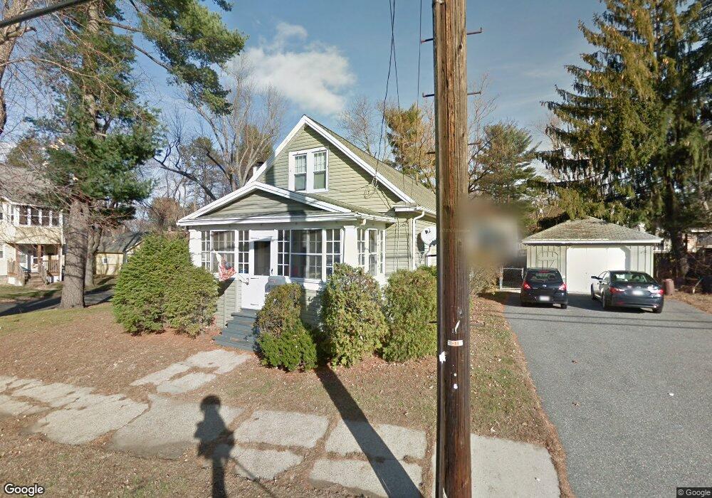
121 Dwight Rd Longmeadow, MA 01106
Estimated Value: $265,603 - $327,000
3
Beds
2
Baths
1,554
Sq Ft
$197/Sq Ft
Est. Value
About This Home
This home is located at 121 Dwight Rd, Longmeadow, MA 01106 and is currently estimated at $306,151, approximately $197 per square foot. 121 Dwight Rd is a home located in Hampden County with nearby schools including Meadowbrook Elementary School, Birchland Park Middle School, and East Longmeadow High School.
Ownership History
Date
Name
Owned For
Owner Type
Purchase Details
Closed on
Nov 28, 1997
Sold by
Tamarkin Leslie C
Bought by
Ross Keith A and Ross Elizabeth M
Current Estimated Value
Home Financials for this Owner
Home Financials are based on the most recent Mortgage that was taken out on this home.
Original Mortgage
$86,477
Interest Rate
7.26%
Mortgage Type
Purchase Money Mortgage
Create a Home Valuation Report for This Property
The Home Valuation Report is an in-depth analysis detailing your home's value as well as a comparison with similar homes in the area
Home Values in the Area
Average Home Value in this Area
Purchase History
We collect this data history from publicly available records. To have your information removed, we recommend requesting removal directly through your county’s website.
| Date | Buyer | Sale Price | Title Company |
|---|---|---|---|
| Ross Keith A | $86,900 | -- |
Source: Public Records
Mortgage History
We collect this data history from publicly available records. To have your information removed, we recommend requesting removal directly through your county’s website.
| Date | Status | Borrower | Loan Amount |
|---|---|---|---|
| Open | Ross Keith A | $109,500 | |
| Closed | Ross Keith A | $86,477 | |
| Previous Owner | Ross Keith A | $91,200 |
Source: Public Records
Tax History
| Year | Tax Paid | Tax Assessment Tax Assessment Total Assessment is a certain percentage of the fair market value that is determined by local assessors to be the total taxable value of land and additions on the property. | Land | Improvement |
|---|---|---|---|---|
| 2025 | $2,395 | $129,600 | $58,600 | $71,000 |
| 2024 | $2,229 | $120,200 | $58,600 | $61,600 |
| 2023 | $1,045 | $109,600 | $53,300 | $56,300 |
| 2022 | $2,013 | $99,200 | $48,500 | $50,700 |
| 2021 | $1,030 | $93,800 | $44,800 | $49,000 |
| 2020 | $1,909 | $91,600 | $44,800 | $46,800 |
| 2019 | $779 | $89,500 | $43,600 | $45,900 |
| 2018 | $890 | $86,400 | $43,600 | $42,800 |
| 2017 | $889 | $82,000 | $41,300 | $40,700 |
| 2016 | $1,791 | $84,800 | $44,600 | $40,200 |
| 2015 | $1,757 | $84,800 | $44,600 | $40,200 |
Source: Public Records
Map
Nearby Homes
- 61 Wood Ave
- 38 Manchester Terrace
- 186 Belvidere St
- 147 Belvidere St
- 129 Cooper St
- 137 Carroll St
- 19 Orpheum Ave
- 139 Tiffany St
- 0 Donald Ave
- 107 Dorset St
- 117-119 Draper St
- 141 Shawmut St
- 77 Dorset St
- 217 Ellsworth Ave
- 12-14 Carver St
- 34 Castle St
- 24 Hiawatha St
- 58 Appleton St
- 119 Powell Ave
- 9 Texel Dr
- 109 Dwight Rd Unit 111
- 109 Dwight Rd Unit 1
- 105 Dwight Rd Unit 107
- 101 Dwight Rd
- 71 Wood Ave
- 106-108 Dwight Rd
- 116 Dwight Rd
- 112 Dwight Rd
- 106 Dwight Rd Unit 1
- 106 Dwight Rd Unit 108
- 95 Dwight Rd Unit 97
- 77 Wood Ave
- 122 Dwight Rd
- 126 Dwight Rd
- 131 Dwight Rd
- 91 Dwight Rd
- 131 Highview Ave
- 55 Wood Ave
- 131 Dwight Rd
- 96 Dwight Rd Unit 98
Your Personal Tour Guide
Ask me questions while you tour the home.