--
Bed
--
Bath
--
Sq Ft
--
Built
About This Home
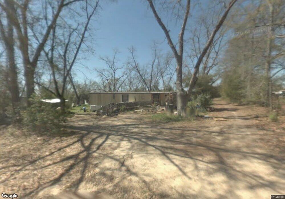
This home is located at 121 Simpson Dr, Pavo, GA 31778. 121 Simpson Dr is a home with nearby schools including North Brooks Elementary School.
Ownership History
We collect this data history from publicly available records. To have your information removed, we recommend requesting removal directly through your county’s website.
Date
Name
Owned For
Owner Type
Purchase Details
Closed on
Sep 14, 2022
Sold by
Bought by
Purchase Details
Closed on
Dec 10, 2021
Sold by
Bought by
Purchase Details
Closed on
Jun 18, 2021
Sold by
Bought by
Purchase Details
Closed on
May 5, 2010
Sold by
Bought by
Purchase Details
Closed on
Jul 28, 2004
Sold by
Bought by
Purchase Details
Closed on
Jan 25, 1988
Sold by
Bought by
Purchase Details
Closed on
Jul 3, 1986
Sold by
Bought by
Purchase Details
Closed on
Mar 31, 1986
Sold by
Bought by
Create a Home Valuation Report for This Property
The Home Valuation Report is an in-depth analysis detailing your home's value as well as a comparison with similar homes in the area
Purchase History
We collect this data history from publicly available records. To have your information removed, we recommend requesting removal directly through your county’s website.
| Date | Buyer | Sale Price | Title Company |
|---|---|---|---|
| -- | -- | ||
| $25,000 | -- | ||
| -- | -- | ||
| $30,000 | -- | ||
| -- | -- | ||
| -- | -- | ||
| $8,500 | -- | ||
| $6,400 | -- |
Source: Public Records
Tax History
We collect this data history from publicly available records. To have your information removed, we recommend requesting removal directly through your county’s website.
| Year | Tax Paid | Tax Assessment Tax Assessment Total Assessment is a certain percentage of the fair market value that is determined by local assessors to be the total taxable value of land and additions on the property. | Land | Improvement |
|---|---|---|---|---|
| 2025 | $939 | $21,768 | $11,360 | $10,408 |
| 2024 | $578 | $13,560 | $11,360 | $2,200 |
| 2023 | $356 | $11,600 | $10,800 | $800 |
| 2022 | $339 | $10,280 | $10,280 | $0 |
| 2021 | $213 | $6,000 | $6,000 | $0 |
| 2020 | $253 | $6,000 | $6,000 | $0 |
| 2019 | $208 | $6,160 | $6,160 | $0 |
| 2018 | $258 | $5,960 | $5,960 | $0 |
| 2017 | $204 | $5,960 | $5,960 | $0 |
| 2016 | $202 | $5,960 | $5,960 | $0 |
| 2015 | -- | $5,960 | $5,960 | $0 |
| 2014 | -- | $5,960 | $5,960 | $0 |
Source: Public Records
Map
Nearby Homes
- 1065 W Harris St
- 1071 W Pear St
- 4051 Main St
- 813 Vonier Rd
- 1197 Vonier Rd
- Tract #1 Convick Cir
- Tract #2 Convick Cir
- 1333 Convick Cir
- 1325 Convick Cir
- 2195 Coffee Rd
- 12772 Hwy 122
- 7402 Coffee Rd
- 0 Salem Rd Unit 10758930
- 9283 Tallokas Rd Unit 54/13
- 9283 Tallokas Rd
- 911 Stephenson Rd
- 536 Heard Rd
- 00000 Austin Lane (3 46 Acres)
- 111 Nicole Britt Dr
- 106 Nicole Britt Dr
Your Personal Tour Guide
Ask me questions while you tour the home.