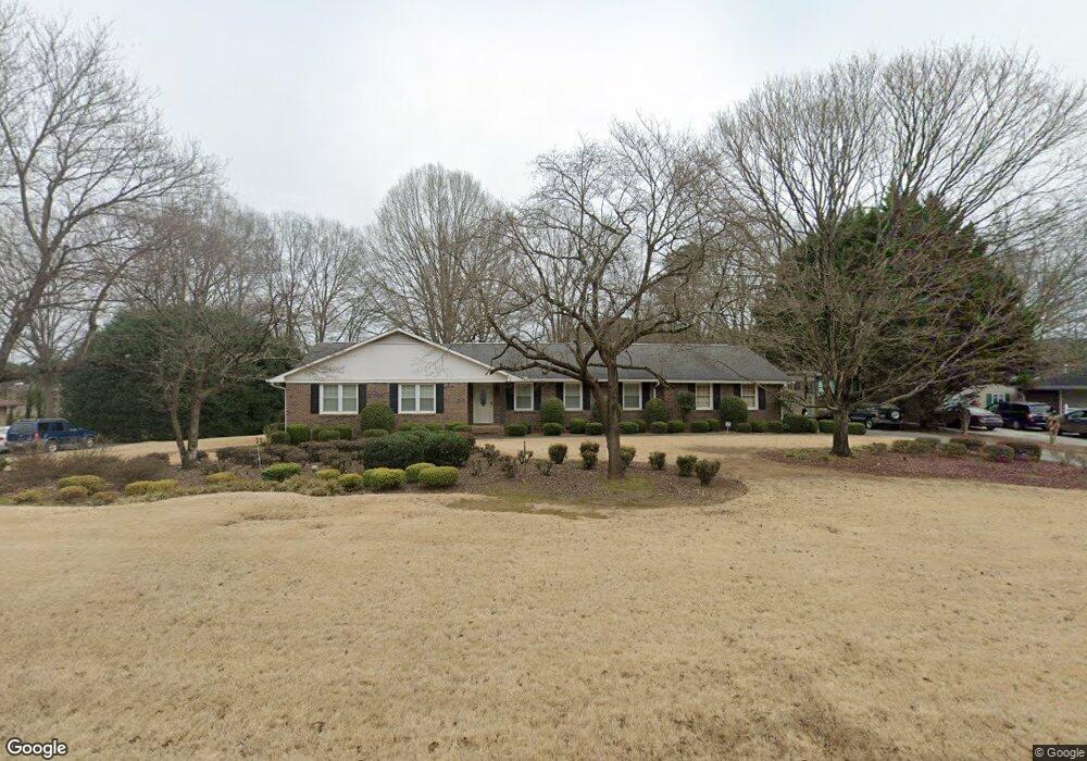
121 Windsor Dr Calhoun, GA 30701
Estimated Value: $304,755 - $417,000
About This Home
This home is located at 121 Windsor Dr, Calhoun, GA 30701 and is currently estimated at $343,689, approximately $162 per square foot. 121 Windsor Dr is a home located in Gordon County with nearby schools including Calhoun Elementary School, Calhoun Middle School, and Calhoun High School.
Ownership History
We collect this data history from publicly available records. To have your information removed, we recommend requesting removal directly through your county’s website.
Purchase Details
Home Financials for this Owner
Home Financials are based on the most recent Mortgage that was taken out on this home.Purchase Details
Home Financials for this Owner
Home Financials are based on the most recent Mortgage that was taken out on this home.Purchase Details
Purchase Details
Purchase History
We collect this data history from publicly available records. To have your information removed, we recommend requesting removal directly through your county’s website.
| Date | Buyer | Sale Price | Title Company |
|---|---|---|---|
| $150,000 | -- | ||
| $195,000 | -- | ||
| $148,000 | -- | ||
| $126,500 | -- |
Mortgage History
We collect this data history from publicly available records. To have your information removed, we recommend requesting removal directly through your county’s website.
| Date | Status | Borrower | Loan Amount |
|---|---|---|---|
| Open | $120,000 | ||
| Previous Owner | $156,000 |
Tax History
We collect this data history from publicly available records. To have your information removed, we recommend requesting removal directly through your county’s website.
| Year | Tax Paid | Tax Assessment Tax Assessment Total Assessment is a certain percentage of the fair market value that is determined by local assessors to be the total taxable value of land and additions on the property. | Land | Improvement |
|---|---|---|---|---|
| 2025 | $966 | $88,980 | $5,600 | $83,380 |
| 2024 | $943 | $78,500 | $5,600 | $72,900 |
| 2023 | $883 | $73,620 | $5,600 | $68,020 |
| 2022 | $638 | $69,100 | $5,600 | $63,500 |
| 2021 | $682 | $57,380 | $5,600 | $51,780 |
| 2020 | $696 | $58,140 | $5,600 | $52,540 |
| 2019 | $692 | $58,140 | $5,600 | $52,540 |
| 2018 | $504 | $54,320 | $5,600 | $48,720 |
| 2017 | $487 | $51,520 | $5,600 | $45,920 |
| 2016 | $488 | $51,520 | $5,600 | $45,920 |
| 2015 | $482 | $50,560 | $5,600 | $44,960 |
| 2014 | $460 | $49,226 | $5,600 | $43,626 |
Map
- 115 Windsor Dr
- 140 Cambridge Ct
- 114 Lindsey Ct NE
- 102 Lindsey Ct NE
- 153 York Place
- 105 Waterside Trail
- 101 Waterside Trail
- 123 Waterside Ridge
- 110 Waterside Ridge
- 326 Curtis Pkwy NE
- 121 Stone Haven Dr
- 316 Waterford Dr
- 117 Stone Haven Dr
- 120 Waterford Dr
- 119 Hunt Dr
- 1125 Dews Pond Rd SE
- 202 Briarwood Dr
- 103 Willowbrook Ct
- 301 Briarwood Dr
- 2148 Red Bud Rd NE
Ask me questions while you tour the home.