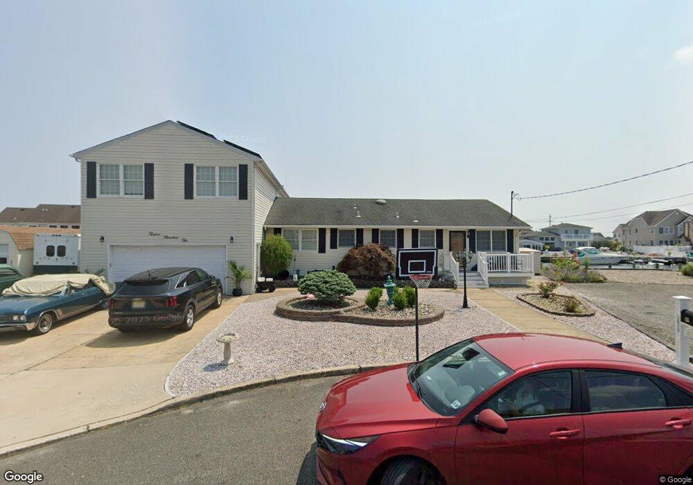
1210 Ariel Dr Forked River, NJ 08731
Estimated Value: $938,000 - $992,000
5
Beds
4
Baths
2,272
Sq Ft
$425/Sq Ft
Est. Value
About This Home
This home is located at 1210 Ariel Dr, Forked River, NJ 08731 and is currently estimated at $966,388, approximately $425 per square foot. 1210 Ariel Dr is a home located in Ocean County with nearby schools including Lacey Township High School.
Ownership History
Date
Name
Owned For
Owner Type
Purchase Details
Closed on
Sep 28, 2022
Sold by
Naia Manuel C
Bought by
Naia Manuel C
Current Estimated Value
Create a Home Valuation Report for This Property
The Home Valuation Report is an in-depth analysis detailing your home's value as well as a comparison with similar homes in the area
Home Values in the Area
Average Home Value in this Area
Purchase History
We collect this data history from publicly available records. To have your information removed, we recommend requesting removal directly through your county’s website.
| Date | Buyer | Sale Price | Title Company |
|---|---|---|---|
| Naia Manuel C | -- | -- | |
| Naia Manuel C | -- | None Listed On Document |
Source: Public Records
Tax History
| Year | Tax Paid | Tax Assessment Tax Assessment Total Assessment is a certain percentage of the fair market value that is determined by local assessors to be the total taxable value of land and additions on the property. | Land | Improvement |
|---|---|---|---|---|
| 2025 | $13,546 | $495,300 | $304,500 | $190,800 |
| 2024 | $11,734 | $495,300 | $304,500 | $190,800 |
| 2023 | $11,209 | $495,300 | $304,500 | $190,800 |
| 2022 | $11,209 | $495,300 | $304,500 | $190,800 |
| 2021 | $11,020 | $495,300 | $304,500 | $190,800 |
| 2020 | $10,669 | $495,300 | $304,500 | $190,800 |
| 2019 | $10,481 | $495,300 | $304,500 | $190,800 |
| 2018 | $10,357 | $495,300 | $304,500 | $190,800 |
| 2017 | $10,119 | $495,300 | $304,500 | $190,800 |
| 2016 | $9,829 | $495,300 | $304,500 | $190,800 |
| 2015 | $9,379 | $495,300 | $304,500 | $190,800 |
| 2014 | $10,333 | $615,300 | $404,500 | $210,800 |
Source: Public Records
Map
Nearby Homes
- 1116 Capstan Dr
- 1025 Capstan Dr
- 1227 Varuna Dr
- 1207 Capstan Dr
- 816 Bowline Dr
- 808 Ensign Dr
- 933 Montauk Dr
- 0 Windward Dr Unit NJOC2039288
- 0 Windward Dr Unit 22601526
- 810 Leeward Dr
- 908 Shenandoah Dr
- 715 Richmond Dr
- 613 Winthrop Dr
- 460 Cedar Dr
- 402 Atlantic City Ct
- 427 Boxwood Dr
- 403 Jersey City Ct
- 1029 Bowsprit Point
- 906 Bowsprit Point
- 0 Union Ct Unit 22605987
Your Personal Tour Guide
Ask me questions while you tour the home.