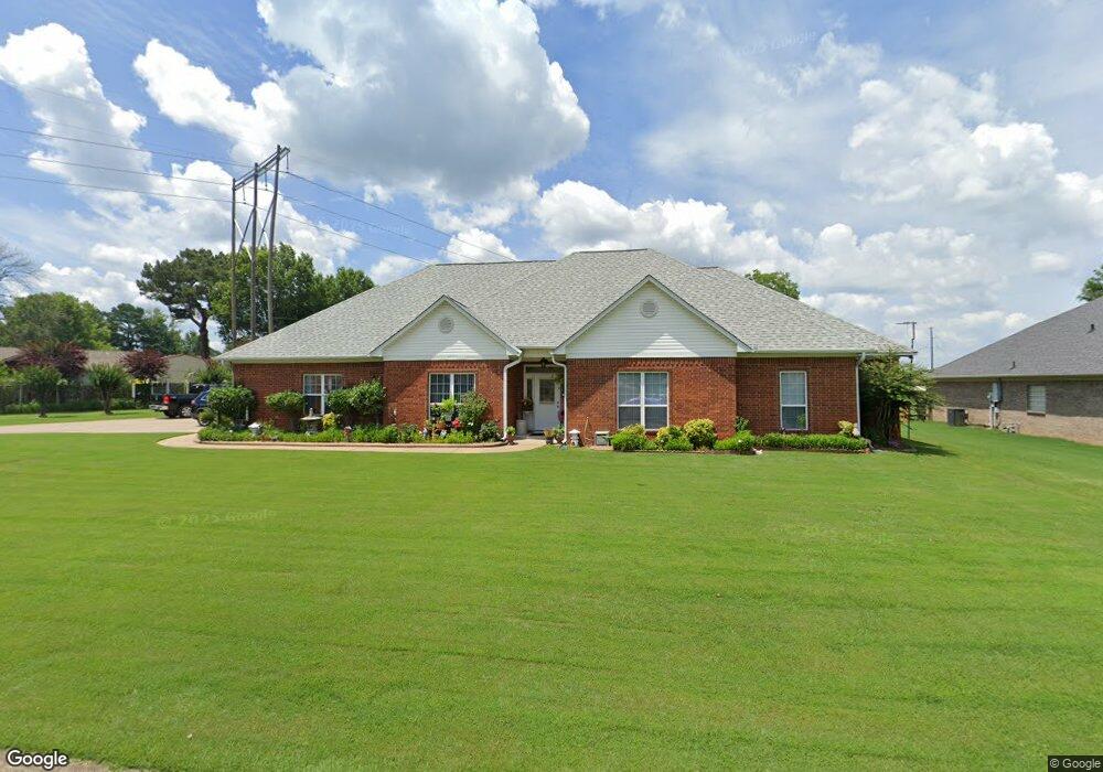
1210 Commons Dr Jacksonville, AR 72076
Estimated Value: $268,876 - $339,000
Studio
2
Baths
2,291
Sq Ft
$135/Sq Ft
Est. Value
About This Home
This home is located at 1210 Commons Dr, Jacksonville, AR 72076 and is currently estimated at $308,969, approximately $134 per square foot. 1210 Commons Dr is a home located in Pulaski County with nearby schools including Bayou Meto Elementary School, Jacksonville Middle School, and Jacksonville High School.
Ownership History
Date
Name
Owned For
Owner Type
Purchase Details
Closed on
Jul 11, 2003
Sold by
Parker Harold E and Parker Angeletta
Bought by
Eaton Allyn R and Eaton Lucia A
Current Estimated Value
Home Financials for this Owner
Home Financials are based on the most recent Mortgage that was taken out on this home.
Original Mortgage
$156,000
Outstanding Balance
$66,173
Interest Rate
5.23%
Mortgage Type
Purchase Money Mortgage
Estimated Equity
$242,796
Purchase Details
Closed on
Mar 31, 2003
Sold by
Jones Richard Leon and The Richard Leon Jones Revocab
Bought by
Parker Harold E and Parker Angeletta
Create a Home Valuation Report for This Property
The Home Valuation Report is an in-depth analysis detailing your home's value as well as a comparison with similar homes in the area
Home Values in the Area
Average Home Value in this Area
Purchase History
We collect this data history from publicly available records. To have your information removed, we recommend requesting removal directly through your county’s website.
| Date | Buyer | Sale Price | Title Company |
|---|---|---|---|
| Eaton Allyn R | $195,000 | United Abstract & Title Co | |
| Parker Harold E | $26,000 | United Abstract & Title Co I |
Source: Public Records
Mortgage History
We collect this data history from publicly available records. To have your information removed, we recommend requesting removal directly through your county’s website.
| Date | Status | Borrower | Loan Amount |
|---|---|---|---|
| Open | Eaton Allyn R | $156,000 |
Source: Public Records
Tax History
| Year | Tax Paid | Tax Assessment Tax Assessment Total Assessment is a certain percentage of the fair market value that is determined by local assessors to be the total taxable value of land and additions on the property. | Land | Improvement |
|---|---|---|---|---|
| 2025 | $2,460 | $47,698 | $5,200 | $42,498 |
| 2024 | $2,156 | $47,698 | $5,200 | $42,498 |
| 2023 | $2,156 | $47,698 | $5,200 | $42,498 |
| 2022 | $2,460 | $47,698 | $5,200 | $42,498 |
| 2021 | $2,460 | $40,070 | $6,300 | $33,770 |
| 2020 | $2,085 | $40,070 | $6,300 | $33,770 |
| 2019 | $2,085 | $40,070 | $6,300 | $33,770 |
| 2018 | $2,110 | $40,070 | $6,300 | $33,770 |
| 2017 | $2,110 | $40,070 | $6,300 | $33,770 |
| 2016 | $2,170 | $40,340 | $6,920 | $33,420 |
| 2015 | $2,170 | $40,340 | $6,920 | $33,420 |
| 2014 | $2,170 | $40,340 | $6,920 | $33,420 |
Source: Public Records
Map
Nearby Homes
- 1003 Latigo Trail
- 1512 Puritan Dr
- 905 Stirrup Place
- 104 Foxdell Cir
- 108 Dale Dr
- 104 Dale Dr
- 113 Shawnee Place
- 116 Arapaho Place
- 10 Woodland Dr
- 100 Foxwood Dr
- 32 Woodland Ct
- 7824 T P White Dr
- 401 Foxwood Dr
- 602 Foxwood Dr
- 2706 Northeastern Ave
- 0 N 1st St
- 00 N 1st St
- 1909 Madden Rd
- 1008 Ferrell Dr
- 1033 Ferrell Dr
- 1214 Commons Dr
- 3903 Knights Place
- 3905 Knights Place
- 1211 Commons Dr
- 3901 Knights Place
- 3907 Knights Place
- 1216 Commons Dr
- 1213 Commons Dr
- 1209 Commons Dr
- 4001 Knights Place
- 1213 Windsor Ct
- 1215 Commons Dr
- 0 Knights Place Unit 15022304
- 0 Knights Place Unit 17035058
- 1201 Commons Dr
- 1218 Commons Dr
- 4005 Knights Place
- 1217 Commons Dr
- 1215 Windsor Ct
- 1114 Grazing Ln
Your Personal Tour Guide
Ask me questions while you tour the home.