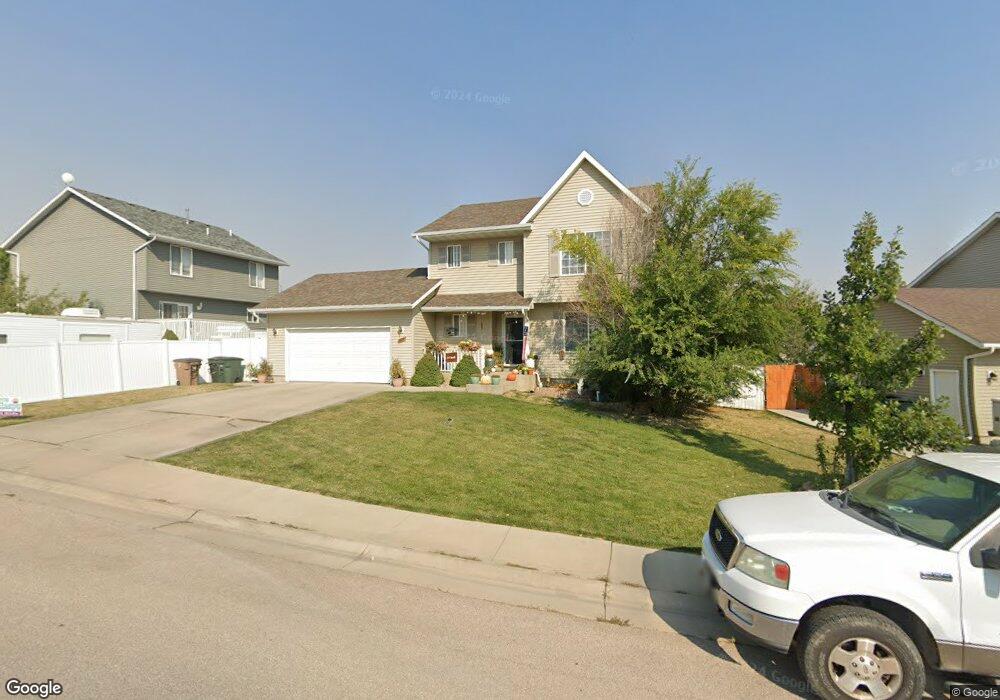
1210 Middle Fork Dr Gillette, WY 82718
Estimated Value: $334,000 - $380,000
4
Beds
4
Baths
1,588
Sq Ft
$222/Sq Ft
Est. Value
About This Home
This home is located at 1210 Middle Fork Dr, Gillette, WY 82718 and is currently estimated at $352,580, approximately $222 per square foot. 1210 Middle Fork Dr is a home located in Campbell County with nearby schools including Westwood High School, Paintbrush Elementary School, and Sage Valley Junior High School.
Ownership History
Date
Name
Owned For
Owner Type
Purchase Details
Closed on
Jan 4, 2010
Sold by
Baker Kevin L and Baker Kristine D
Bought by
Tystad Jason
Current Estimated Value
Home Financials for this Owner
Home Financials are based on the most recent Mortgage that was taken out on this home.
Original Mortgage
$239,250
Interest Rate
4.95%
Mortgage Type
New Conventional
Create a Home Valuation Report for This Property
The Home Valuation Report is an in-depth analysis detailing your home's value as well as a comparison with similar homes in the area
Purchase History
| Date | Buyer | Sale Price | Title Company |
|---|---|---|---|
| Tystad Jason | -- | None Available |
Source: Public Records
Mortgage History
| Date | Status | Borrower | Loan Amount |
|---|---|---|---|
| Previous Owner | Tystad Jason | $239,250 |
Source: Public Records
Tax History
| Year | Tax Paid | Tax Assessment Tax Assessment Total Assessment is a certain percentage of the fair market value that is determined by local assessors to be the total taxable value of land and additions on the property. | Land | Improvement |
|---|---|---|---|---|
| 2025 | $1,984 | $22,007 | $3,972 | $18,035 |
| 2024 | $20 | $28,214 | $5,092 | $23,122 |
| 2023 | $1,936 | $27,523 | $5,092 | $22,431 |
| 2022 | $1,691 | $23,971 | $4,047 | $19,924 |
| 2021 | $1,452 | $21,278 | $4,047 | $17,231 |
| 2020 | $1,409 | $20,702 | $4,047 | $16,655 |
| 2019 | $1,409 | $20,751 | $4,047 | $16,704 |
| 2018 | $1,376 | $20,351 | $4,047 | $16,304 |
| 2017 | $1,509 | $22,361 | $3,800 | $18,561 |
| 2016 | $1,584 | $23,442 | $3,800 | $19,642 |
| 2015 | -- | $21,813 | $3,800 | $18,013 |
| 2014 | -- | $21,717 | $3,800 | $17,917 |
Source: Public Records
Map
Nearby Homes
- 1105 W Beaver Dr
- 3113 Sutherland Dr -
- 2371 Mahogany Cir
- 2382 Mahogany Cir
- 2307 Big Lost Dr
- Tbd Pronghorn Ranch
- 3306 Sutherland Dr
- 0000 Tract A6 Broad Axe Rd
- 640 W 12th St
- 1801 S Gillette Ave
- 209 E Tonk St
- 3000 W Lakeway Rd
- 480 Boxelder Rd
- 4105 Brorby Blvd
- 1403 W 3rd St
- 410 Edwards St
- 4205 Lexington Ave
- Lot 3 Moonshiner Ln
- 309 Rockpile Blvd
- 2808-2814 Dogwood Ave
- 2400 N Buckboard Ct
- 1206 Middle Fork Dr
- 1206 Middle Fork Dr -
- 2402 N Buckboard Ct
- 1304 Meadow Brook Ln
- 1215 Middle Fork Dr
- 1211 Middle Fork Dr
- 1219 Middle Fork Dr
- 1302 Meadow Brook Ln
- 2404 N Buckboard Ct
- 1202 Middle Fork Dr
- 2410 N Buckboard Ct
- 1207 Middle Fork Dr
- 1223 Middle Fork Dr
- 2406 N Buckboard Ct -
- 1203 Middle Fork Dr
- 1301 Middle Fork Dr
- 1308 Meadow Brook Ln
- 1404 W Beaver Dr
- 1406 W Beaver Dr
Your Personal Tour Guide
Ask me questions while you tour the home.