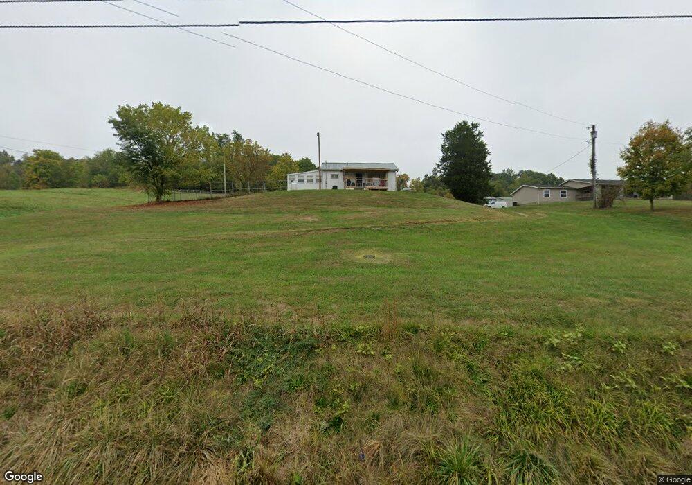
12134 State Route 690 Athens, OH 45701
Estimated Value: $79,000 - $161,000
2
Beds
1
Bath
768
Sq Ft
$138/Sq Ft
Est. Value
About This Home
This home is located at 12134 State Route 690, Athens, OH 45701 and is currently estimated at $105,873, approximately $137 per square foot. 12134 State Route 690 is a home located in Athens County with nearby schools including Amesville Elementary School, Coolville Elementary School, and Federal Hocking Middle School.
Ownership History
Date
Name
Owned For
Owner Type
Purchase Details
Closed on
Dec 6, 2017
Sold by
Smith Karne Jean and Smith Abbott Pat
Bought by
Lorubbio Carl James
Current Estimated Value
Purchase Details
Closed on
Jan 6, 2016
Sold by
Smith Abbott Pat and Smith Karen Jean
Bought by
Smith Karen Jean
Purchase Details
Closed on
Jun 9, 2004
Sold by
Loeffler Helen D
Bought by
Smith Abbott P
Purchase Details
Closed on
Feb 9, 1993
Sold by
Loeffler Kenneth
Bought by
Loeffler Helen D
Create a Home Valuation Report for This Property
The Home Valuation Report is an in-depth analysis detailing your home's value as well as a comparison with similar homes in the area
Purchase History
| Date | Buyer | Sale Price | Title Company |
|---|---|---|---|
| Lorubbio Carl James | $50,000 | None Available | |
| Smith Karen Jean | -- | Attorney | |
| Smith Abbott P | $50,000 | -- | |
| Loeffler Helen D | -- | -- |
Source: Public Records
Tax History
| Year | Tax Paid | Tax Assessment Tax Assessment Total Assessment is a certain percentage of the fair market value that is determined by local assessors to be the total taxable value of land and additions on the property. | Land | Improvement |
|---|---|---|---|---|
| 2025 | $1,189 | $23,840 | $7,380 | $16,460 |
| 2024 | $1,678 | $23,840 | $7,380 | $16,460 |
| 2023 | $1,157 | $23,840 | $7,380 | $16,460 |
| 2022 | $968 | $19,040 | $6,150 | $12,890 |
| 2021 | $971 | $19,040 | $6,150 | $12,890 |
| 2020 | $971 | $19,040 | $6,150 | $12,890 |
| 2019 | $728 | $14,230 | $5,260 | $8,970 |
| 2018 | $724 | $14,230 | $5,260 | $8,970 |
| 2017 | $956 | $14,230 | $5,260 | $8,970 |
| 2016 | $685 | $13,110 | $4,780 | $8,330 |
| 2015 | $892 | $13,110 | $4,780 | $8,330 |
| 2014 | $892 | $13,110 | $4,780 | $8,330 |
| 2013 | $792 | $12,210 | $4,100 | $8,110 |
Source: Public Records
Map
Nearby Homes
- 16714 Mush Run Rd
- 16749 Mush Run Rd
- 0 Ohio 550
- 17777 Mush Run Rd
- 43 Main St
- 47 Main St
- 0 Hooper Ridge Rd
- 19129 Felton Rd
- 14240 Della Dr
- 0 E Copeland Rd Unit 2434030
- 11711 Peach Ridge Rd
- 13864 Keirns Rd
- 12189 Bean Hollow Rd
- 37 Euclid Dr
- 14 Euclid Dr
- 44 Strathmore Blvd
- 58 Strathmore Blvd
- 0 E State St Unit 226002681
- 14494 Keirns Rd
- 10965 Northpoint Dr
Your Personal Tour Guide
Ask me questions while you tour the home.