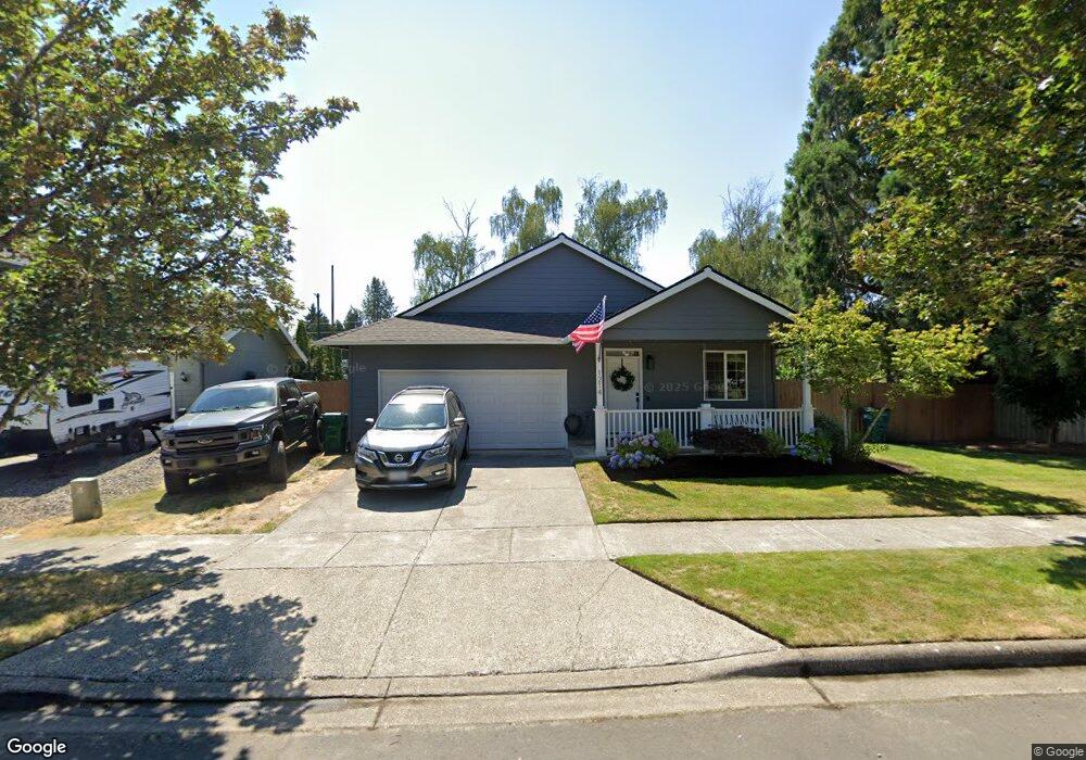
1214 Snapdragon Ave Forest Grove, OR 97116
Estimated Value: $399,000 - $495,000
3
Beds
1
Bath
1,086
Sq Ft
$408/Sq Ft
Est. Value
About This Home
This home is located at 1214 Snapdragon Ave, Forest Grove, OR 97116 and is currently estimated at $443,494, approximately $408 per square foot. 1214 Snapdragon Ave is a home located in Washington County with nearby schools including Harvey Clarke Elementary School, Tom McCall Upper Elementary School, and Neil Armstrong Middle School.
Ownership History
Date
Name
Owned For
Owner Type
Purchase Details
Closed on
Mar 17, 2020
Sold by
Coffey Robert C
Bought by
Vandecoevering Nick Ryan and Syverson Briana
Current Estimated Value
Home Financials for this Owner
Home Financials are based on the most recent Mortgage that was taken out on this home.
Original Mortgage
$301,500
Outstanding Balance
$265,346
Interest Rate
3.4%
Mortgage Type
New Conventional
Estimated Equity
$178,148
Purchase Details
Closed on
Mar 27, 2012
Sold by
Coffey Robert C and Coffey Robert
Bought by
Coffey Robert C
Home Financials for this Owner
Home Financials are based on the most recent Mortgage that was taken out on this home.
Original Mortgage
$152,884
Interest Rate
3.83%
Mortgage Type
VA
Purchase Details
Closed on
Jul 27, 2011
Sold by
Selene Rmof Reo Acquisition Llc
Bought by
Coffey Robert
Home Financials for this Owner
Home Financials are based on the most recent Mortgage that was taken out on this home.
Original Mortgage
$148,300
Interest Rate
4.46%
Mortgage Type
New Conventional
Purchase Details
Closed on
Sep 13, 2010
Sold by
Wright Michael and Wright Robin D
Bought by
Selene Rmof Reo Acquisition Llc
Purchase Details
Closed on
Mar 10, 2000
Sold by
Obrien Kienan P and Obrien Amy R
Bought by
Wright Michael and Wright Robin D
Home Financials for this Owner
Home Financials are based on the most recent Mortgage that was taken out on this home.
Original Mortgage
$134,476
Interest Rate
8.27%
Mortgage Type
VA
Purchase Details
Closed on
Apr 10, 1997
Sold by
Skyline Development Inc
Bought by
Obrien Kieran P and Obrien Amy R
Home Financials for this Owner
Home Financials are based on the most recent Mortgage that was taken out on this home.
Original Mortgage
$131,568
Interest Rate
7.06%
Mortgage Type
FHA
Create a Home Valuation Report for This Property
The Home Valuation Report is an in-depth analysis detailing your home's value as well as a comparison with similar homes in the area
Purchase History
| Date | Buyer | Sale Price | Title Company |
|---|---|---|---|
| Vandecoevering Nick Ryan | $335,000 | Wfg National Title | |
| Coffey Robert C | -- | Lawyers Title | |
| Coffey Robert | $152,900 | Fidelity National Title Co | |
| Selene Rmof Reo Acquisition Llc | $134,827 | Fatco | |
| Wright Michael | $131,840 | First American Title Co | |
| Obrien Kieran P | $132,600 | First American Title Ins Co |
Source: Public Records
Mortgage History
| Date | Status | Borrower | Loan Amount |
|---|---|---|---|
| Open | Vandecoevering Nick Ryan | $301,500 | |
| Previous Owner | Coffey Robert C | $152,884 | |
| Previous Owner | Coffey Robert | $148,300 | |
| Previous Owner | Wright Michael | $134,476 | |
| Previous Owner | Obrien Kieran P | $131,568 |
Source: Public Records
Tax History
| Year | Tax Paid | Tax Assessment Tax Assessment Total Assessment is a certain percentage of the fair market value that is determined by local assessors to be the total taxable value of land and additions on the property. | Land | Improvement |
|---|---|---|---|---|
| 2026 | $4,134 | $232,160 | -- | -- |
| 2025 | $4,134 | $225,400 | -- | -- |
| 2024 | $3,988 | $218,840 | -- | -- |
| 2023 | $3,988 | $212,470 | $0 | $0 |
| 2022 | $3,488 | $212,470 | $0 | $0 |
| 2021 | $3,442 | $200,290 | $0 | $0 |
| 2020 | $3,424 | $194,460 | $0 | $0 |
| 2019 | $3,348 | $188,800 | $0 | $0 |
| 2018 | $3,245 | $183,310 | $0 | $0 |
| 2017 | $3,145 | $177,980 | $0 | $0 |
| 2016 | $3,056 | $172,800 | $0 | $0 |
| 2015 | $2,939 | $167,770 | $0 | $0 |
| 2014 | $2,925 | $162,890 | $0 | $0 |
Source: Public Records
Map
Nearby Homes
- 1407 Willamina Ave
- 1224 Alyssum Ave
- 1425 Willamina Ave
- 1015 Gales Creek Rd
- 1440 Alyssum Ave
- 1820 NW Thatcher Rd
- 1125 32nd Place
- 922 Rosebud Ct
- 918 Rosebud Ct
- 916 Rosebud Ct
- 1636 Bonnie Ln
- 1109 Stonewall Ave
- 911 Rosebud Ct
- 945 Willamina Ave
- 904 Rosebud Ct
- 1611 Camino Dr
- 3240 Oakcrest Dr
- 3305 Butte Dr
- 865 Glade Ave
- 811 Misty Ln
- 1214 Snapdragon Ln
- 0 Laundromat Unit 24549914
- 1220 Snapdragon Ave
- 1220 Snapdragon Ln
- 0 Snapdragon Ln
- 1400 Thatcher Rd
- 1209 Snapdragon Ave
- 1215 Snapdragon Ave
- 1338 Snapdragon Ave
- 2912 Twinflower St
- 2924 Twinflower St
- 1370 Thatcher Rd
- 1337 Snapdragon Ave
- 1337 Snapdragon Ln
- 2918 Twinflower St
- 3007 Twinflower St
- 1344 Snapdragon Ave
- 2930 Twinflower St
- 3014 Periwinkle St
- 1460 Thatcher Rd
Your Personal Tour Guide
Ask me questions while you tour the home.