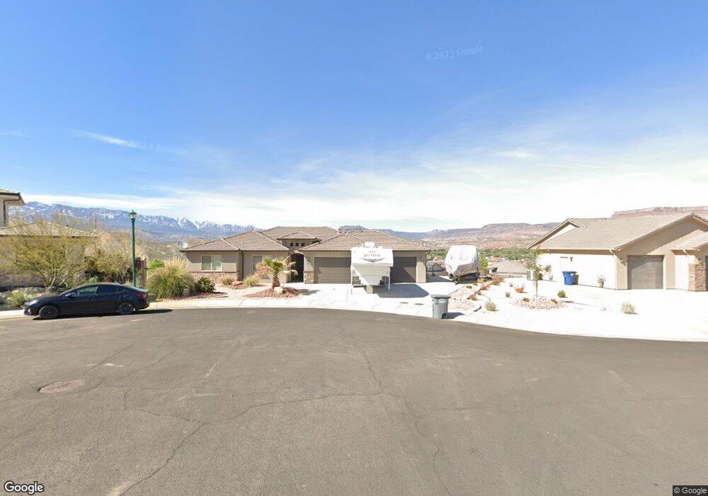
1215 N 50 E Hurricane, UT 84737
Estimated Value: $600,457 - $644,000
4
Beds
3
Baths
2,369
Sq Ft
$263/Sq Ft
Est. Value
About This Home
This home is located at 1215 N 50 E, Hurricane, UT 84737 and is currently estimated at $622,229, approximately $262 per square foot. 1215 N 50 E is a home located in Washington County with nearby schools including Hurricane Middle School, Hurricane High School, and Hurricane Elementary School.
Ownership History
Date
Name
Owned For
Owner Type
Purchase Details
Closed on
Oct 7, 2022
Sold by
Langston Kaden
Bought by
Langston Kaden Scott and Hobbs Savannah
Current Estimated Value
Home Financials for this Owner
Home Financials are based on the most recent Mortgage that was taken out on this home.
Original Mortgage
$490,000
Outstanding Balance
$469,865
Interest Rate
5.55%
Mortgage Type
New Conventional
Estimated Equity
$152,364
Purchase Details
Closed on
Oct 22, 2021
Sold by
Crowther Kim and Crowther Kay L
Bought by
Langston Kaden and Hobbs Savannah
Purchase Details
Closed on
Aug 7, 2020
Sold by
Crowther Kim
Bought by
Crowther Kim and Crowther Kay L
Purchase Details
Closed on
Jun 4, 2019
Sold by
Manwaring Jeffrey Cameron
Bought by
Crowther Kim
Purchase Details
Closed on
Jul 12, 2017
Sold by
Dh Real Estate Lp
Bought by
Manwaring Jeffrey Cameron
Create a Home Valuation Report for This Property
The Home Valuation Report is an in-depth analysis detailing your home's value as well as a comparison with similar homes in the area
Purchase History
| Date | Buyer | Sale Price | Title Company |
|---|---|---|---|
| Langston Kaden Scott | -- | Gt Title Services | |
| Langston Kaden | -- | Us Title | |
| Crowther Kim | -- | Us Title Insurance Agency | |
| Crowther Kim | -- | Us Title Insurance Agency | |
| Manwaring Jeffrey Cameron | -- | Infinity Title Insurance Age |
Source: Public Records
Mortgage History
| Date | Status | Borrower | Loan Amount |
|---|---|---|---|
| Open | Langston Kaden Scott | $490,000 |
Source: Public Records
Tax History
| Year | Tax Paid | Tax Assessment Tax Assessment Total Assessment is a certain percentage of the fair market value that is determined by local assessors to be the total taxable value of land and additions on the property. | Land | Improvement |
|---|---|---|---|---|
| 2025 | $2,300 | $310,090 | $68,750 | $241,340 |
| 2023 | $2,482 | $332,970 | $57,750 | $275,220 |
| 2022 | $880 | $90,000 | $90,000 | $0 |
| 2021 | $636 | $65,000 | $65,000 | $0 |
| 2020 | $523 | $50,000 | $50,000 | $0 |
| 2019 | $378 | $35,000 | $35,000 | $0 |
| 2016 | $347 | $28,000 | $0 | $0 |
Source: Public Records
Map
Nearby Homes
- 44 E Sunset Ridge Dr
- 1207 N Sunset Ridge Dr
- 16 E Sunset Ridge Dr
- 1173 N 50 E
- 51 E 1175 N
- Lot 10 50 E
- 1188 N Main St
- 41 E Sunset Ridge Dr
- 1228 N Main St
- 0 Sunset Ridge Dr Unit 17-186061
- 0 Sunset Ridge Dr Unit 17-183659
- 0 Sunset Ridge Dr Unit 17-182400
- Lot #49 Sunset Ridge Dr
- 0 Sunset Ridge Dr Unit 14-156473
- 0 Sunset Ridge Dr Unit 14-156472
- 0 Sunset Ridge Dr Unit 13-150117
- 0 Sunset Ridge Dr Unit 12-142738
- 0 Sunset Ridge Dr Unit 10-122866
- 0 Sunset Ridge Dr Unit 12-142740
- 0 Sunset Ridge Dr Unit 13-143073
Your Personal Tour Guide
Ask me questions while you tour the home.