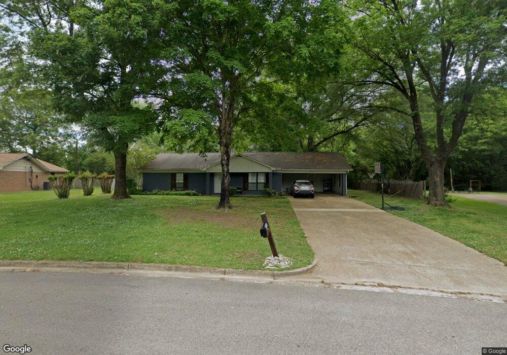
1215 Queensgate Dr Tupelo, MI 38801
Estimated Value: $159,000 - $225,008
3
Beds
2
Baths
1,460
Sq Ft
$128/Sq Ft
Est. Value
About This Home
This home is located at 1215 Queensgate Dr, Tupelo, MI 38801 and is currently estimated at $187,502, approximately $128 per square foot. 1215 Queensgate Dr is a home located in Lee County with nearby schools including Lawndale Elementary School, Parkway Elementary School, and Tupelo Middle School.
Ownership History
Date
Name
Owned For
Owner Type
Purchase Details
Closed on
Feb 20, 2024
Bought by
White Maleah and Sanders Doris P
Current Estimated Value
Purchase Details
Closed on
Feb 21, 2020
Bought by
Gillespie Robbie and Gillespie Cyndi
Purchase Details
Closed on
Dec 20, 2017
Bought by
Gillespie Robbie and Gillespie Cyndi
Purchase Details
Closed on
Sep 21, 2012
Sold by
Nevada Llc
Bought by
Lanza Bethany A and Gable Debbie
Purchase Details
Closed on
Feb 5, 2009
Sold by
Lanza Bethany A and Gable Debbie
Bought by
Queensgate 1215 Llc
Purchase Details
Closed on
Sep 6, 2008
Sold by
Sellars Bobby and Sellars Jennifer
Bought by
Lanza Bethany and Gable Debbie
Home Financials for this Owner
Home Financials are based on the most recent Mortgage that was taken out on this home.
Original Mortgage
$71,600
Interest Rate
6.45%
Create a Home Valuation Report for This Property
The Home Valuation Report is an in-depth analysis detailing your home's value as well as a comparison with similar homes in the area
Purchase History
| Date | Buyer | Sale Price | Title Company |
|---|---|---|---|
| White Maleah | $165,000 | -- | |
| Gillespie Robbie | $72,000 | -- | |
| Gillespie Robbie | -- | None Available | |
| Gillespie Robbie | $72,000 | -- | |
| Lanza Bethany A | -- | -- | |
| Queensgate 1215 Llc | -- | -- | |
| Lanza Bethany | -- | -- |
Source: Public Records
Mortgage History
| Date | Status | Borrower | Loan Amount |
|---|---|---|---|
| Previous Owner | Lanza Bethany | $71,600 |
Source: Public Records
Tax History
| Year | Tax Paid | Tax Assessment Tax Assessment Total Assessment is a certain percentage of the fair market value that is determined by local assessors to be the total taxable value of land and additions on the property. | Land | Improvement |
|---|---|---|---|---|
| 2025 | $1,924 | $14,149 | $0 | $0 |
| 2024 | $1,924 | $14,149 | $0 | $0 |
| 2023 | $1,191 | $8,901 | $0 | $0 |
| 2022 | $956 | $8,901 | $0 | $0 |
| 2021 | $918 | $8,901 | $0 | $0 |
| 2020 | $1,787 | $13,352 | $0 | $0 |
| 2019 | $1,896 | $13,488 | $0 | $0 |
| 2018 | $1,896 | $13,488 | $0 | $0 |
| 2017 | $1,890 | $13,488 | $0 | $0 |
| 2016 | $1,890 | $13,488 | $0 | $0 |
| 2015 | $1,788 | $12,996 | $0 | $0 |
| 2014 | $1,788 | $12,996 | $0 | $0 |
Source: Public Records
Map
Nearby Homes
- 9 Cambridge Dr
- Lot 1 Dunbarton Place
- 1103 Lawndale Dr
- 1712 Valley View Dr
- 1702 Fillmore Dr
- 1904 Bob White Dr
- 1811 Cardinal Dr
- 1011 Coolidge St
- 1914 Cardinal Dr
- 2010 Lawndale Dr
- 920 Eisenhower Dr
- 1015 Taft St
- 1009 Taft St
- 404 Smith St
- 400 Smith St
- 1909 President Ave
- 1303 Van Buren Ave
- 219 Lakeview Dr
- 2404 Crestwood Dr
- 610 Trout St
- 1215 Queensgate Dr
- 1213 Queensgate Dr
- 1213 Queensgate Dr
- 1217 Queensgate Dr
- 1217 Queensgate Dr
- 1210 Queensgate Dr
- 4 Buckingham Place
- 1211 Queensgate Dr
- 3 Buckingham Place
- 1219 Queensgate Dr
- 1212 Queensgate Dr
- 1212 Queensgate Dr
- 2 Buckingham Place
- 1208 Queensgate Dr
- 2 Buckingham Place
- 1208 Queensgate Dr
- 5 Buckingham Place
- 1 Buckingham Place
- 1209 Queensgate Dr
- 1209 Queensgate Dr
Your Personal Tour Guide
Ask me questions while you tour the home.