Estimated Value: $292,074 - $771,000
3
Beds
1
Bath
--
Sq Ft
5,009
Sq Ft Lot Lot
About This Home
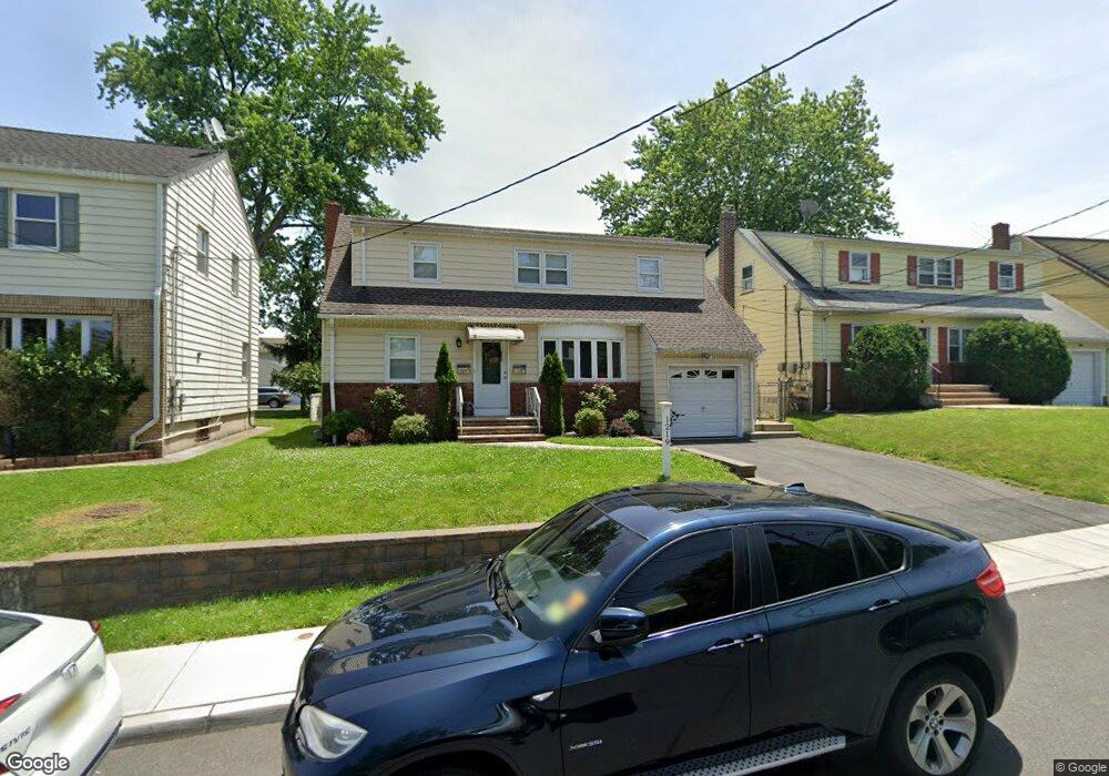
This home is located at 1219 Robert St Unit 2, Union, NJ 07083 and is currently estimated at $584,019. 1219 Robert St Unit 2 is a home located in Union County with nearby schools including Livingston Elementary School, Union High School, and St Michael Parish School.
Ownership History
Date
Name
Owned For
Owner Type
Purchase Details
Closed on
May 27, 2015
Sold by
U S Bank Na
Bought by
Morgado Roberto and Morgado Luciany Pereira
Current Estimated Value
Purchase Details
Closed on
Aug 26, 2014
Sold by
Murray Mmalkia and Bradley Alicia
Bought by
U S Bank Na
Purchase Details
Closed on
Jun 2, 2006
Sold by
Costa Manuel C
Bought by
Murray Malkia and Bradley Alicia
Home Financials for this Owner
Home Financials are based on the most recent Mortgage that was taken out on this home.
Original Mortgage
$432,000
Interest Rate
6.83%
Create a Home Valuation Report for This Property
The Home Valuation Report is an in-depth analysis detailing your home's value as well as a comparison with similar homes in the area
Home Values in the Area
Average Home Value in this Area
Purchase History
We collect this data history from publicly available records. To have your information removed, we recommend requesting removal directly through your county’s website.
| Date | Buyer | Sale Price | Title Company |
|---|---|---|---|
| Morgado Roberto | $186,309 | Chicago Title Insurance Co | |
| U S Bank Na | $1,000 | None Available | |
| Murray Malkia | $540,000 | -- |
Source: Public Records
Mortgage History
We collect this data history from publicly available records. To have your information removed, we recommend requesting removal directly through your county’s website.
| Date | Status | Borrower | Loan Amount |
|---|---|---|---|
| Previous Owner | Murray Malkia | $432,000 |
Source: Public Records
Tax History
| Year | Tax Paid | Tax Assessment Tax Assessment Total Assessment is a certain percentage of the fair market value that is determined by local assessors to be the total taxable value of land and additions on the property. | Land | Improvement |
|---|---|---|---|---|
| 2025 | $12,561 | $56,200 | $20,000 | $36,200 |
| 2024 | $12,178 | $56,200 | $20,000 | $36,200 |
| 2023 | $12,178 | $56,200 | $20,000 | $36,200 |
| 2022 | $11,755 | $56,200 | $20,000 | $36,200 |
| 2021 | $11,470 | $56,200 | $20,000 | $36,200 |
| 2020 | $11,241 | $56,200 | $20,000 | $36,200 |
| 2019 | $11,090 | $56,200 | $20,000 | $36,200 |
| 2018 | $10,901 | $56,200 | $20,000 | $36,200 |
| 2017 | $10,740 | $56,200 | $20,000 | $36,200 |
| 2016 | $10,478 | $56,200 | $20,000 | $36,200 |
| 2015 | $10,304 | $56,200 | $20,000 | $36,200 |
| 2014 | $10,073 | $56,200 | $20,000 | $36,200 |
Source: Public Records
Map
Nearby Homes
- 1175 Erhardt St
- 1393 Cornell Place
- 1341 Marcella Dr
- 1585 Barton Rd
- 1282 Marcella Dr
- 1318 Marcella Dr
- 1046 Lorraine Ave
- 566 Chapman St
- 524 Lehigh St
- 537 Us Highway 22
- 525 Us Highway 22
- 404 Rutgers Ave
- 1221 Oak Place
- 1307 Dartmouth Terrace
- 575 Purce St
- 120 Parkside Dr
- 402 Rutgers Ave
- 1090 Salem Rd
- 1386 Beverly Rd
- 1841 Cider Mill Rd
- 1219 Robert St
- 1213 Robert St
- 1223 Robert St
- 1211 Robert St
- 1549 Vauxhall Rd
- 144 Louis Place
- 142 Louis Place
- 1270 Robert St
- 1207 Robert St
- 1467 Vauxhall Rd
- 1547 Vauxhall Rd
- 1218 Biscayne Blvd
- 1214 Biscayne Blvd
- 1471 Vauxhall Rd
- 1224 Biscayne Blvd
- 1210 Biscayne Blvd
- 1215 Erhardt St
- 1228 Biscayne Blvd
- 1539 Vauxhall Rd
- 1221 Erhardt St
Your Personal Tour Guide
Ask me questions while you tour the home.