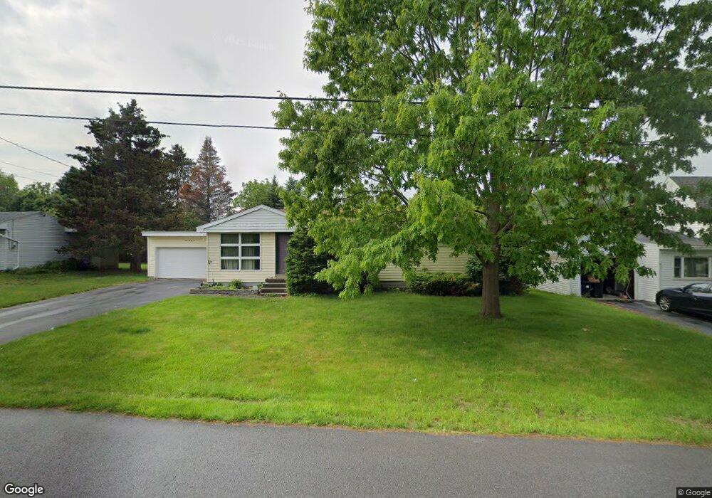
122 Howe St Black River, NY 13612
Estimated Value: $185,000 - $199,612
3
Beds
1
Bath
1,257
Sq Ft
$153/Sq Ft
Est. Value
About This Home
This home is located at 122 Howe St, Black River, NY 13612 and is currently estimated at $191,903, approximately $152 per square foot. 122 Howe St is a home located in Jefferson County with nearby schools including Carthage Senior High School.
Ownership History
Date
Name
Owned For
Owner Type
Purchase Details
Closed on
Dec 23, 2025
Sold by
L & P Properties Of Watertown Llc
Bought by
Mace David S and Mace Tyan A
Current Estimated Value
Home Financials for this Owner
Home Financials are based on the most recent Mortgage that was taken out on this home.
Original Mortgage
$186,558
Outstanding Balance
$186,558
Interest Rate
6.26%
Mortgage Type
FHA
Estimated Equity
$5,345
Purchase Details
Closed on
Apr 11, 2016
Sold by
Macnay Lynn J
Bought by
L & P Properties Llc
Purchase Details
Closed on
Jun 22, 2011
Sold by
Macnay Lynn
Bought by
Macnay Lynn
Purchase Details
Closed on
May 18, 2011
Sold by
Macnay Lynn
Bought by
Macnay Lynn
Purchase Details
Closed on
Apr 23, 2011
Sold by
Martin Markus Martin
Bought by
Macnay Lynn
Purchase Details
Closed on
Oct 27, 2004
Sold by
Macnay James
Bought by
Macnay Lynn
Create a Home Valuation Report for This Property
The Home Valuation Report is an in-depth analysis detailing your home's value as well as a comparison with similar homes in the area
Home Values in the Area
Average Home Value in this Area
Purchase History
| Date | Buyer | Sale Price | Title Company |
|---|---|---|---|
| Mace David S | $190,000 | None Listed On Document | |
| L & P Properties Llc | -- | Andrew Capone | |
| Macnay Lynn | -- | Andrew Capone | |
| Macnay Lynn | $90,000 | Andrew Capone | |
| Macnay Lynn | -- | -- | |
| Macnay Lynn | -- | -- |
Source: Public Records
Mortgage History
| Date | Status | Borrower | Loan Amount |
|---|---|---|---|
| Open | Mace David S | $186,558 |
Source: Public Records
Tax History
| Year | Tax Paid | Tax Assessment Tax Assessment Total Assessment is a certain percentage of the fair market value that is determined by local assessors to be the total taxable value of land and additions on the property. | Land | Improvement |
|---|---|---|---|---|
| 2025 | $3,048 | $167,200 | $22,800 | $144,400 |
| 2024 | $3,048 | $150,600 | $22,800 | $127,800 |
| 2023 | $3,238 | $150,600 | $22,800 | $127,800 |
| 2022 | $3,259 | $150,600 | $22,800 | $127,800 |
| 2021 | $3,154 | $135,700 | $22,800 | $112,900 |
| 2020 | $3,156 | $135,700 | $22,800 | $112,900 |
| 2019 | $3,190 | $135,700 | $22,800 | $112,900 |
| 2018 | $3,190 | $135,700 | $22,800 | $112,900 |
| 2017 | $3,174 | $135,700 | $22,800 | $112,900 |
| 2016 | $4,436 | $135,700 | $22,800 | $112,900 |
| 2015 | -- | $135,700 | $22,800 | $112,900 |
| 2014 | -- | $135,700 | $22,800 | $112,900 |
Source: Public Records
Map
Nearby Homes
- 122 Leray St
- 100 N Main St
- 142 N Main St
- 140 Maple St
- 112 Stafford Dr
- 29580 Maple St Unit 584
- 29721 Burnup Rd
- 27317 Five Corners Rd
- 23522 Rex Dr
- 30072 State Route 3
- 26998 Lafave Rd
- 22503 Riverbend Dr E
- 30230 State Route 3
- 0 Sanford Corners Rd
- 0 Ridge Rd Unit S1602421
- 24406 Back St
- 22925 Duffy Rd
- 30942 County Route 143
- 23717 Woodland Dr
- 30810 Burnup Rd
Your Personal Tour Guide
Ask me questions while you tour the home.