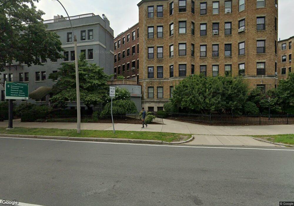
Riverway Square 122 Riverway Unit 20 Boston, MA 02215
Estimated Value: $519,000 - $589,000
1
Bed
1
Bath
575
Sq Ft
$945/Sq Ft
Est. Value
About This Home
This home is located at 122 Riverway Unit 20, Boston, MA 02215 and is currently estimated at $543,457, approximately $945 per square foot. 122 Riverway Unit 20 is a home located in Suffolk County with nearby schools including New England Hebrew Academy and Winsor School.
Ownership History
Date
Name
Owned For
Owner Type
Purchase Details
Closed on
Jul 24, 2025
Sold by
Smirles Kimberly
Bought by
Kimberly Ann Smirles Ret and Smirles
Current Estimated Value
Purchase Details
Closed on
Dec 15, 2005
Sold by
Riverway Square Condo and Benouaich
Bought by
Smirles Kimberly
Home Financials for this Owner
Home Financials are based on the most recent Mortgage that was taken out on this home.
Original Mortgage
$240,000
Interest Rate
6.34%
Mortgage Type
Purchase Money Mortgage
Create a Home Valuation Report for This Property
The Home Valuation Report is an in-depth analysis detailing your home's value as well as a comparison with similar homes in the area
Purchase History
| Date | Buyer | Sale Price | Title Company |
|---|---|---|---|
| Kimberly Ann Smirles Ret | -- | -- | |
| Smirles Kimberly | $300,000 | -- | |
| Smirles Kimberly A | $300,000 | -- |
Source: Public Records
Mortgage History
| Date | Status | Borrower | Loan Amount |
|---|---|---|---|
| Previous Owner | Smirles Kimberly | $276,000 | |
| Previous Owner | Smirles Kimberly A | $240,000 |
Source: Public Records
Tax History
| Year | Tax Paid | Tax Assessment Tax Assessment Total Assessment is a certain percentage of the fair market value that is determined by local assessors to be the total taxable value of land and additions on the property. | Land | Improvement |
|---|---|---|---|---|
| 2025 | $5,234 | $452,000 | $0 | $452,000 |
| 2024 | $4,795 | $439,900 | $0 | $439,900 |
| 2023 | $4,583 | $426,700 | $0 | $426,700 |
| 2022 | $4,553 | $418,500 | $0 | $418,500 |
| 2021 | $4,378 | $410,300 | $0 | $410,300 |
| 2020 | $4,731 | $448,000 | $0 | $448,000 |
| 2019 | $4,414 | $418,800 | $0 | $418,800 |
| 2018 | $4,065 | $387,900 | $0 | $387,900 |
| 2017 | $3,910 | $369,200 | $0 | $369,200 |
| 2016 | $3,869 | $351,700 | $0 | $351,700 |
| 2015 | $3,856 | $318,400 | $0 | $318,400 |
| 2014 | $3,638 | $289,200 | $0 | $289,200 |
Source: Public Records
About Riverway Square
Map
Nearby Homes
- 188 Brookline Ave Unit 26G
- 188 Brookline Ave Unit 23B
- 188 Brookline Ave Unit 24I
- 188 Brookline Ave Unit 29D
- 188 Brookline Ave Unit 22K
- 188 Brookline Ave Unit 19B
- 188 Brookline Ave Unit 21B
- 188 Brookline Ave Unit 23I
- 137 Peterborough St Unit 21
- 448 Park Dr Unit 1
- 108 Peterborough St Unit 4F
- 57 Monmouth St
- 16 Miner St Unit 304
- 66 Queensberry St Unit 221
- 62 Queensberry St Unit 204
- 922 Beacon St Unit 24
- 131 Park Dr Unit 2
- 131 Park Dr Unit 12
- 60 Queensberry St Unit 19
- 1002 Beacon St
- 122 the Riverway Unit 18
- 122 Riverway Unit 19
- 122 Riverway Unit 18
- 122 Riverway Unit 17
- 122 Riverway Unit 16
- 122 Riverway Unit 15
- 122 Riverway Unit 14
- 122 Riverway Unit 12A
- 122 Riverway Unit 12
- 122 Riverway Unit 11
- 122 Riverway Unit 10
- 122 Riverway Unit 9
- 122 Riverway Unit 8
- 122 Riverway Unit 7
- 122 Riverway Unit 6
- 122 Riverway Unit 4
- 122 Riverway Unit 3
- 122 Riverway Unit 2
- 122 Riverway Unit 1
- 122 the Riverway Unit 15
Your Personal Tour Guide
Ask me questions while you tour the home.