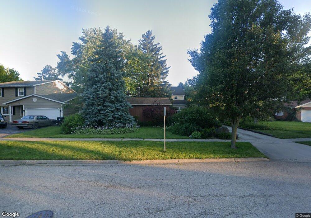
122 W Maple Ave Wauconda, IL 60084
Estimated Value: $328,000 - $382,000
3
Beds
4
Baths
1,943
Sq Ft
$182/Sq Ft
Est. Value
About This Home
This home is located at 122 W Maple Ave, Wauconda, IL 60084 and is currently estimated at $354,132, approximately $182 per square foot. 122 W Maple Ave is a home located in Lake County with nearby schools including Wauconda Grade School, Wauconda Middle School, and Wauconda High School.
Ownership History
Date
Name
Owned For
Owner Type
Purchase Details
Closed on
Sep 11, 2002
Sold by
Dewyze Brian R and Dewyze Deanna K
Bought by
Dewyze Brian R and Dewyze Deanna K
Current Estimated Value
Home Financials for this Owner
Home Financials are based on the most recent Mortgage that was taken out on this home.
Original Mortgage
$95,000
Interest Rate
6.39%
Purchase Details
Closed on
Sep 24, 1993
Sold by
Augustin Edward J and Augustin Patricia B
Bought by
Dewyze Brian and Limperes Deanna K
Home Financials for this Owner
Home Financials are based on the most recent Mortgage that was taken out on this home.
Original Mortgage
$123,500
Interest Rate
7.15%
Create a Home Valuation Report for This Property
The Home Valuation Report is an in-depth analysis detailing your home's value as well as a comparison with similar homes in the area
Home Values in the Area
Average Home Value in this Area
Purchase History
We collect this data history from publicly available records. To have your information removed, we recommend requesting removal directly through your county’s website.
| Date | Buyer | Sale Price | Title Company |
|---|---|---|---|
| Dewyze Brian R | -- | Lawyers Title | |
| Dewyze Brian | $86,666 | Golden Title |
Source: Public Records
Mortgage History
We collect this data history from publicly available records. To have your information removed, we recommend requesting removal directly through your county’s website.
| Date | Status | Borrower | Loan Amount |
|---|---|---|---|
| Closed | Dewyze Brian R | $95,000 | |
| Closed | Dewyze Brian | $123,500 |
Source: Public Records
Tax History
| Year | Tax Paid | Tax Assessment Tax Assessment Total Assessment is a certain percentage of the fair market value that is determined by local assessors to be the total taxable value of land and additions on the property. | Land | Improvement |
|---|---|---|---|---|
| 2025 | $6,582 | $96,056 | $18,968 | $77,088 |
| 2024 | $6,510 | $89,983 | $17,769 | $72,214 |
| 2023 | $7,144 | $82,251 | $16,242 | $66,009 |
| 2022 | $7,144 | $71,468 | $16,353 | $55,115 |
| 2021 | $6,811 | $67,531 | $15,452 | $52,079 |
| 2020 | $6,586 | $64,364 | $14,727 | $49,637 |
| 2019 | $5,843 | $60,829 | $13,918 | $46,911 |
| 2018 | $6,649 | $63,775 | $16,535 | $47,240 |
| 2017 | $6,635 | $63,038 | $16,344 | $46,694 |
| 2016 | $6,223 | $59,695 | $15,477 | $44,218 |
| 2015 | $5,836 | $54,801 | $14,208 | $40,593 |
| 2014 | $5,088 | $50,187 | $16,483 | $33,704 |
| 2012 | $4,972 | $49,576 | $15,771 | $33,805 |
Source: Public Records
Map
Nearby Homes
- 124 Hubbard Ct
- 150 E Mill St
- 211 E Liberty St Unit 4
- 450 N Main St Unit S302B
- 460 N Main St Unit N206A
- 501 E Liberty St
- 214 Minerva Ave
- 25586 W High St
- 25578 W High St
- 426 Brown St
- 25570 W High St
- 335 Farmhill Cir
- 610 Orton Ave
- 411 Oak Grove Cir
- 345 Sundown Ct Unit B
- 360 Promontory Ln Unit D
- 25817 W Cook St
- 365 Lake Ave Unit C
- 541 Meadowview Dr
- 304 Hill St Unit 1004
- 116 W Maple Ave
- 110 W Maple Ave
- 113 W Maple Ave
- 102 W Maple Ave
- 115 W Maple Ave
- 130 W Maple Ave
- 117 Bangs St
- 117 W Maple Ave
- 105 W Church St
- 123 W Maple Ave
- 101 W Church St
- 129 W Maple Ave
- 103 S Maple Ave
- 136 W Maple Ave
- 109 W Church St
- 109 S Maple Ave
- 135 W Maple Ave
- 100 S Church St
- 140 W Maple Ave
- 101 N Main St
Your Personal Tour Guide
Ask me questions while you tour the home.