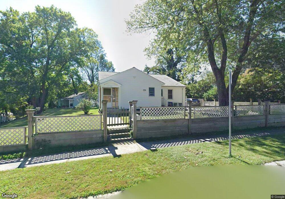
12200 Bond St Silver Spring, MD 20902
Connecticut Avenue Park NeighborhoodEstimated Value: $392,735 - $554,000
Studio
1
Bath
1,636
Sq Ft
$283/Sq Ft
Est. Value
About This Home
This home is located at 12200 Bond St, Silver Spring, MD 20902 and is currently estimated at $463,434, approximately $283 per square foot. 12200 Bond St is a home located in Montgomery County with nearby schools including Arcola Elementary School, Odessa Shannon Middle School, and Northwood High School.
Ownership History
Date
Name
Owned For
Owner Type
Purchase Details
Closed on
Jun 12, 2023
Sold by
Flores Raul Armando and Flores Jazzlyn
Bought by
Raul Armando Flores And Jazzlyn Flores Revoca and Flores
Current Estimated Value
Purchase Details
Closed on
Jul 2, 2002
Sold by
Flores Jazzlyn C D and Flores A R
Bought by
Flores Jazzlyn and Flores Raul A
Create a Home Valuation Report for This Property
The Home Valuation Report is an in-depth analysis detailing your home's value as well as a comparison with similar homes in the area
Home Values in the Area
Average Home Value in this Area
Purchase History
| Date | Buyer | Sale Price | Title Company |
|---|---|---|---|
| Raul Armando Flores And Jazzlyn Flores Revoca | -- | None Listed On Document | |
| Raul Armando Flores And Jazzlyn Flores Revoca | -- | None Listed On Document | |
| Flores Jazzlyn | -- | -- |
Source: Public Records
Tax History
| Year | Tax Paid | Tax Assessment Tax Assessment Total Assessment is a certain percentage of the fair market value that is determined by local assessors to be the total taxable value of land and additions on the property. | Land | Improvement |
|---|---|---|---|---|
| 2025 | $4,814 | $369,600 | $201,900 | $167,700 |
| 2024 | $4,814 | $354,633 | $0 | $0 |
| 2023 | $3,925 | $339,667 | $0 | $0 |
| 2022 | $3,544 | $324,700 | $179,900 | $144,800 |
| 2021 | $3,014 | $305,233 | $0 | $0 |
| 2020 | $3,014 | $285,767 | $0 | $0 |
| 2019 | $2,765 | $266,300 | $164,700 | $101,600 |
| 2018 | $2,620 | $255,533 | $0 | $0 |
| 2017 | $2,539 | $244,767 | $0 | $0 |
| 2016 | -- | $234,000 | $0 | $0 |
| 2015 | $2,201 | $232,233 | $0 | $0 |
| 2014 | $2,201 | $230,467 | $0 | $0 |
Source: Public Records
Map
Nearby Homes
- 12312 Valleywood Dr
- 2913 Weisman Rd
- 12015 Claridge Rd
- 12124 Livingston St
- 12106 Bluhill Rd
- 3008 Hardy Ave
- 3027 Medway St
- 12220 Centerhill St
- 3410 Embry St
- 2715 Randolph Rd
- 2707 Urbana Dr
- 3405 Fredale St
- 12526 Epping Ct
- 12605 Bluhill Rd
- 3103 Dawson Ave
- 12816 Valleywood Dr
- 2611 Arvin St
- 2600 Arcola Ave
- 2904 Fenimore Rd
- 3409 Janet Rd
- 12104 Berry St
- 12204 Bond St
- 3105 Henderson Ave
- 12208 Bond St
- 12201 Bond St
- 3109 Henderson Ave
- 12113 Berry St
- 12109 Berry St
- 12100 Berry St
- 12117 Berry St
- 12105 Berry St
- 12205 Bond St
- 12201 Berry St
- 12212 Bond St
- 3201 Henderson Ave
- 12204 Berry St
- 12101 Berry St
- 12205 Berry St
- 12202 Kendall St
- 12210 Kendall St
Your Personal Tour Guide
Ask me questions while you tour the home.