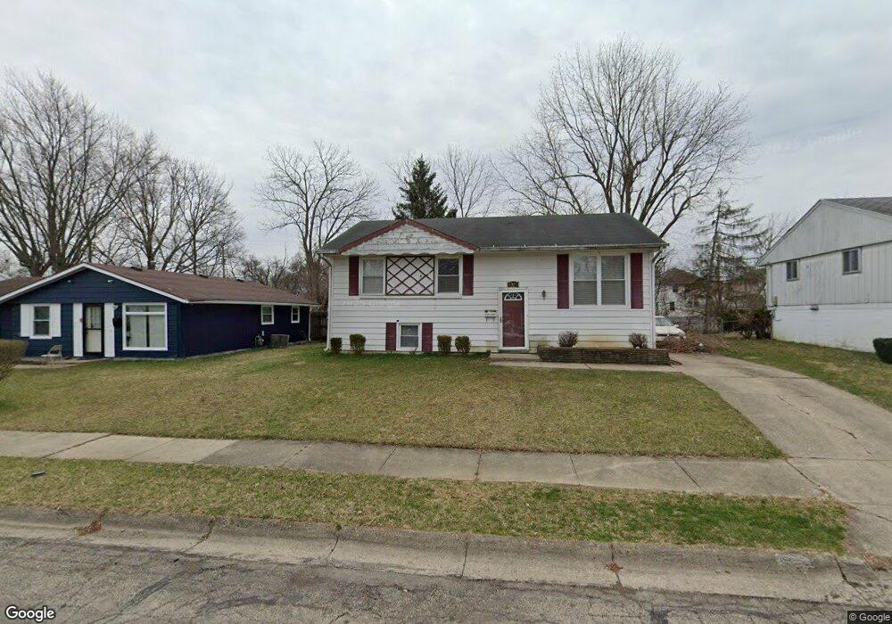
1221 Liberty Ave Springfield, OH 45506
Estimated Value: $99,000 - $136,000
3
Beds
2
Baths
999
Sq Ft
$114/Sq Ft
Est. Value
About This Home
This home is located at 1221 Liberty Ave, Springfield, OH 45506 and is currently estimated at $113,546, approximately $113 per square foot. 1221 Liberty Ave is a home located in Clark County with nearby schools including Fulton Elementary School, Hayward Middle School, and Springfield High School.
Ownership History
Date
Name
Owned For
Owner Type
Purchase Details
Closed on
Jun 8, 2006
Sold by
Cornell Estates Llc
Bought by
Bailum Nicole D
Current Estimated Value
Home Financials for this Owner
Home Financials are based on the most recent Mortgage that was taken out on this home.
Original Mortgage
$78,764
Outstanding Balance
$45,844
Interest Rate
6.68%
Mortgage Type
FHA
Estimated Equity
$67,702
Purchase Details
Closed on
Feb 15, 2006
Sold by
Zitzner John B and Zitzner Brad
Bought by
Cornell Estates Llc
Purchase Details
Closed on
Jan 15, 2006
Sold by
Beneficial Ohio Inc
Bought by
Zitzner John B
Purchase Details
Closed on
Oct 24, 2005
Sold by
Embry David E
Bought by
Beneficial Ohio Inc
Create a Home Valuation Report for This Property
The Home Valuation Report is an in-depth analysis detailing your home's value as well as a comparison with similar homes in the area
Home Values in the Area
Average Home Value in this Area
Purchase History
| Date | Buyer | Sale Price | Title Company |
|---|---|---|---|
| Bailum Nicole D | $80,000 | None Available | |
| Cornell Estates Llc | -- | None Available | |
| Zitzner John B | $31,000 | None Available | |
| Beneficial Ohio Inc | -- | -- |
Source: Public Records
Mortgage History
| Date | Status | Borrower | Loan Amount |
|---|---|---|---|
| Open | Bailum Nicole D | $78,764 |
Source: Public Records
Tax History
| Year | Tax Paid | Tax Assessment Tax Assessment Total Assessment is a certain percentage of the fair market value that is determined by local assessors to be the total taxable value of land and additions on the property. | Land | Improvement |
|---|---|---|---|---|
| 2025 | $1,182 | $29,210 | $3,300 | $25,910 |
| 2024 | $1,151 | $23,880 | $2,920 | $20,960 |
| 2023 | $1,151 | $23,880 | $2,920 | $20,960 |
| 2022 | $1,179 | $23,880 | $2,920 | $20,960 |
| 2021 | $1,030 | $19,260 | $2,360 | $16,900 |
| 2020 | $1,032 | $19,260 | $2,360 | $16,900 |
| 2019 | $1,035 | $19,260 | $2,360 | $16,900 |
| 2018 | $1,006 | $17,990 | $2,720 | $15,270 |
| 2017 | $1,005 | $17,987 | $2,720 | $15,267 |
| 2016 | $1,007 | $17,987 | $2,720 | $15,267 |
| 2015 | $1,026 | $17,987 | $2,720 | $15,267 |
| 2014 | $1,022 | $17,987 | $2,720 | $15,267 |
| 2013 | $1,011 | $17,987 | $2,720 | $15,267 |
Source: Public Records
Map
Nearby Homes
- 929 S Western Ave
- 916 Innisfallen Ave
- 0 Montgomery Ave
- 1109 Montgomery Ave
- 830 Dibert Ave
- 802 Innisfallen Ave
- 770 W State St
- 1453 W Clark St
- 1230 W Pleasant St
- 1002 S Yellow Springs St
- 1124 W Mulberry St
- 329 S Western Ave
- 1362 W Mulberry St Unit 1364
- 1374 W Mulberry St
- 525 S Light St
- 1618 W Pleasant St
- 709-711 W Mulberry St
- 506 W Southern Ave
- 525 W Clark St
- 550 W Parkwood Ave
- 1215 Liberty Ave
- 1227 Liberty Ave
- 920 Farnam St
- 1209 Liberty Ave
- 1224 Innisfallen Ave
- 1230 Innisfallen Ave
- 1220 Liberty Ave
- 1226 Liberty Ave
- 1232 Innisfallen Ave
- 1214 Liberty Ave
- 917 Eden Ave
- 1212 Innisfallen Ave
- 1236 Liberty Ave
- 1208 Liberty Ave
- 1202 Innisfallen Ave
- 844 Farnam St
- 1204 Liberty Ave
- 1219 Cobb Ave
- 1225 Cobb Ave
- 1213 Cobb Ave
Your Personal Tour Guide
Ask me questions while you tour the home.