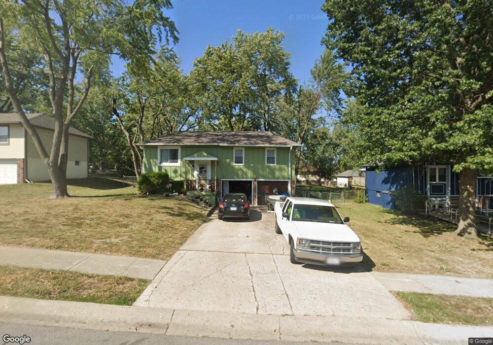
1222 R D Mize Rd Grain Valley, MO 64029
Estimated Value: $214,000 - $239,000
3
Beds
2
Baths
1,014
Sq Ft
$224/Sq Ft
Est. Value
About This Home
This home is located at 1222 R D Mize Rd, Grain Valley, MO 64029 and is currently estimated at $226,918, approximately $223 per square foot. 1222 R D Mize Rd is a home located in Jackson County with nearby schools including Grain Valley High School, Plaza Heights Christian Academy, and St John Lalande School.
Ownership History
Date
Name
Owned For
Owner Type
Purchase Details
Closed on
Apr 28, 2008
Sold by
Paden Robert and Madden Ricky
Bought by
Wood Adam J
Current Estimated Value
Home Financials for this Owner
Home Financials are based on the most recent Mortgage that was taken out on this home.
Original Mortgage
$99,216
Outstanding Balance
$62,422
Interest Rate
5.84%
Mortgage Type
FHA
Estimated Equity
$164,496
Purchase Details
Closed on
Feb 15, 2006
Sold by
Hsbc Bank Usa Na
Bought by
Paden Robert and Madden Ricky
Purchase Details
Closed on
Sep 26, 2005
Sold by
Royster Clarence R and Royster Linda M
Bought by
Mortgage Electronic Registration Systems
Create a Home Valuation Report for This Property
The Home Valuation Report is an in-depth analysis detailing your home's value as well as a comparison with similar homes in the area
Home Values in the Area
Average Home Value in this Area
Purchase History
We collect this data history from publicly available records. To have your information removed, we recommend requesting removal directly through your county’s website.
| Date | Buyer | Sale Price | Title Company |
|---|---|---|---|
| Wood Adam J | -- | Commonwealth Land Title Insu | |
| Paden Robert | -- | Continental Title Company | |
| Hsbc Bank Usa Na | -- | Continental Title Company | |
| Mortgage Electronic Registration Systems | $89,250 | Continental Title Company |
Source: Public Records
Mortgage History
We collect this data history from publicly available records. To have your information removed, we recommend requesting removal directly through your county’s website.
| Date | Status | Borrower | Loan Amount |
|---|---|---|---|
| Open | Wood Adam J | $99,216 |
Source: Public Records
Tax History
| Year | Tax Paid | Tax Assessment Tax Assessment Total Assessment is a certain percentage of the fair market value that is determined by local assessors to be the total taxable value of land and additions on the property. | Land | Improvement |
|---|---|---|---|---|
| 2025 | $2,059 | $26,132 | $4,345 | $21,787 |
| 2024 | $1,982 | $25,004 | $3,627 | $21,377 |
| 2023 | $1,982 | $25,004 | $3,701 | $21,303 |
| 2022 | $1,791 | $19,760 | $5,140 | $14,620 |
| 2021 | $1,749 | $19,760 | $5,140 | $14,620 |
| 2020 | $1,769 | $19,710 | $5,140 | $14,570 |
| 2019 | $1,733 | $19,710 | $5,140 | $14,570 |
| 2018 | $1,771 | $18,819 | $3,408 | $15,411 |
| 2017 | $1,771 | $18,819 | $3,408 | $15,411 |
| 2016 | $1,687 | $17,936 | $3,344 | $14,592 |
| 2014 | $1,589 | $16,773 | $3,332 | $13,441 |
Source: Public Records
Map
Nearby Homes
- 602 SW Ridgeview Dr
- 702 NW Eagle Dr
- 1308 NW Ashley Dr
- 1307 NW Hilltop Ln
- 1614 NW Hilltop Ln
- 2701 NE Crestview St
- 2604 NE Crestview St
- 2600 NE Amanda Ln
- 2605 NE Crestview St
- 2609 NE Crestview St
- 2700 NE Crestview St
- 2701 NE Wheatley Dr
- 2601 NE Wheatley Dr
- 2512 NE Crestview St
- 2700 NE Wheatley Dr
- 1004 NW High View Dr
- 2512 NE Wheatley Dr
- 1405 NW Aspen Cir
- 1205 NW Hilltop Ln
- 1102 NW Aspen Ct
- 1220 R D Mize Rd
- 1231 R D Mize Rd
- 1235 R D Mize Rd
- 1237 R D Mize Rd
- 1218 R D Mize Rd
- 1227 R D Mize Rd
- 1300 R D Mize Rd
- 1225 NW Golfview Dr
- 1223 R D Mize Rd
- 1225 R D Mize Rd
- 1223 NW Golfview Dr
- 1216 R D Mize Rd
- 1227 NW Golfview Dr
- 809 NW Meadow Rd
- 1221 R D Mize Rd
- 1221 NW Golfview Dr
- 1118 NW Scenic Dr
- 1214 R D Mize Rd
- 1116 NW Scenic Dr
- 1302 R D Mize Rd
Your Personal Tour Guide
Ask me questions while you tour the home.