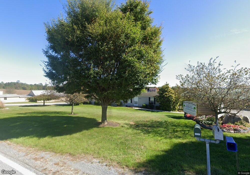
12239 Ashton Rd Clear Spring, MD 21722
Estimated Value: $354,996
About This Home
This home is located at 12239 Ashton Rd, Clear Spring, MD 21722 and is currently estimated at $354,996, approximately $112 per square foot. 12239 Ashton Rd is a home located in Washington County with nearby schools including Clear Spring Elementary School, Clear Spring Middle School, and Clear Spring High School.
Ownership History
We collect this data history from publicly available records. To have your information removed, we recommend requesting removal directly through your county’s website.
Purchase Details
Purchase Details
Purchase Details
Purchase History
We collect this data history from publicly available records. To have your information removed, we recommend requesting removal directly through your county’s website.
| Date | Buyer | Sale Price | Title Company |
|---|---|---|---|
| $325,000 | None Listed On Document | ||
| -- | None Listed On Document | ||
| $7,000 | -- |
Mortgage History
We collect this data history from publicly available records. To have your information removed, we recommend requesting removal directly through your county’s website.
| Date | Status | Borrower | Loan Amount |
|---|---|---|---|
| Open | $140,000 | ||
| Open | $626,642 | ||
| Previous Owner | $66,317 | ||
| Previous Owner | $13,647 | ||
| Previous Owner | $327,751 | ||
| Previous Owner | $305,000 | ||
| Previous Owner | $62,000 | ||
| Previous Owner | $283,000 | ||
| Previous Owner | $190,000 |
Tax History
We collect this data history from publicly available records. To have your information removed, we recommend requesting removal directly through your county’s website.
| Year | Tax Paid | Tax Assessment Tax Assessment Total Assessment is a certain percentage of the fair market value that is determined by local assessors to be the total taxable value of land and additions on the property. | Land | Improvement |
|---|---|---|---|---|
| 2025 | $3,654 | $347,133 | $0 | $0 |
| 2024 | $3,592 | $341,167 | $0 | $0 |
| 2023 | $3,531 | $335,200 | $160,900 | $174,300 |
| 2022 | $3,506 | $332,800 | $158,500 | $174,300 |
| 2021 | $3,572 | $332,800 | $158,500 | $174,300 |
| 2020 | $4,240 | $335,000 | $158,500 | $176,500 |
| 2019 | $3,611 | $335,000 | $158,500 | $176,500 |
| 2018 | $4,069 | $335,000 | $158,500 | $176,500 |
| 2017 | $3,603 | $335,700 | $0 | $0 |
| 2016 | -- | $334,267 | $0 | $0 |
| 2015 | -- | $332,833 | $0 | $0 |
| 2014 | $3,883 | $331,400 | $0 | $0 |
Map
- 11841 Ashton Rd
- 13811 National Pike
- 11717 Ashton Rd
- 0 Mulberry St
- 29 S Martin St
- 13844 Clear Spring Rd
- 12421 Nesbitt Ave
- 12504 National Pike
- 12706 Spickler Rd
- Block 92 Lot 41 Neverglades Rd
- Block 92 Lot 40 Neverglades Ave
- Block 139 Lot 47 Boo Blvd
- Block 7 Lot 30 & 31 Campfire Blvd
- Block 8 Lot 16 & 17 Campfire Blvd
- Block 91 Lot 5 Bear Bottom Rd
- 11868 National Pike
- Block 6 Lots 15 & 16 Poison Oak
- Block 5 Lots 2 & 3 Poison Oak Rd
- Block 5 Lot 46 Chipmunk Cir
- Block 5 lot 7 Poison Oak
- 12306 Ashton Rd
- 12229 Ashton Rd
- 12215 Ashton Rd
- 12247 Ashton Rd
- 12303 Ashton Rd
- 12305 Ashton Rd
- 13404 Philadelphia Ln
- 12402 Ashton Rd
- 12406 Ashton Rd
- 13411 Rhodes Ct
- 12408 Ashton Rd
- 13403 Rhodes Ct
- 13419 Rhodes Ct
- 13415 Rhodes Ct
- 12424 Ashton Rd
- 13402 Rhodes Ct
- 13414 Philadelphia Ln
- 12118 Ashton Rd
- 12432 Ashton Rd
- 13410 Philadelphia Ln
Ask me questions while you tour the home.