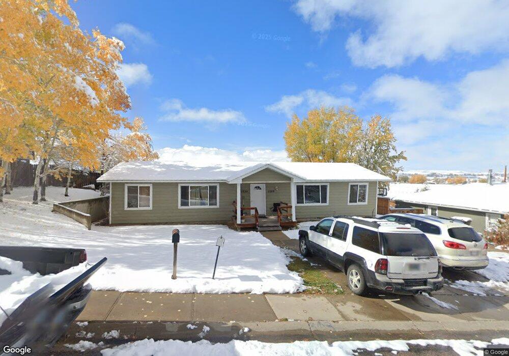
1224 Mcdougall Dr Lander, WY 82520
Estimated Value: $315,000 - $368,000
4
Beds
2
Baths
1,680
Sq Ft
$206/Sq Ft
Est. Value
About This Home
This home is located at 1224 Mcdougall Dr, Lander, WY 82520 and is currently estimated at $345,677, approximately $205 per square foot. 1224 Mcdougall Dr is a home located in Fremont County with nearby schools including Lander Valley High School and Lander Christian Academy.
Ownership History
We collect this data history from publicly available records. To have your information removed, we recommend requesting removal directly through your county’s website.
Date
Name
Owned For
Owner Type
Purchase Details
Closed on
May 15, 2009
Sold by
Bought by
Current Estimated Value
Home Financials for this Owner
Home Financials are based on the most recent Mortgage that was taken out on this home.
Original Mortgage
$115,000
Interest Rate
4.76%
Mortgage Type
New Conventional
Create a Home Valuation Report for This Property
The Home Valuation Report is an in-depth analysis detailing your home's value as well as a comparison with similar homes in the area
Home Values in the Area
Average Home Value in this Area
Tax History
We collect this data history from publicly available records. To have your information removed, we recommend requesting removal directly through your county’s website.
| Year | Tax Paid | Tax Assessment Tax Assessment Total Assessment is a certain percentage of the fair market value that is determined by local assessors to be the total taxable value of land and additions on the property. | Land | Improvement |
|---|---|---|---|---|
| 2025 | $2,420 | $23,579 | $6,369 | $17,210 |
| 2024 | $2,420 | $31,354 | $8,492 | $22,862 |
| 2023 | $2,297 | $30,002 | $8,233 | $21,769 |
| 2022 | $2,248 | $25,658 | $8,233 | $17,425 |
| 2021 | $1,768 | $22,838 | $7,994 | $14,844 |
| 2020 | $1,711 | $22,143 | $7,994 | $14,149 |
| 2019 | $1,758 | $22,397 | $7,976 | $14,421 |
| 2018 | $1,756 | $22,129 | $7,976 | $14,153 |
| 2017 | $1,684 | $21,163 | $7,976 | $13,187 |
| 2016 | $1,598 | $20,113 | $7,976 | $12,137 |
| 2015 | $1,596 | $20,320 | $7,976 | $12,344 |
| 2014 | $1,224 | $15,608 | $7,976 | $7,632 |
Source: Public Records
Map
Nearby Homes
- 1105 Mcdougall Dr
- 935 Cliff St
- 1020 Mcdougall Dr
- 770 Shoshone St
- 975 Dabich Ave
- 846 S 7th St
- 960 Dabich Ave
- 839 S 6th St
- 915 Black Blvd
- 1185 Goodrich Dr
- 1285 Goodrich Dr
- 120 Roaring Fork Ct
- 835 Garfield St
- 574 W Brodie St
- 1345 Goodrich Dr
- 485 S 5th St
- 900 Lincoln St
- 930 Lincoln St
- 920 Lincoln St
- 910 Lincoln St
- 1065 Cascade St
- 1215 Mcdougall Dr
- 1055 Cascade St
- 789 Welch Blvd
- 789 Welch Blvd Unit cascade
- 1225 Mcdougall Dr
- 1155 Mcdougall Dr
- 1050 Cascade St
- 1180 Mcdougall Dr
- 791 Welch Blvd
- 1210 Mcdougall Dr
- 1160 Mcdougall Dr
- 1040 Cascade St
- 1235 Mcdougall Dr
- 793 Welch Blvd
- 1145 Mcdougall Dr
- 788 Welch Blvd
- 788 Welch Blvd Unit Cascade St
- 1140 Mcdougall Dr
- 1055 Cliff St
Your Personal Tour Guide
Ask me questions while you tour the home.