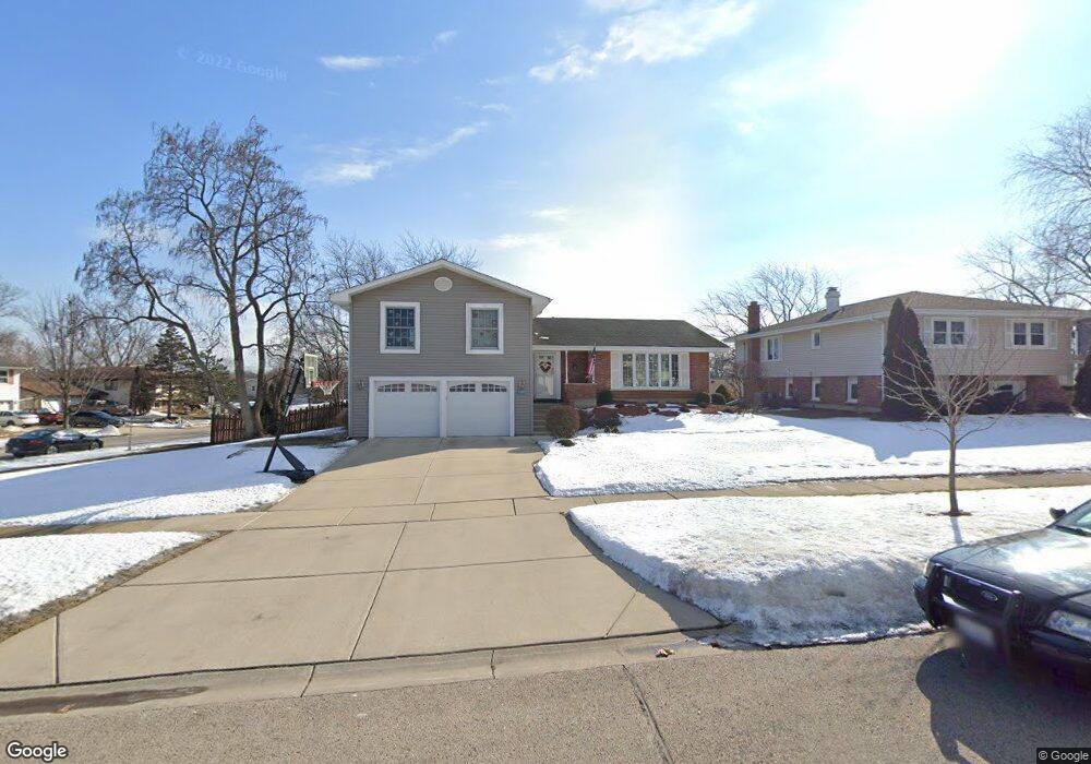
1225 Mayfield Ln Hoffman Estates, IL 60169
High Point Park NeighborhoodEstimated Value: $460,000 - $508,000
About This Home
This home is located at 1225 Mayfield Ln, Hoffman Estates, IL 60169 and is currently estimated at $485,126, approximately $246 per square foot. 1225 Mayfield Ln is a home located in Cook County with nearby schools including MacArthur International Spanish Academy, Dwight D Eisenhower Junior High School, and Hoffman Estates High School.
Ownership History
We collect this data history from publicly available records. To have your information removed, we recommend requesting removal directly through your county’s website.
Purchase Details
Purchase Details
Home Financials for this Owner
Home Financials are based on the most recent Mortgage that was taken out on this home.Home Values in the Area
Average Home Value in this Area
Purchase History
We collect this data history from publicly available records. To have your information removed, we recommend requesting removal directly through your county’s website.
| Date | Buyer | Sale Price | Title Company |
|---|---|---|---|
| -- | -- | ||
| $182,000 | -- |
Mortgage History
We collect this data history from publicly available records. To have your information removed, we recommend requesting removal directly through your county’s website.
| Date | Status | Borrower | Loan Amount |
|---|---|---|---|
| Closed | $127,000 |
Tax History
We collect this data history from publicly available records. To have your information removed, we recommend requesting removal directly through your county’s website.
| Year | Tax Paid | Tax Assessment Tax Assessment Total Assessment is a certain percentage of the fair market value that is determined by local assessors to be the total taxable value of land and additions on the property. | Land | Improvement |
|---|---|---|---|---|
| 2025 | $9,109 | $43,000 | $10,601 | $32,399 |
| 2024 | $9,109 | $33,000 | $8,834 | $24,166 |
| 2023 | $8,785 | $33,000 | $8,834 | $24,166 |
| 2022 | $8,785 | $33,000 | $8,834 | $24,166 |
| 2021 | $8,041 | $27,330 | $5,889 | $21,441 |
| 2020 | $7,928 | $27,330 | $5,889 | $21,441 |
| 2019 | $7,886 | $30,367 | $5,889 | $24,478 |
| 2018 | $8,124 | $28,351 | $5,006 | $23,345 |
| 2017 | $7,999 | $28,351 | $5,006 | $23,345 |
| 2016 | $7,703 | $28,351 | $5,006 | $23,345 |
| 2015 | $6,668 | $23,384 | $4,417 | $18,967 |
| 2014 | $6,567 | $23,384 | $4,417 | $18,967 |
| 2013 | $6,381 | $23,384 | $4,417 | $18,967 |
Map
- 1145 Nottingham Ln
- 1350 Nottingham Ln
- 1140 Rosedale Ln
- 1030 Cobble Hill Ct
- 1475 Rosedale Ln
- 2020 Carling Rd
- 1150 Glen Ln
- 1438 Della Dr
- 1820 Claremont Rd
- 1964 Kenilworth Cir Unit 1964
- 1950 Kenilworth Cir Unit A
- 1975 Kenilworth Cir Unit B
- 1981 Kenilworth Cir Unit G
- 1360 Devonshire Ln
- 1345 Devonshire Ln
- 790 Evergreen Ln
- 1800 Huntington Blvd Unit AE507
- 1800 Huntington Blvd Unit 607
- 1756 Fayette Walk Unit C
- 1726 Sessions Walk Unit 1726
- 1235 Mayfield Ln
- 1220 Hassell Rd
- 1230 Hassell Rd
- 1255 Mayfield Ln
- 2025 Greenfield Rd
- 2015 Greenfield Rd
- 1240 Mayfield Ln
- 1220 Mayfield Ln
- 2031 Greenfield Rd
- 1250 Hassell Rd
- 1250 Mayfield Ln
- 2005 Greenfield Rd
- 2037 Greenfield Rd
- 1275 Mayfield Ln
- 1260 Mayfield Ln
- 1260 Hassell Rd
- 2041 Greenfield Rd
- 2010 Hilltop Rd
- 1285 Mayfield Ln
- 2020 Hilltop Rd
Ask me questions while you tour the home.