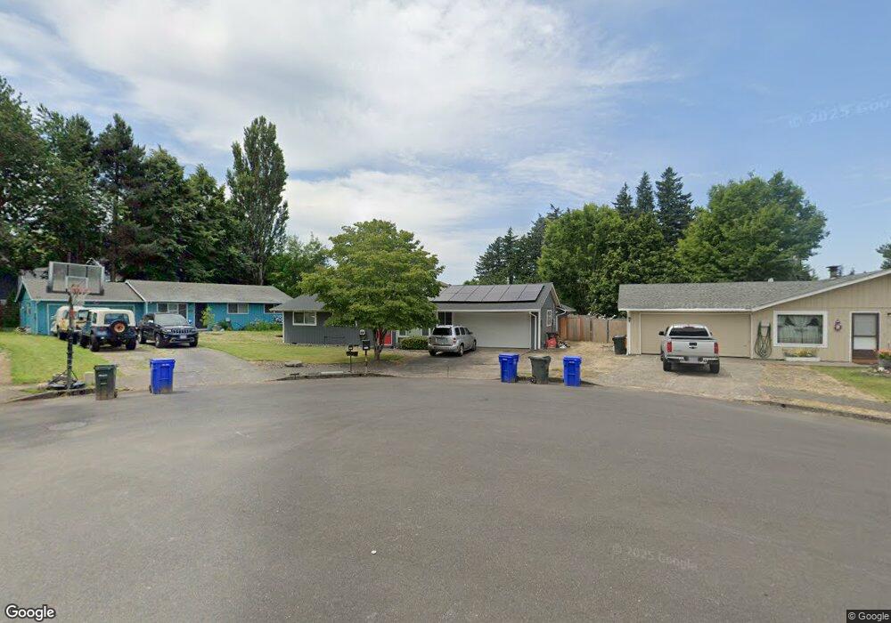
1225 NE Hale Place Gresham, OR 97030
Northeast Gresham NeighborhoodEstimated Value: $364,000 - $438,000
3
Beds
2
Baths
1,092
Sq Ft
$372/Sq Ft
Est. Value
About This Home
This home is located at 1225 NE Hale Place, Gresham, OR 97030 and is currently estimated at $406,473, approximately $372 per square foot. 1225 NE Hale Place is a home located in Multnomah County with nearby schools including Hall Elementary School, Gordon Russell Middle School, and Sam Barlow High School.
Ownership History
Date
Name
Owned For
Owner Type
Purchase Details
Closed on
Jan 6, 1999
Sold by
Morris Robert and Morris Barbara
Bought by
Barnes Jason A
Current Estimated Value
Purchase Details
Closed on
Jan 20, 1997
Sold by
Hoff Brenton James
Bought by
Spahr Stacy F and Spahr Michelle L
Home Financials for this Owner
Home Financials are based on the most recent Mortgage that was taken out on this home.
Original Mortgage
$131,580
Interest Rate
7.58%
Mortgage Type
VA
Purchase Details
Closed on
Jan 17, 1997
Sold by
Spahr Stacy F
Bought by
Defender Max J and Defender Barbara A
Home Financials for this Owner
Home Financials are based on the most recent Mortgage that was taken out on this home.
Original Mortgage
$131,580
Interest Rate
7.58%
Mortgage Type
VA
Create a Home Valuation Report for This Property
The Home Valuation Report is an in-depth analysis detailing your home's value as well as a comparison with similar homes in the area
Home Values in the Area
Average Home Value in this Area
Purchase History
We collect this data history from publicly available records. To have your information removed, we recommend requesting removal directly through your county’s website.
| Date | Buyer | Sale Price | Title Company |
|---|---|---|---|
| Barnes Jason A | $65,000 | Chicago Title | |
| Spahr Stacy F | $68,262 | Ticor Title | |
| Defender Max J | $129,000 | Ticor Title Insurance |
Source: Public Records
Mortgage History
We collect this data history from publicly available records. To have your information removed, we recommend requesting removal directly through your county’s website.
| Date | Status | Borrower | Loan Amount |
|---|---|---|---|
| Previous Owner | Defender Max J | $131,580 |
Source: Public Records
Tax History
| Year | Tax Paid | Tax Assessment Tax Assessment Total Assessment is a certain percentage of the fair market value that is determined by local assessors to be the total taxable value of land and additions on the property. | Land | Improvement |
|---|---|---|---|---|
| 2025 | $4,571 | $224,610 | -- | -- |
| 2024 | $4,375 | $218,070 | -- | -- |
| 2023 | $3,986 | $211,720 | $0 | $0 |
| 2022 | $3,875 | $205,560 | $0 | $0 |
| 2021 | $3,777 | $199,580 | $0 | $0 |
| 2020 | $3,554 | $193,770 | $0 | $0 |
| 2019 | $3,461 | $188,130 | $0 | $0 |
| 2018 | $3,300 | $182,660 | $0 | $0 |
| 2017 | $3,166 | $177,340 | $0 | $0 |
| 2016 | $2,792 | $172,180 | $0 | $0 |
| 2015 | $2,732 | $167,170 | $0 | $0 |
| 2014 | $2,665 | $162,310 | $0 | $0 |
Source: Public Records
Map
Nearby Homes
- 2905 NE 13th St
- 2980 NE Division St Unit 31
- 2980 NE Division St Unit 13
- 1458 NE Paropa Ct Unit 2
- 2794 NE 15th St
- 1553 NE Hale Place Unit 1
- 1537 NE Kane Dr Unit 2
- 1504 NE Village Squire Ct
- 1601 NE Hale Place Unit 2
- 820 NE Cochran Ave
- 1185 NE Hacienda Ln
- 3110 NE 7th Ct Unit 3130
- 2811 NE 6th St
- 2632 NE 7th Ct
- 1445 NE Country Club Ave
- 579 NE Fleming Ave Unit C41
- 3454 NE 5th Ct
- 1661 NE Barnes Ln
- 900 NE Francis Ave Unit 63
- 361 NE Village Squire Ave Unit 4
- 1197 NE Hale Place
- 1253 NE Hale Place
- 1238 NE Palmblad Dr Unit 902
- 1238 Palmblad (#902) Dr
- 1182 NE Hale Place
- 1198 NE Palmblad Dr Unit 802
- 1252 NE Palmblad Dr Unit 1001
- 1234 NE Palmblad Dr Unit 901
- 1256 NE Palmblad Dr Unit 1002
- 2988 NE 13th St
- 1194 NE Palmblad Dr Unit 801
- 1170 NE Palmblad Dr Unit 702
- 1166 NE Palmblad Dr Unit 701
- 2980 NE 13th St
- 2982 NE 13th St
- 1218 NE Hale Place
- 1142 NE Palmblad Dr Unit 601
- 1196 NE Hale Place
- 1264 NE Hale Place
- 1146 NE Palmblad Dr Unit 602
Your Personal Tour Guide
Ask me questions while you tour the home.