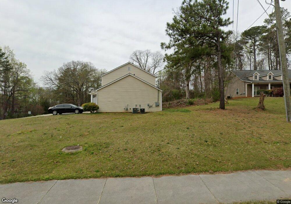
1226 Blaire Pointe Dr Unit 4 Austell, GA 30168
Estimated Value: $185,000 - $202,000
2
Beds
3
Baths
1,432
Sq Ft
$136/Sq Ft
Est. Value
About This Home
This home is located at 1226 Blaire Pointe Dr Unit 4, Austell, GA 30168 and is currently estimated at $194,689, approximately $135 per square foot. 1226 Blaire Pointe Dr Unit 4 is a home located in Cobb County with nearby schools including Bryant Elementary School, Lindley Middle School, and Pebblebrook High School.
Ownership History
Date
Name
Owned For
Owner Type
Purchase Details
Closed on
Sep 25, 2025
Sold by
Fyr Sfr Borrower Llc
Bought by
Pr Borrower 26 Llc
Current Estimated Value
Home Financials for this Owner
Home Financials are based on the most recent Mortgage that was taken out on this home.
Original Mortgage
$617,548,000
Outstanding Balance
$608,810,016
Interest Rate
6.5%
Mortgage Type
New Conventional
Estimated Equity
-$608,615,327
Purchase Details
Closed on
Aug 8, 2018
Sold by
Rha 1 Llc
Bought by
Fyr Sfr Borrower Llc
Purchase Details
Closed on
Apr 30, 2014
Sold by
Auxo Homes Llc
Bought by
Rha 1 Llc
Purchase Details
Closed on
Jul 5, 2013
Sold by
Federal Home Loan Mortgage Corporation
Bought by
Auxo Homes Llc
Purchase Details
Closed on
Feb 5, 2013
Sold by
Wells Fargo Bank Na
Bought by
Federal Home Loan Mortgage Corporation
Purchase Details
Closed on
Oct 29, 2004
Sold by
Homeland Legacy Inc
Bought by
Etheridge Adrianne
Home Financials for this Owner
Home Financials are based on the most recent Mortgage that was taken out on this home.
Original Mortgage
$119,400
Interest Rate
5.62%
Mortgage Type
New Conventional
Create a Home Valuation Report for This Property
The Home Valuation Report is an in-depth analysis detailing your home's value as well as a comparison with similar homes in the area
Home Values in the Area
Average Home Value in this Area
Purchase History
We collect this data history from publicly available records. To have your information removed, we recommend requesting removal directly through your county’s website.
| Date | Buyer | Sale Price | Title Company |
|---|---|---|---|
| Pr Borrower 26 Llc | -- | Selene Title | |
| Fyr Sfr Borrower Llc | $98,787 | -- | |
| Rha 1 Llc | $65,000 | -- | |
| Auxo Homes Llc | $59,900 | -- | |
| Federal Home Loan Mortgage Corporation | $42,750 | -- | |
| Wells Fargo Bank Na | $42,750 | -- | |
| Etheridge Adrianne | $125,700 | -- |
Source: Public Records
Mortgage History
We collect this data history from publicly available records. To have your information removed, we recommend requesting removal directly through your county’s website.
| Date | Status | Borrower | Loan Amount |
|---|---|---|---|
| Open | Pr Borrower 26 Llc | $617,548,000 | |
| Previous Owner | Etheridge Adrianne | $119,400 |
Source: Public Records
Tax History
| Year | Tax Paid | Tax Assessment Tax Assessment Total Assessment is a certain percentage of the fair market value that is determined by local assessors to be the total taxable value of land and additions on the property. | Land | Improvement |
|---|---|---|---|---|
| 2025 | $2,235 | $74,176 | $12,000 | $62,176 |
| 2024 | $2,236 | $74,176 | $12,000 | $62,176 |
| 2023 | $2,236 | $74,176 | $12,000 | $62,176 |
| 2022 | $1,530 | $50,400 | $9,600 | $40,800 |
| 2021 | $1,530 | $50,400 | $9,600 | $40,800 |
| 2020 | $1,374 | $45,256 | $9,600 | $35,656 |
| 2019 | $1,374 | $45,256 | $9,600 | $35,656 |
| 2018 | $1,220 | $40,212 | $7,200 | $33,012 |
| 2017 | $1,156 | $40,212 | $7,200 | $33,012 |
| 2016 | $689 | $23,948 | $7,308 | $16,640 |
| 2015 | $706 | $23,948 | $7,308 | $16,640 |
| 2014 | $711 | $23,948 | $0 | $0 |
Source: Public Records
Map
Nearby Homes
- 1203 Blairs Pointe Dr Unit 1
- 1329 Ling Dr
- 1184 Flamingo Dr
- 1195 Park Center Cir
- 1182 Laurel Log Place
- 1163 Park Center Cir
- 7254 Silverton Trail
- 1250 Park Center Cir
- 7098 Pleasant Dr
- 6979 Ling Ln Unit 2
- 1350 Oak Ridge Rd
- 00 Hembree Ln
- 0 Hembree Ln Unit 10633605
- 1370 Ling Dr
- 1090 Blair Bridge Rd
- 840 Revena Dr
- 1178 Summerstone Trace
- 6794 Hembree Dr
- 6615 Crossing Creek Point
- 7230 Bridgeport Ct
- 1203 Blairs Pointe Dr
- 1201 Blairs Pointe Dr
- 1201 Blairs Pointe Dr Unit 1201
- 1205 Blairs Pointe Dr Unit 1
- 1207 Blairs Pointe Dr Unit 1
- 1209 Blairs Pointe Dr Unit 1
- 1211 Blairs Pointe Dr Unit 1
- 1213 Blairs Pointe Dr Unit 1
- 1213 Blairs Point
- 1215 Blairs Pointe Dr Unit 1
- 1226 Blairs Pointe Dr SW
- 1226 Blairs Pointe Dr Unit 4
- 1226 Blairs Pointe Dr
- 1226 Blairs Pointe Dr Unit 1226
- 1228 Blairs Pointe Dr Unit 4
- 1228 Blairs Point SW
- 1228 Blairs Pointe Dr SW
- 1230 Blairs Pointe Dr Unit 4
- 1230 Blairs Pointe Dr
- 1230 Blairs Pointe Dr Unit 26
Your Personal Tour Guide
Ask me questions while you tour the home.