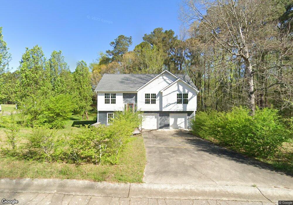
1226 Cabots Dr Unit 2 Auburn, GA 30011
Estimated Value: $266,217 - $305,000
3
Beds
2
Baths
1,283
Sq Ft
$223/Sq Ft
Est. Value
About This Home
This home is located at 1226 Cabots Dr Unit 2, Auburn, GA 30011 and is currently estimated at $286,304, approximately $223 per square foot. 1226 Cabots Dr Unit 2 is a home located in Barrow County with nearby schools including Auburn Elementary School, Westside Middle School, and Apalachee High School.
Ownership History
Date
Name
Owned For
Owner Type
Purchase Details
Closed on
Feb 12, 2004
Sold by
Wells Fargo Bk
Bought by
Luttgens Tracey A
Current Estimated Value
Home Financials for this Owner
Home Financials are based on the most recent Mortgage that was taken out on this home.
Original Mortgage
$103,377
Outstanding Balance
$47,493
Interest Rate
5.87%
Mortgage Type
VA
Estimated Equity
$238,811
Purchase Details
Closed on
Oct 7, 2003
Sold by
Bayer Matthew R F An
Bought by
Wells Fargo Bank Minnesota
Purchase Details
Closed on
May 28, 1998
Sold by
Scruggs Richie A and Scruggs Dawn M
Bought by
Bayer Matthew R
Home Financials for this Owner
Home Financials are based on the most recent Mortgage that was taken out on this home.
Original Mortgage
$94,950
Interest Rate
7.15%
Mortgage Type
New Conventional
Purchase Details
Closed on
Apr 30, 1992
Bought by
Scruggs Richie A and Scruggs D
Create a Home Valuation Report for This Property
The Home Valuation Report is an in-depth analysis detailing your home's value as well as a comparison with similar homes in the area
Home Values in the Area
Average Home Value in this Area
Purchase History
| Date | Buyer | Sale Price | Title Company |
|---|---|---|---|
| Luttgens Tracey A | $105,000 | -- | |
| Wells Fargo Bank Minnesota | -- | -- | |
| Bayer Matthew R | $97,900 | -- | |
| Scruggs Richie A | $75,400 | -- |
Source: Public Records
Mortgage History
| Date | Status | Borrower | Loan Amount |
|---|---|---|---|
| Open | Luttgens Tracey A | $103,377 | |
| Previous Owner | Bayer Matthew R | $94,950 |
Source: Public Records
Tax History
| Year | Tax Paid | Tax Assessment Tax Assessment Total Assessment is a certain percentage of the fair market value that is determined by local assessors to be the total taxable value of land and additions on the property. | Land | Improvement |
|---|---|---|---|---|
| 2025 | $2,650 | $87,711 | $20,000 | $67,711 |
| 2024 | $2,636 | $85,856 | $20,000 | $65,856 |
| 2023 | $1,725 | $67,154 | $20,000 | $47,154 |
| 2022 | $1,523 | $51,504 | $12,800 | $38,704 |
| 2021 | $1,631 | $51,504 | $12,800 | $38,704 |
| 2020 | $1,641 | $51,504 | $12,800 | $38,704 |
| 2019 | $1,539 | $51,504 | $12,800 | $38,704 |
| 2018 | $1,335 | $45,440 | $9,800 | $35,640 |
| 2017 | $213 | $39,042 | $9,800 | $29,242 |
| 2016 | $1,009 | $35,940 | $9,800 | $26,140 |
| 2015 | $1,021 | $36,270 | $9,800 | $26,470 |
| 2014 | $872 | $33,072 | $6,272 | $26,800 |
| 2013 | -- | $31,838 | $6,272 | $25,566 |
Source: Public Records
Map
Nearby Homes
- 1223 Cabots Dr
- 1236 Cabots Dr
- 410 Kilcrease Rd
- 264 Kilcrease Rd
- 4079 Brookmont Way
- 5779 Wheeler Ridge Rd
- 4048 Brookmont Way
- 1308 Smokerise Ln
- 301 Jonaquil Ave
- 1311 Ridgeview Rd Unit 4
- 305 Bradford Ct
- 305 Scott Alex Cir
- 0 Brown Bridge Rd Unit CL352178
- 0 Brown Bridge Rd Unit 10719495
- 405 Bradford Way
- 0 Apalachee Ridge Rd
- 1127 Bradford Park Dr
- 1133 Bradford Park Dr
- 00 Atlanta Hwy
- 1237 Carl Bethlehem Rd
- 1224 Cabots Dr
- 1230 Cabots Dr
- 1225 Cabots Dr
- 1229 Cabots Dr
- 1229 Cabots Dr Unit 1
- 1221 NW Saint Andrews
- 1221 Saint Andrews Dr
- 1221 St Andrews Dr
- 1232 Cabots Dr
- 1220 Cabots Dr
- 1222 Cabots Ridge Unit 2
- 1219 Saint Andrews Dr
- 1223 Saint Andrews Dr
- 1234 Cabots Dr
- 1223 St Andrews Dr
- 1223 St Andrews Dr Unit 2
- 1237 Cabots Dr Unit 2
- 1217 Saint Andrews Dr
- 1218 Cabots Dr Unit 2
- 1218 Cabot's Dr Unit 8
Your Personal Tour Guide
Ask me questions while you tour the home.