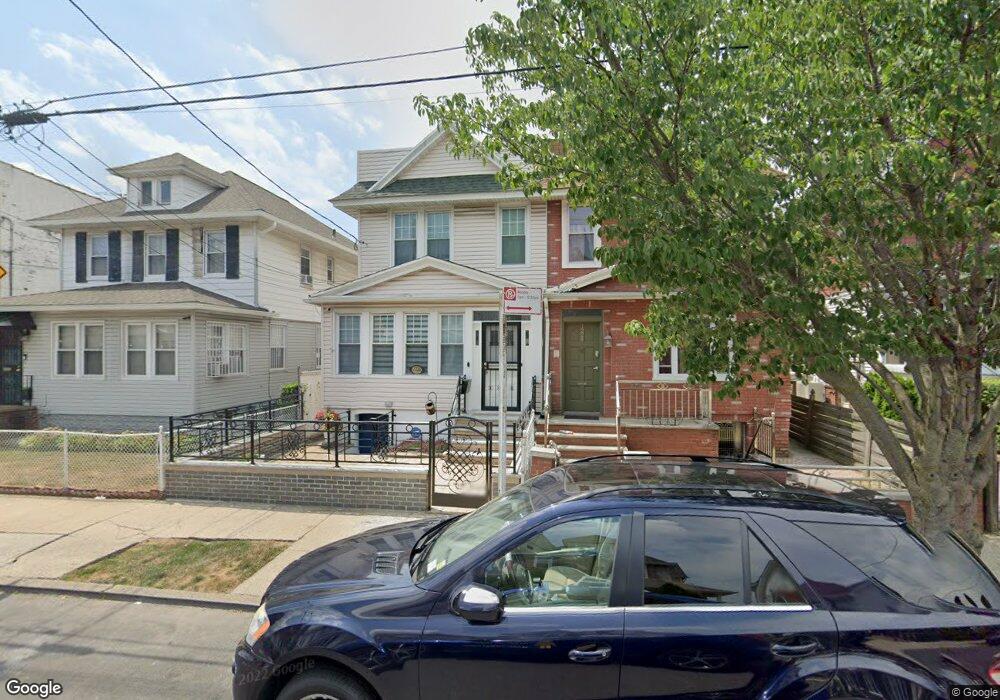
1226 E 39th St Brooklyn, NY 11210
Flatlands NeighborhoodEstimated Value: $652,388 - $817,000
Studio
--
Bath
1,504
Sq Ft
$497/Sq Ft
Est. Value
About This Home
This home is located at 1226 E 39th St, Brooklyn, NY 11210 and is currently estimated at $747,347, approximately $496 per square foot. 1226 E 39th St is a home located in Kings County with nearby schools including P.S. 119 Amersfort, Andries Hudde School, and Mesivta Tiferes Yisroel.
Ownership History
Date
Name
Owned For
Owner Type
Purchase Details
Closed on
Jun 15, 2020
Sold by
Thomas Neila
Bought by
Rollins Neila
Current Estimated Value
Purchase Details
Closed on
Sep 14, 2011
Sold by
Thomas Erwin and Thomas Neila
Bought by
Thomas Neila
Purchase Details
Closed on
Feb 12, 2004
Sold by
Neila Thomas and Neila Rollins
Bought by
Thomas Erwin and Thomas Neila
Purchase Details
Closed on
May 19, 1997
Sold by
Massiah James
Bought by
Rollins Neila Massiah
Purchase Details
Closed on
Mar 14, 1996
Sold by
Massiah James
Bought by
Massiah James and Massiah Neila J
Create a Home Valuation Report for This Property
The Home Valuation Report is an in-depth analysis detailing your home's value as well as a comparison with similar homes in the area
Home Values in the Area
Average Home Value in this Area
Purchase History
We collect this data history from publicly available records. To have your information removed, we recommend requesting removal directly through your county’s website.
| Date | Buyer | Sale Price | Title Company |
|---|---|---|---|
| Rollins Neila | -- | -- | |
| Rollins Neila | -- | -- | |
| Rollins Neila | -- | -- | |
| Thomas Neila | -- | -- | |
| Thomas Neila | -- | -- | |
| Thomas Erwin | -- | -- | |
| Thomas Erwin | -- | -- | |
| Rollins Neila Massiah | -- | American Title Ins Co | |
| Rollins Neila Massiah | -- | American Title Ins Co | |
| Massiah James | -- | American Title Ins Co | |
| Massiah James | -- | American Title Ins Co |
Source: Public Records
Mortgage History
We collect this data history from publicly available records. To have your information removed, we recommend requesting removal directly through your county’s website.
| Date | Status | Borrower | Loan Amount |
|---|---|---|---|
| Closed | Thomas Erwin | $0 |
Source: Public Records
Tax History
| Year | Tax Paid | Tax Assessment Tax Assessment Total Assessment is a certain percentage of the fair market value that is determined by local assessors to be the total taxable value of land and additions on the property. | Land | Improvement |
|---|---|---|---|---|
| 2026 | $6,133 | $49,020 | $8,640 | $40,380 |
| 2025 | $5,936 | $42,360 | $8,640 | $33,720 |
| 2024 | $5,936 | $46,440 | $8,640 | $37,800 |
| 2023 | $5,653 | $42,780 | $8,640 | $34,140 |
| 2022 | $5,292 | $38,940 | $8,640 | $30,300 |
| 2021 | $5,314 | $37,920 | $8,640 | $29,280 |
| 2020 | $2,638 | $34,500 | $8,640 | $25,860 |
| 2019 | $5,103 | $34,500 | $8,640 | $25,860 |
| 2018 | $4,669 | $24,364 | $7,594 | $16,770 |
| 2017 | $4,448 | $23,288 | $6,858 | $16,430 |
| 2016 | $4,131 | $22,213 | $7,439 | $14,774 |
| 2015 | $2,430 | $22,192 | $8,535 | $13,657 |
| 2014 | $2,430 | $21,496 | $7,428 | $14,068 |
Source: Public Records
Map
Nearby Homes
- 1229 E 37th St
- 1153 E 40th St
- 1202 E 38th St
- 1144 E 37th St
- 1130 E 42nd St
- 1810 Avenue N Unit 2F
- 1810 Avenue N Unit 4C
- 1742 Flatbush Ave
- 3412 Avenue J
- 1203 E 34th St
- 1077 E 36th St
- 1213 E 34th St
- 3402 Avenue J
- 4032 Hubbard Place
- 3517 Avenue I
- 4042 Hubbard Place
- 4204 Avenue I
- 1173 E 43rd St
- 1065 E 39th St
- 1708 Flatbush Ave
- 3810 Avenue J
- 3806 Avenue J
- 3812 Avenue J
- 3804 Avenue J
- 3814 Avenue J
- 3816 Avenue J
- 3802 Avenue J
- 1147 E 38th St
- 1147 E 38th St Unit 6
- 3818 Avenue J
- 1149 E 38th St
- 3822 Avenue J
- 1214 E 39th St
- 1151 E 38th St
- 1151 E 38th St
- 1151 E 38th St
- 1151 E 38th St
- 1151 E 38th St Unit 6
- 1216 E 39th St
- 1155 E 38th St
Your Personal Tour Guide
Ask me questions while you tour the home.