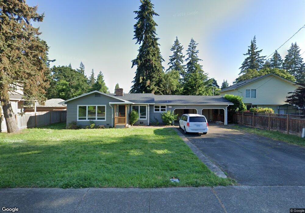
1227 Cal Young Rd Eugene, OR 97401
Cal Young NeighborhoodEstimated Value: $433,000 - $473,000
2
Beds
2
Baths
1,522
Sq Ft
$300/Sq Ft
Est. Value
About This Home
This home is located at 1227 Cal Young Rd, Eugene, OR 97401 and is currently estimated at $456,719, approximately $300 per square foot. 1227 Cal Young Rd is a home located in Lane County with nearby schools including Willagillespie Elementary School, Cal Young Middle School, and Sheldon High School.
Ownership History
Date
Name
Owned For
Owner Type
Purchase Details
Closed on
Jun 13, 2024
Sold by
Zarzycki David M
Bought by
Newell Jessie
Current Estimated Value
Home Financials for this Owner
Home Financials are based on the most recent Mortgage that was taken out on this home.
Original Mortgage
$329,515
Outstanding Balance
$305,072
Interest Rate
7.22%
Mortgage Type
Seller Take Back
Estimated Equity
$151,647
Purchase Details
Closed on
Jan 22, 2002
Sold by
Va
Bought by
Zarzycki David M and Zarzycki Cindy S
Create a Home Valuation Report for This Property
The Home Valuation Report is an in-depth analysis detailing your home's value as well as a comparison with similar homes in the area
Home Values in the Area
Average Home Value in this Area
Purchase History
| Date | Buyer | Sale Price | Title Company |
|---|---|---|---|
| Newell Jessie | $419,515 | Fidelity National Title | |
| Zarzycki David M | $34,000 | Fidelity National Title Ins |
Source: Public Records
Mortgage History
| Date | Status | Borrower | Loan Amount |
|---|---|---|---|
| Open | Newell Jessie | $329,515 |
Source: Public Records
Tax History
| Year | Tax Paid | Tax Assessment Tax Assessment Total Assessment is a certain percentage of the fair market value that is determined by local assessors to be the total taxable value of land and additions on the property. | Land | Improvement |
|---|---|---|---|---|
| 2025 | $4,014 | $206,031 | -- | -- |
| 2024 | $3,964 | $200,031 | -- | -- |
| 2023 | $3,964 | $194,205 | $0 | $0 |
| 2022 | $3,714 | $188,549 | $0 | $0 |
| 2021 | $3,488 | $183,058 | $0 | $0 |
| 2020 | $3,501 | $177,727 | $0 | $0 |
| 2019 | $3,381 | $172,551 | $0 | $0 |
| 2018 | $3,182 | $162,647 | $0 | $0 |
| 2017 | $3,040 | $162,647 | $0 | $0 |
| 2016 | $2,964 | $157,910 | $0 | $0 |
| 2015 | $2,879 | $153,311 | $0 | $0 |
| 2014 | $2,790 | $148,846 | $0 | $0 |
Source: Public Records
Map
Nearby Homes
- 0 Piper Ln Unit Lot 1
- 0 Piper Ln Unit Lot 3
- 0 Piper Ln Unit Lot 2
- 0 Piper Ln Unit Lot 5
- 1500 Norkenzie Rd Unit 12
- 996 Sherwood Place
- 1376 Brickley Rd
- 1328 Spyglass Dr
- 1230 Debrick Rd
- 1332 Jeppesen Ave
- 410 Spyglass Dr
- 0 Butte Ln
- 1625 Monterey Ln
- 0 Crenshaw Rd Unit 740506614
- 2281 Ridgeway Dr
- 982 Shaughnessy Ln
- 516 Spyglass Dr
- 1282 Evening Star Ln
- 0 Cal Young Rd Unit Lot 4
- 1230 Evening Star Ln
- 1395 Fir Acres Dr
- 1235 Cal Young Rd
- 1355 Fir Acres Dr
- 1245 Cal Young Rd
- 1399 Fir Acres Dr
- 1335 Fir Acres Dr
- 1238 Piper Ln
- 1255 Cal Young Rd
- 1248 Piper Ln
- 1265 Cal Young Rd
- 1224 Cal Young Rd
- 1236 Cal Young Rd
- 1214 Piper Ln
- 1258 Piper Ln
- 1226 Piper Ln
- 1248 Cal Young Rd
- 1277 Cal Young Rd
- 1360 Debrick Rd
- 1350 Fir Acres Dr
- 1171 Cal Young Rd
Your Personal Tour Guide
Ask me questions while you tour the home.