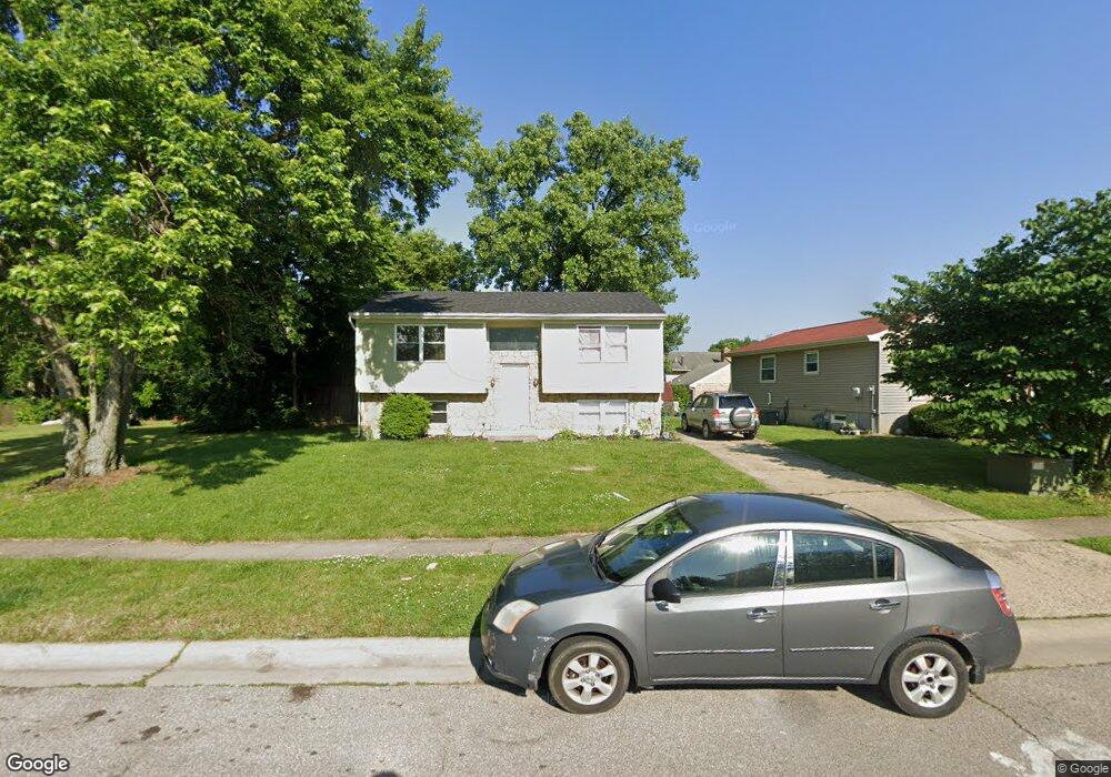
1228 Dixie Ct Cincinnati, OH 45215
Estimated Value: $139,000 - $203,000
About This Home
This home is located at 1228 Dixie Ct, Cincinnati, OH 45215 and is currently estimated at $176,149, approximately $100 per square foot. 1228 Dixie Ct is a home located in Hamilton County with nearby schools including Glendale Elementary School, Princeton Community Middle School, and Princeton High School.
Ownership History
We collect this data history from publicly available records. To have your information removed, we recommend requesting removal directly through your county’s website.
Purchase Details
Home Financials for this Owner
Home Financials are based on the most recent Mortgage that was taken out on this home.Purchase Details
Purchase Details
Home Financials for this Owner
Home Financials are based on the most recent Mortgage that was taken out on this home.Purchase Details
Purchase Details
Purchase Details
Home Financials for this Owner
Home Financials are based on the most recent Mortgage that was taken out on this home.Home Values in the Area
Average Home Value in this Area
Purchase History
We collect this data history from publicly available records. To have your information removed, we recommend requesting removal directly through your county’s website.
| Date | Buyer | Sale Price | Title Company |
|---|---|---|---|
| -- | Yonas & Phillabaum Llc | ||
| $20,300 | Attorney | ||
| $85,000 | Fidelity Land Title Agency | ||
| $22,000 | -- | ||
| $50,000 | -- | ||
| $75,000 | -- |
Mortgage History
We collect this data history from publicly available records. To have your information removed, we recommend requesting removal directly through your county’s website.
| Date | Status | Borrower | Loan Amount |
|---|---|---|---|
| Open | $109,500 | ||
| Previous Owner | $84,333 | ||
| Previous Owner | $72,750 |
Tax History
We collect this data history from publicly available records. To have your information removed, we recommend requesting removal directly through your county’s website.
| Year | Tax Paid | Tax Assessment Tax Assessment Total Assessment is a certain percentage of the fair market value that is determined by local assessors to be the total taxable value of land and additions on the property. | Land | Improvement |
|---|---|---|---|---|
| 2025 | $2,565 | $31,791 | $2,821 | $28,970 |
| 2023 | $2,163 | $31,791 | $2,821 | $28,970 |
| 2022 | $2,091 | $18,652 | $2,604 | $16,048 |
| 2021 | $1,934 | $18,652 | $2,604 | $16,048 |
| 2020 | $1,920 | $18,652 | $2,604 | $16,048 |
| 2019 | $2,025 | $18,652 | $2,604 | $16,048 |
| 2018 | $1,961 | $18,652 | $2,604 | $16,048 |
| 2017 | $1,912 | $18,652 | $2,604 | $16,048 |
| 2016 | $513 | $5,684 | $3,297 | $2,387 |
| 2015 | $542 | $5,684 | $3,297 | $2,387 |
| 2014 | $547 | $5,684 | $3,297 | $2,387 |
| 2013 | $663 | $7,105 | $4,123 | $2,982 |
Map
- 10152 Timberview Ct
- 10152 Chester Rd
- 10124 Chester Rd
- 910 Byrd Ave
- 502 Marion Rd
- 955 Simmons Ave
- 10167 Wayne Ave
- 505 Glendale Milford Rd
- 414 Jonte Ave
- 401 Jonte Ave
- 1530 Maple Ave
- 409 Home Ave
- 15 Bonham Rd
- 0 E Leslie Ave
- 1723 Harmon Dr
- 112 Bacon St
- 1701 Harmon Dr
- 26 Chestnut Ave
- 19 Evergreen Cir
- 1040 Burns Ave
Ask me questions while you tour the home.